The Landing Page for Light Footprint Tours ‘Self Guided Walks’ introduces the range of walks available for purchase.
Light Footprint Tours
Self-Guided Walks
My Light Footprint Self-Guided Walks give you full control of when to take the walk, the pace you want to walk at, and how long you want to spend at any attraction. All you need to do is follow the suggested route, using the detailed walking directions.
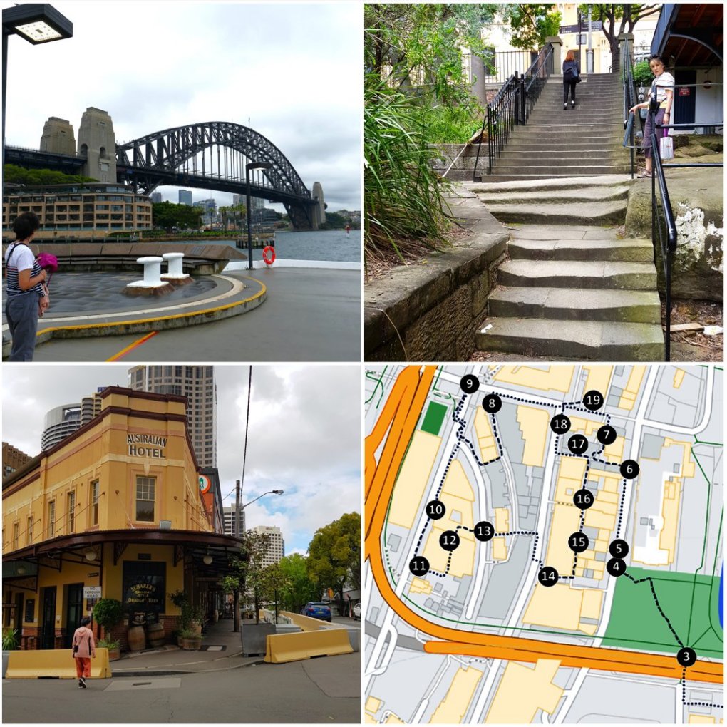
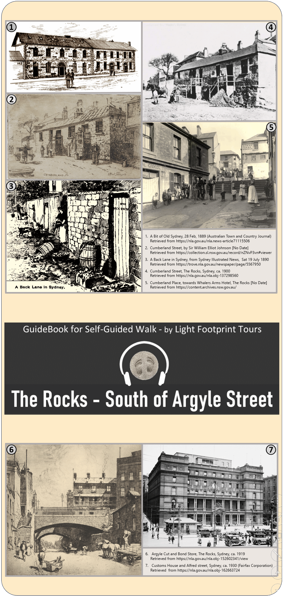
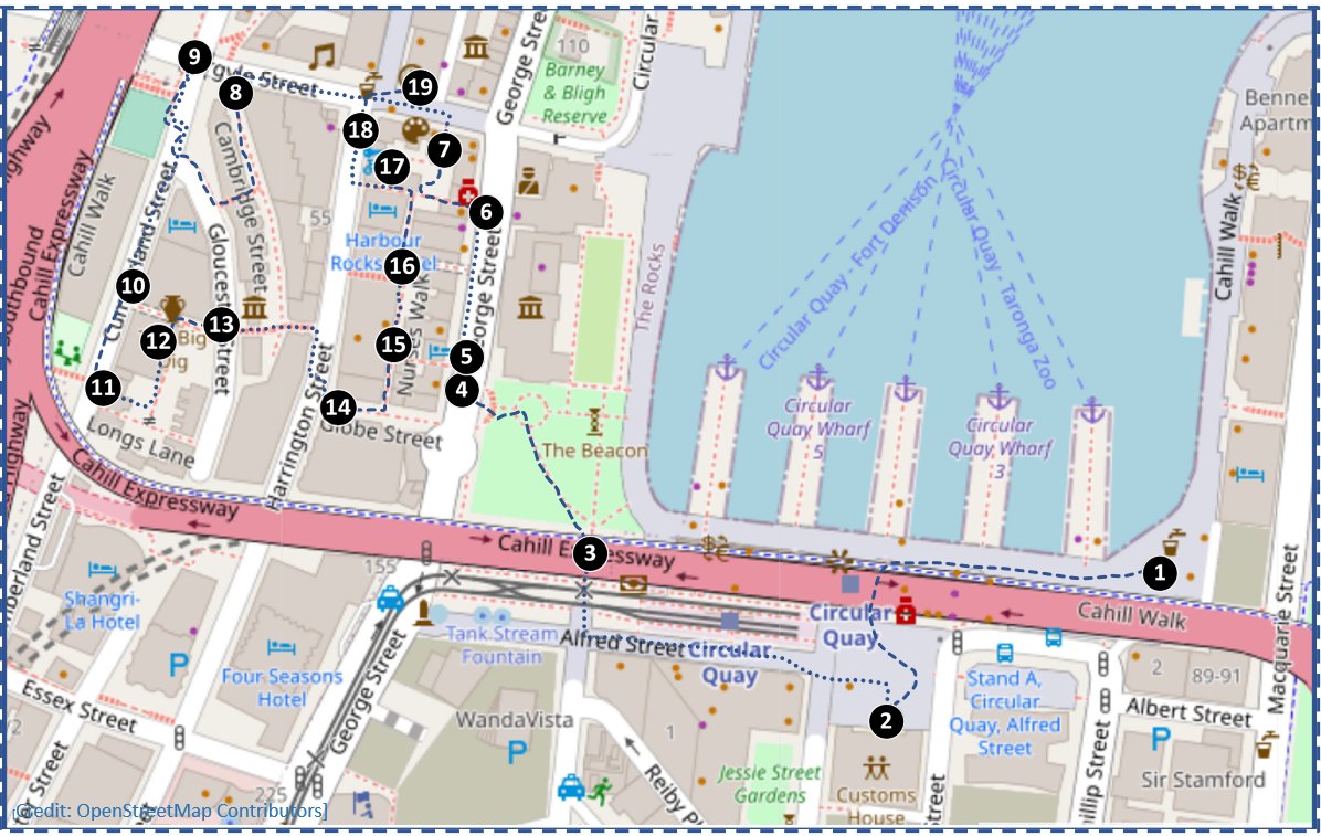
From Circular Quay, this walk explores The Rocks to the south of Argyle Street, taking in 18 attractions, before finishing on Argyle Street, at The Rocks Centre. The actual walking distance is approximately 1550 metres (0.95 miles).
As The Rocks district is set on a steep, rocky headland, the walking route involves a necessary amount of climbing and descending. Much of the climbing is on footpaths, which follow a gentler gradient, while much of the descending is by various sets of steps.
Because of this, a reasonable level of fitness is recommended. Unfortunately, the various sets of steps along the route make it difficult for those who require mobility aids.
As this Walk is ‘self-guided’, you are able to set your own pace, and to decide where and when you might need to take any personal stops along the way.
You can also ‘customise’ the route, should you wish; e.g. you may opt to bypass a particular Section of the route.
Depending on your walking pace, the walking part of the full route is likely to take between 60 and 75 minutes to complete, without any allowance for stops along the way.
Based on a stop of 5-10-minutes at each Attraction, around a further 90-180 minutes should be added, suggesting that from 2½ to 4 hours, or perhaps a little more, may be needed to complete the full walk, taking in all of the Attractions along the route.
Should you wish to linger longer at any particular point along the way, that is (of course) completely within your discretion, as you set your own pace, and keep your own time.
Along the way, depending on the time of the day, and the day of the week, when you take your walk, there are likely to be various amenities (cafes, etc.) and facilities (toilets) available.
Hint: Before taking your walk, scan through the 18 listed attractions, to identify any which you may wish to bypass.
This PDF GuideBook is designed for screen-reading. While it can be read on any screen, it is optimised for a mobile device. However, it is not suitable for printing.
The GuideBook contains numerous hyperlinks, both to internal (bookmark) links, and also to external web pages. The internal links offer quick navigation within the GuideBook, while the external links are to useful sites (external links will ask to open a new browser page).
Based on my testing of the .PDF GuideBook, the best options for using the internal links come from:
iPhone: Opening the GuideBook in a browser window. Both Chrome and Safari successfully open the .PDF file in a browser window when it downloads; both browsers also correctly read the internal links.
Android devices: Downloading the Guidebook, and then opening it with a reader. Firefox will successfully open and read a downloaded .PDF file; Android Chrome does not read a .PDF file; Edge does open a .PDF file in a browser window, however it does not work correctly with the internal links.
For reading a downloaded .PDF file on either iPhone or Android, you can use the Adobe Acrobat Reader app (the “intrusive” AI Assistant can be annoying!).
Importantly, I have found that the current versions of almost all other mobile PDF Readers DO NOT work correctly with internal bookmark links within a PDF document. Many either fail to recognise any internal links, or else they fail to jump to the correct place on the page.
Of course, you can still use the GuideBook if you have a PDF reader other than Adobe Acrobat, or do not use a browser. However, some scrolling will be needed to replace navigating via my bookmarks.
This walking route has been designed based on open access to public areas such as roads, streets, footpaths, pavements, pathways, laneways, walkways, stairways, arcades, walk-throughs, bridges, public squares, parks, reserves, beaches, etc.
From time to time, the suggested route may be disrupted by activities such as construction or maintenance, or by public events or occurrences of weather.
Currently known long-term disruptions to the walking route are noted at:
This site is specifically designed for responsive display on a mobile device On devices with wider screens, it will appear as a single, center-aligned column