afootwego-01-how-to-get-to-the-spit-bridge-using-public-transport
afootwego Posts + Stories template
…for people who love to walk…
Supporting Mindful and Responsible Travel
The trickiest part of the very popular 10km Spit to Manly Walk is to find where the walking route actually starts at The Spit. This Post provides guiding directions of what to do and where to go arrival at The Spit/Spit Bridge
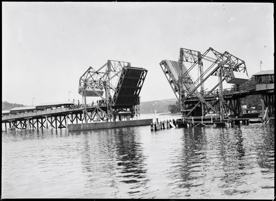
Spit Bridge open to marine traffic Sydney ca 1930s. The first Spit Bridge, built of timber, and using two half-spans that were lifted at the same time, was opened in 1924 to replace the steam punt ferry service
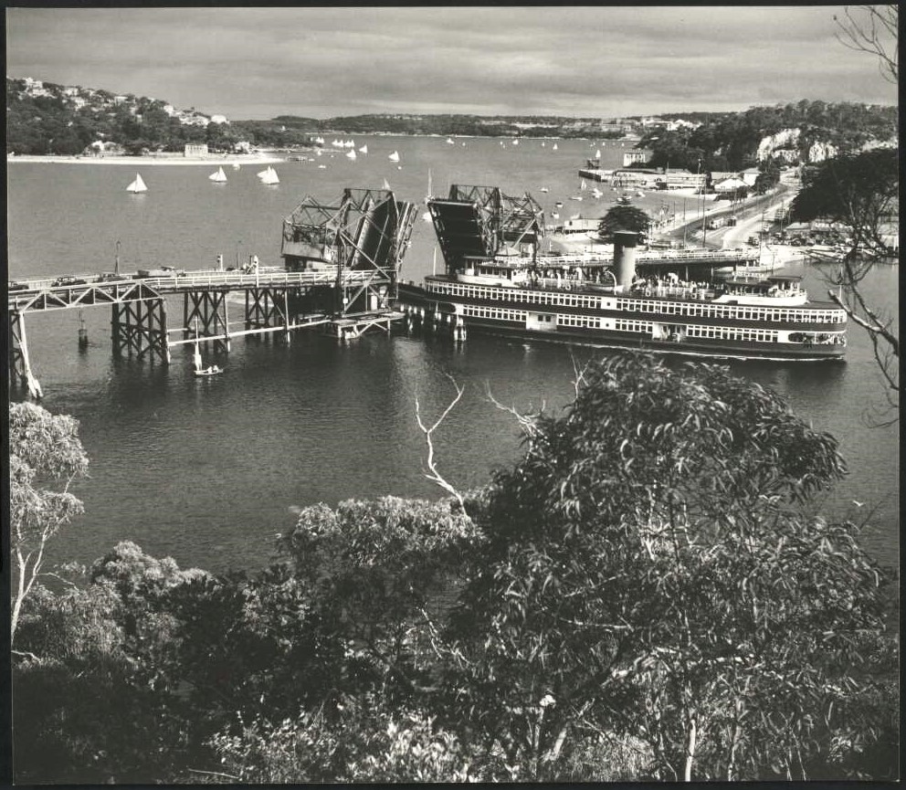
Showboat Kalang going through the old Spit Bridge ca 1940s. Kalang was built as a vehicle ferry in the mid-1920s; after the Sydney Harbour Bridge was opened in 1932, she was converted into a showboat. Photographer: Max Dupain
How to Get to The Spit Bridge Walk
(Using Public Transport)
Dec 2024
13
The Spit Bridge – Where The Spit to Manly Walk Begins (or Ends)
The very popular 10km Spit to Manly (or Manly to Spit) Walk is actually a part of the longer 20km
Many prefer to start their walk from
However, The Spit end of the walk can be a little complicated for those who are ‘first-timers’ on the route. In fact, unless you know where to go, this is potentially the ‘trickiest’ part of the entire walk.
Be AWARE that most maps show the route for the
A Look at What’s Inside:
Let’s unpack this further, using public transport to arrive at (or to depart from) The Spit. We will look into four important points:
Acknowledgement of Country
We acknowledge the Gayamaygal, Cammeraigal, and Borogegal peoples of the Eora Nation as the Traditional Custodians of the lands described in this Post, and we pay our respects to their Elders, past, present, and emerging.
We recognise that although the Eora people may no longer be the title-holders to these lands, they are still connected to the culture and Country of their ancestors, and as custodians of their culture, legitimately consider themselves caretakers of their Country.
We also extend our respects to all other First Nations peoples across Australia, and support the continuation of their cultural, spiritual and educational practices.
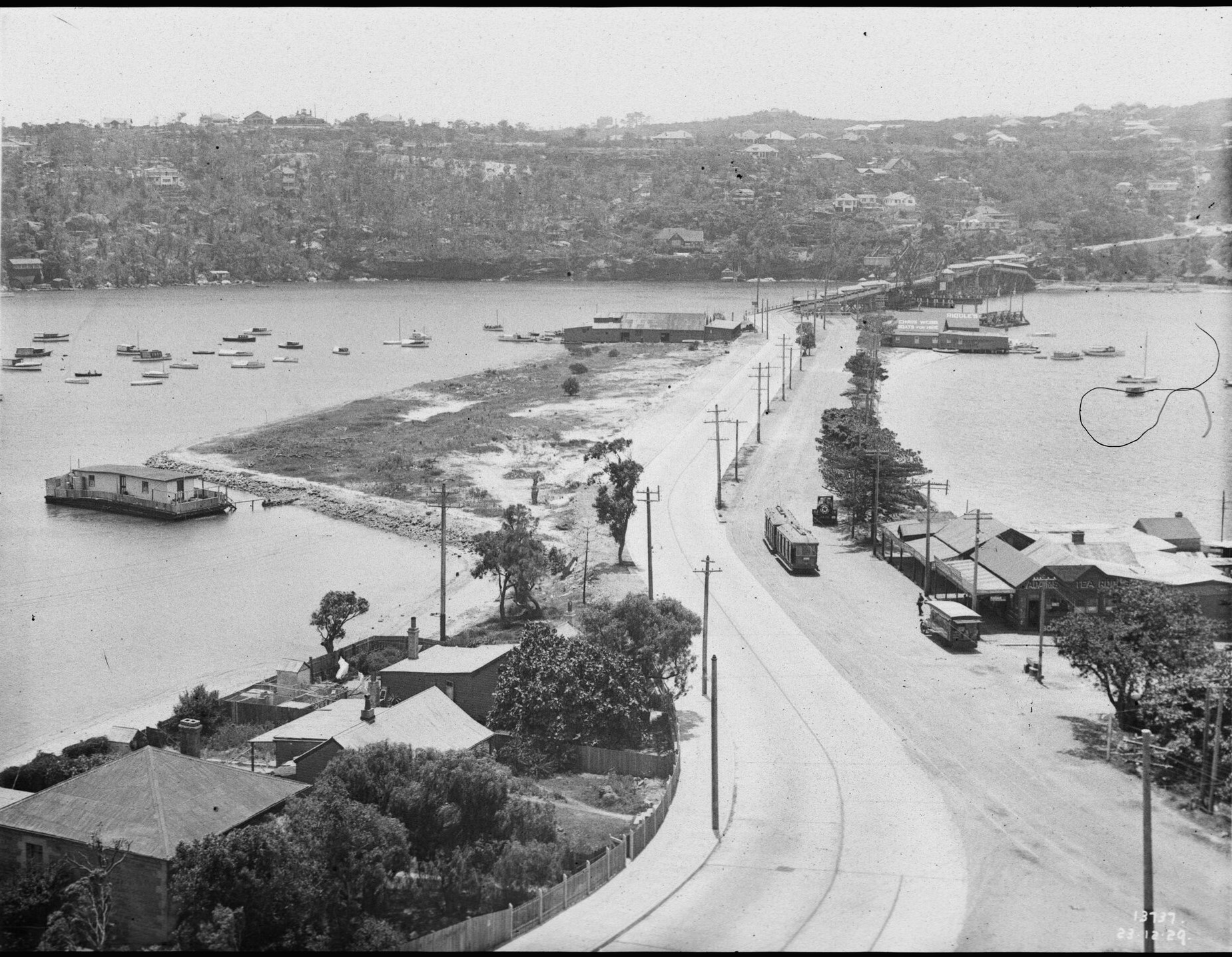
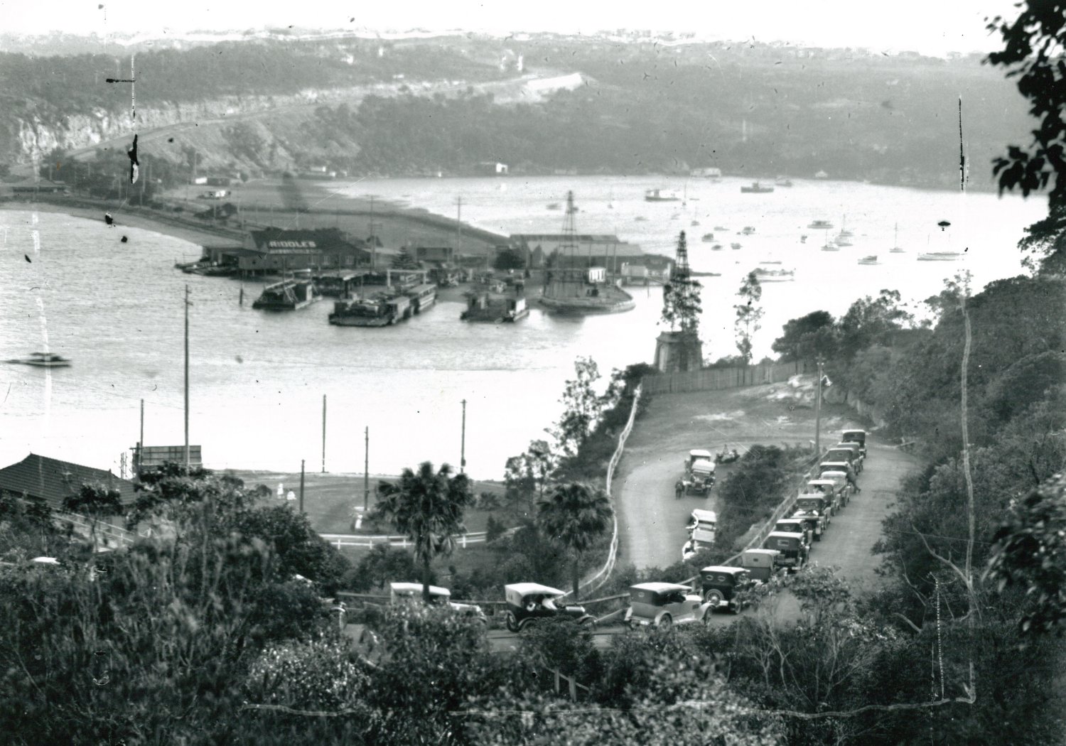
Lower Spit Road looking towards Spit Bridge, Mosman [From NSW Government Printer series: Main Roads] ca 1929. The first Spit Bridge, of only two lanes, was opened in 1924. Compare this image with one below, taken almost 50 years later, from a similar position
1. ‘Need to Know’ about The Spit Bridge, and the A8 Carriageway
The Spit Bridge is a working ‘lift’ bridge, on Sydney’s A8 Carriageway through the north-eastern suburbs. The centre span of the bridge opens at scheduled times during the day to allow boat traffic into/out of the upper parts of Middle Harbour. Each opening cycle takes about 10 minutes. During these times, A8 traffic is completely halted.
The Spit Bridge opening schedules can be found online:
As a major transport link, the A8 is a very busy stretch of road, with three lanes in both directions. However, the Spit Bridge carries only three lanes (total). As traffic approaches the bridge, it is channelled into two lanes in one direction, and one lane in the other (depending on the time of the day).
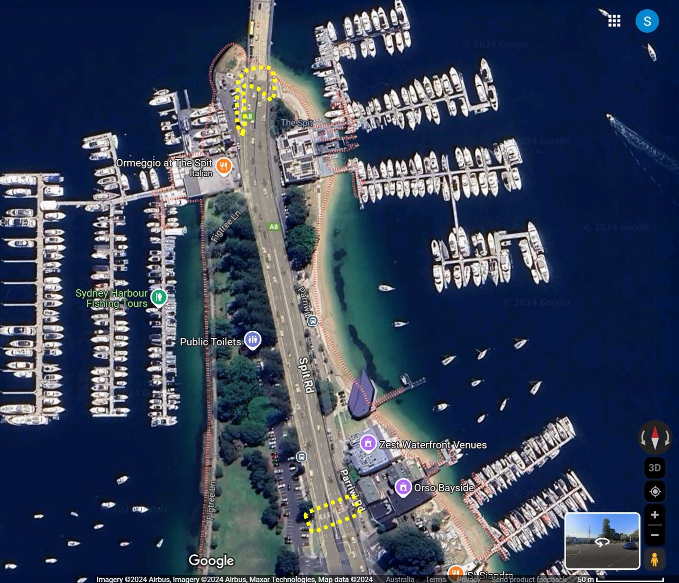
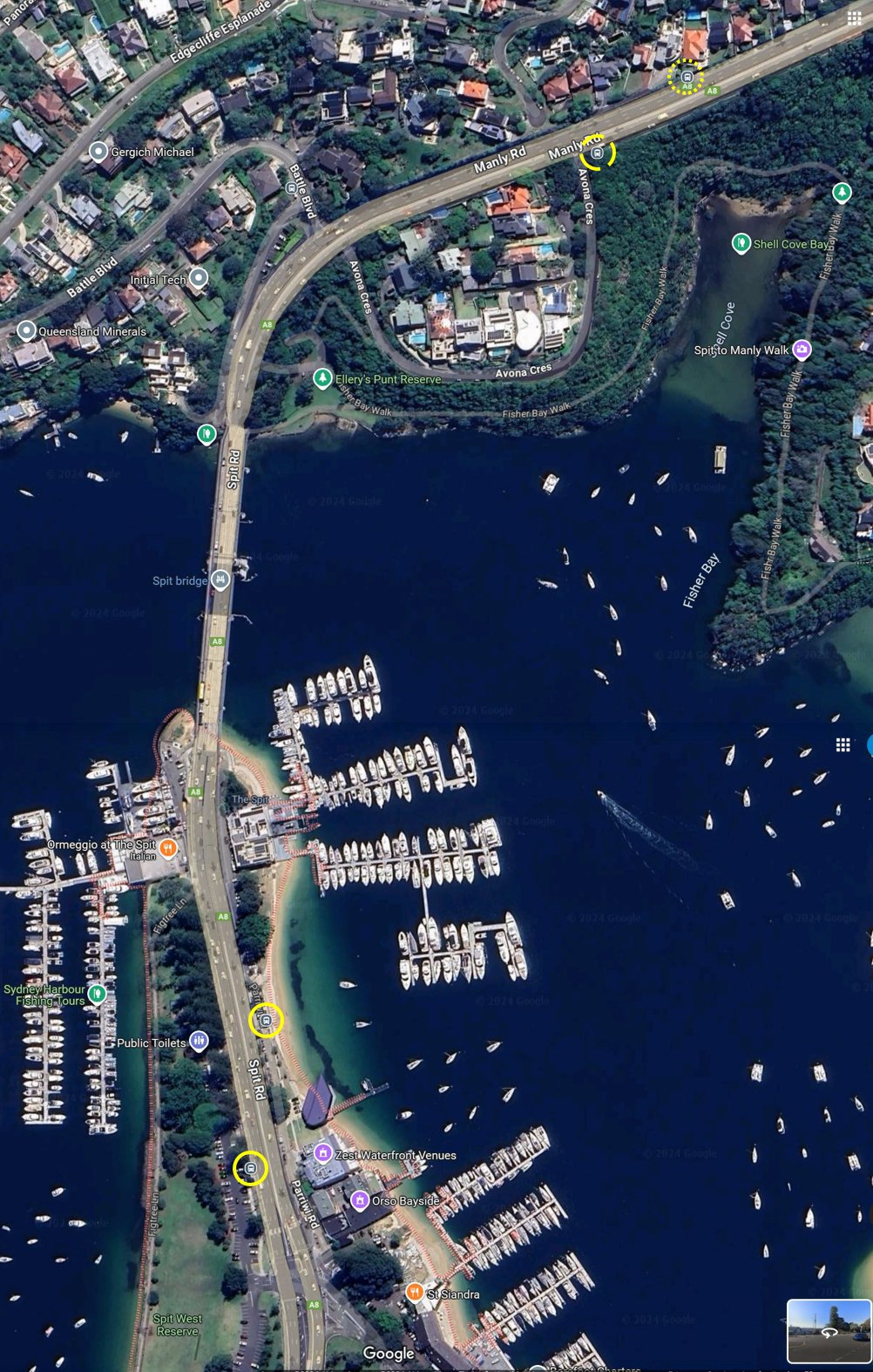
Note that there are only two crossing points on the A8 between the Spit West Reserve (i.e. the bus stop) and the Spit Bridge. The first is a traffic-light controlled pedestrian crossing at the Parriwi Road intersection; the second is a walkway which goes beneath the southern end of the bridge.
Important Note:
There are Public Toilets available in the Spit West Reserve, about 100 meters to the north of the Bus Stop.
As an aside, it seems that parts of Spit Road on the southern side of the bridge may also be known as Military Road in some reference sources.
2. Starting at The Spit (coming from the CBD, or from Manly)
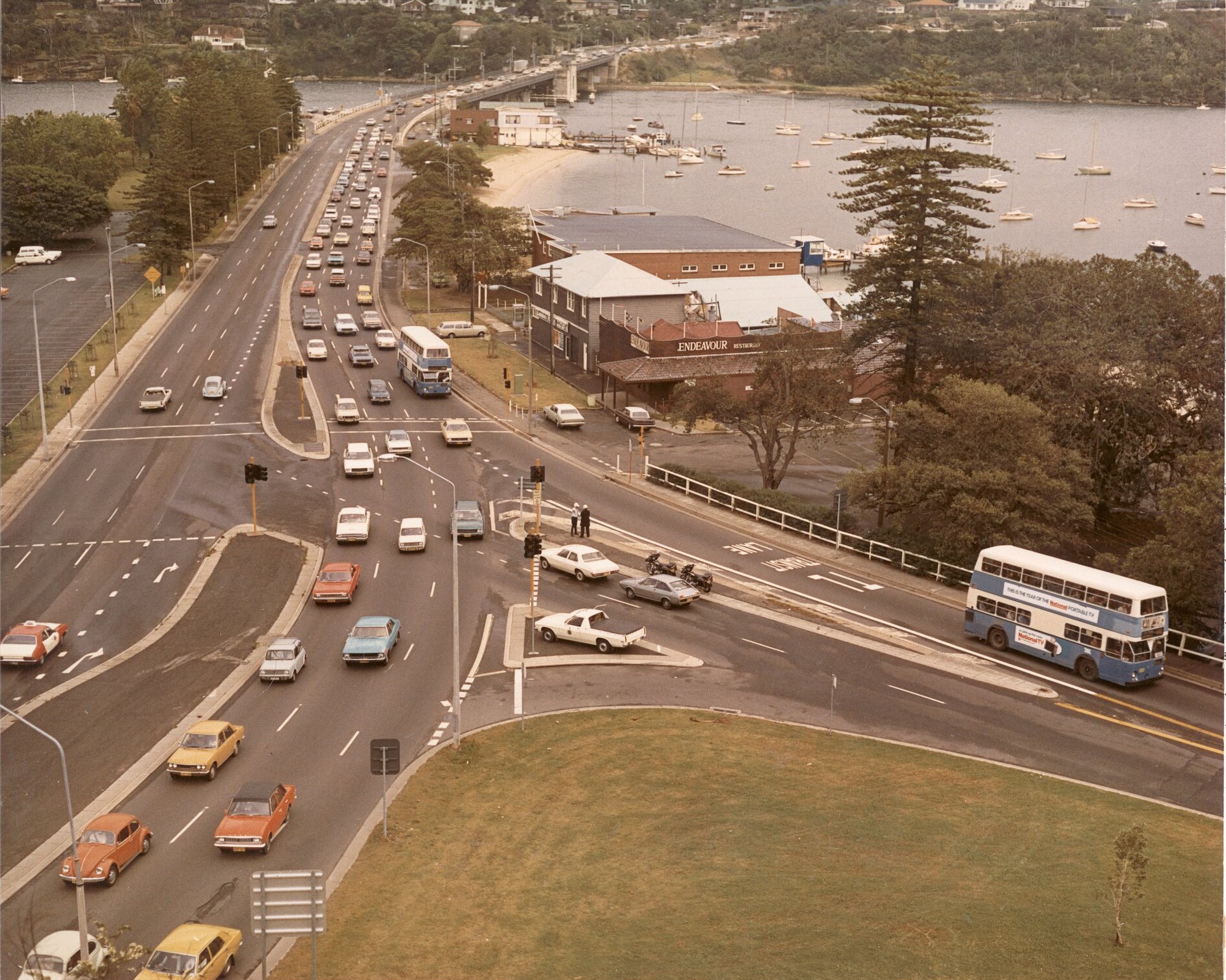
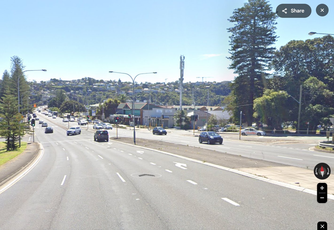
Spit Bridge, South side, Sydney Bus Routes ca 1980s. Around fifty years later, the area remains recognisable
Coming from the CBD
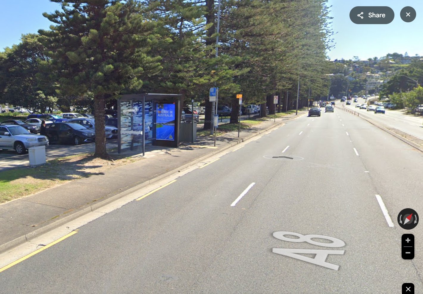
This stop is about 75m after the traffic-lights, at the controlled junction of Spit Road with Parriwi Road.
For public transport, use the NSW Transport Trip Planner to work out your details:
https://transportnsw.info/trip#/trip
Your ‘
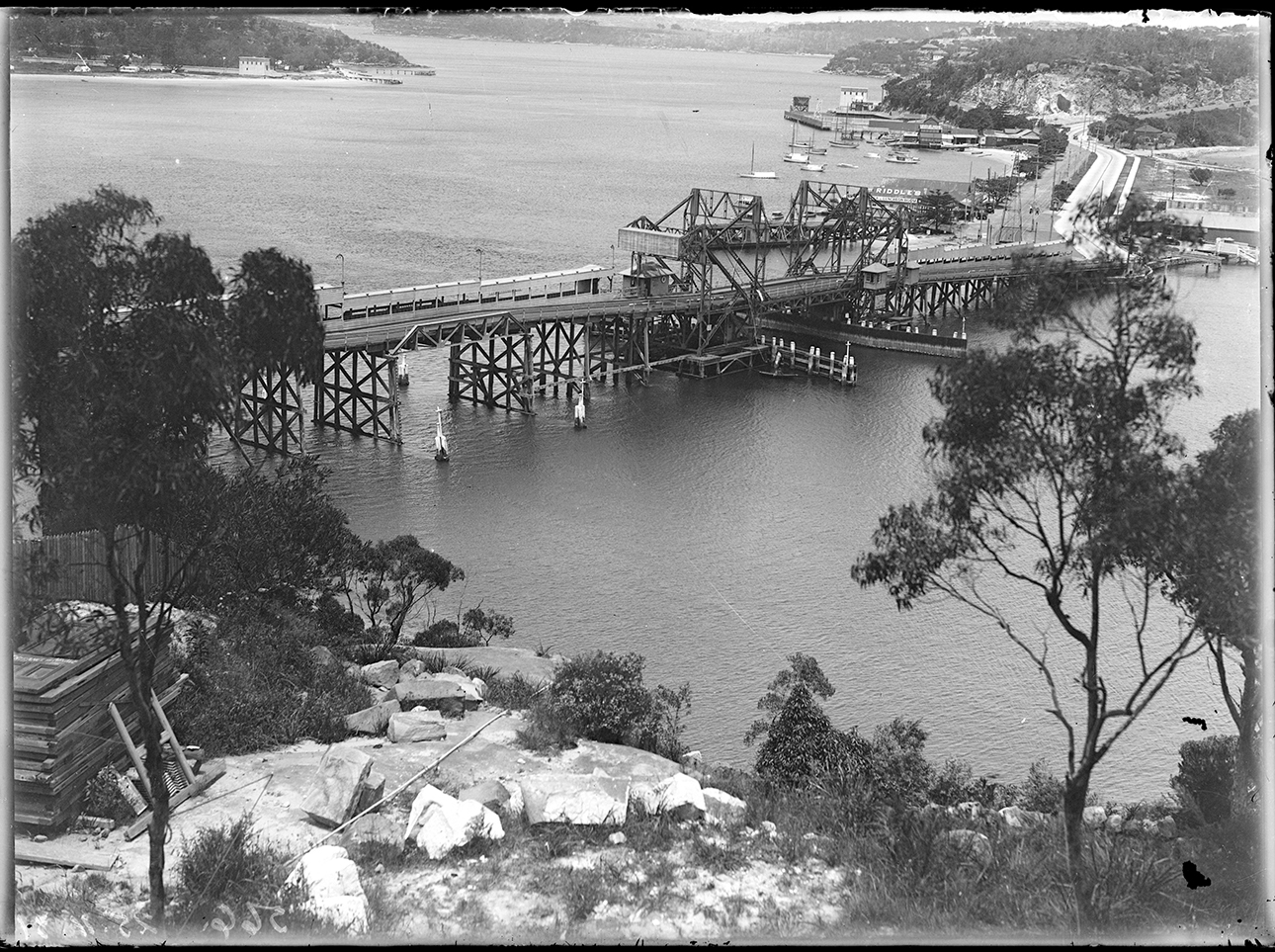
The Spit bridge, 25 November 1931, viewed from Seaforth
Having alighted at Spit West Reserve, walk northwards (towards The Spit Bridge), along the pedestrian pathway beside the road, for about 300 meters, to the deck of the bridge.
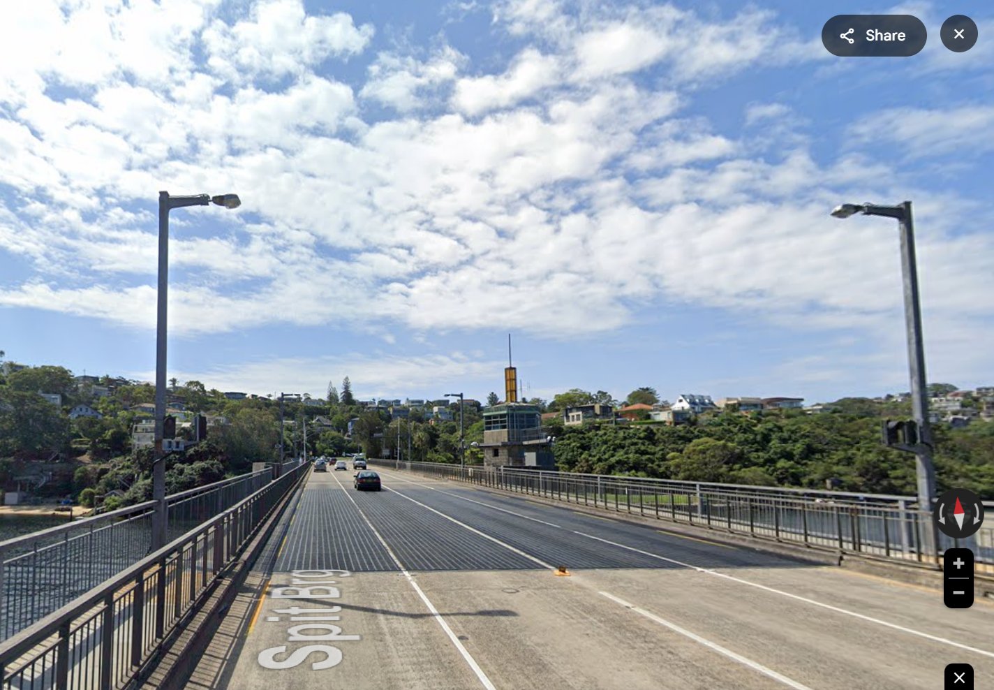
The pedestrian pathway continues over the bridge; the bridge span is about 250 meters (You may be required to wait for a bridge opening cycle).
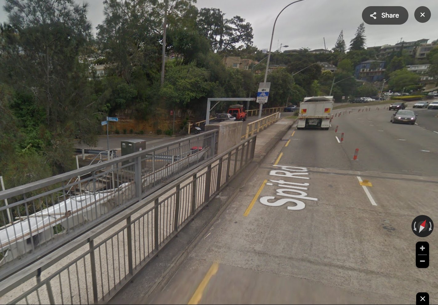
As you reach the northern side of the bridge, look for a set of steps on the left, leading into Battle Boulevard.
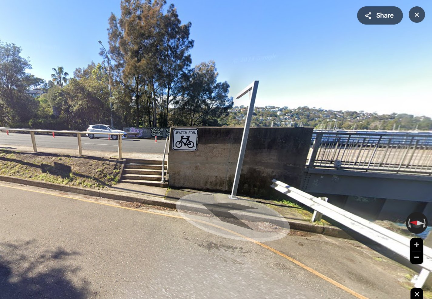
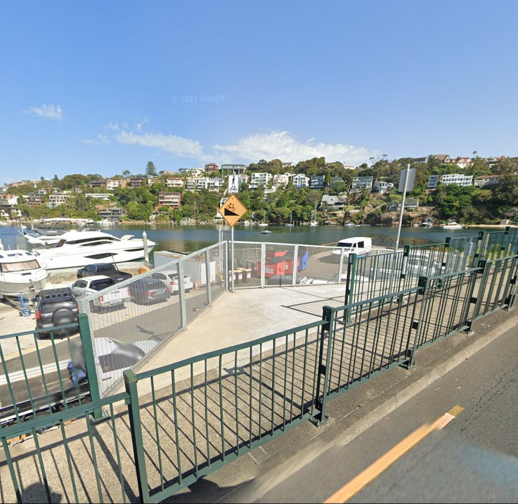
From there, on the left again, another set of steps leads down from Battle Boulevard towards Middle Harbour. This goes to a walkway under the bridge, which takes you into
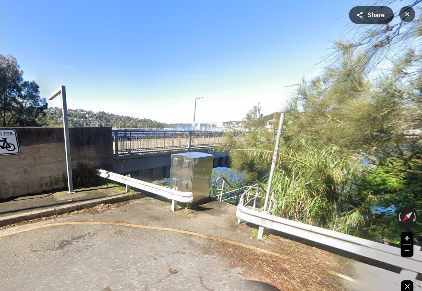
Ellery’s Punt Reserve is the recognised start-point (or end) of the route for
Ahead you will see a sign “Manly Scenic Walkway Fisher Bay”. Now you are onto the Spit to Manly Walk; you will find numerous signposts along the way to guide you.
![view from Seaforth shows the second Spit Bridge being constructed alongside the first bridge - Credit: Don Shearman [flickr]](https://afootwego.com/wp-content/uploads/2024/12/flickr-Spit-Bridge-Construction-ca-1955-don-shearman-CC-BY-NC-2.0-26764188845_467eb3c250_o-scaled.jpg)
Spit Bridge Construction ca 1955. This view from Seaforth shows the second Spit Bridge being constructed alongside the still-in-use two lane first bridge. Construction began in 1952, but did not finish until 1958
Coming from Manly (to The Spit)
Having alighted at
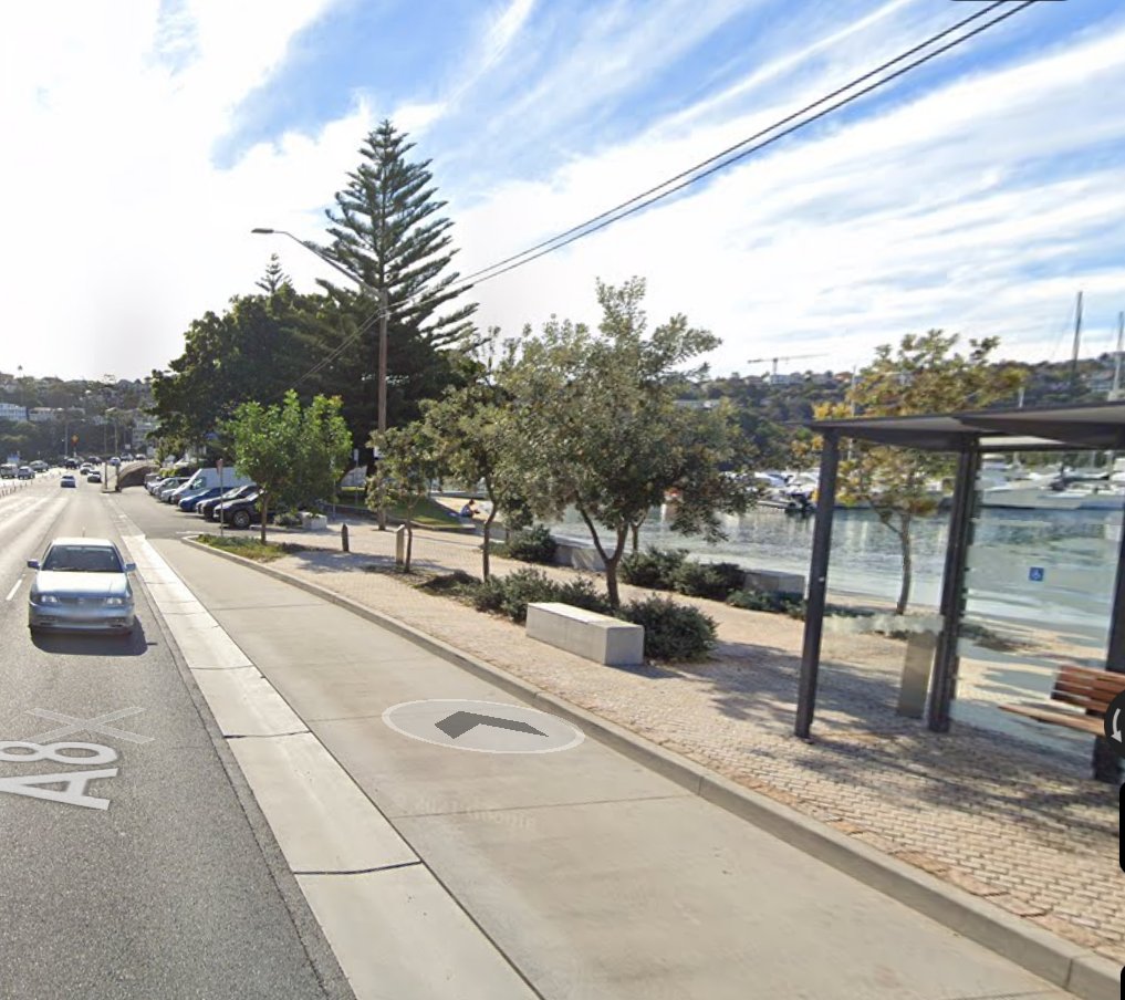
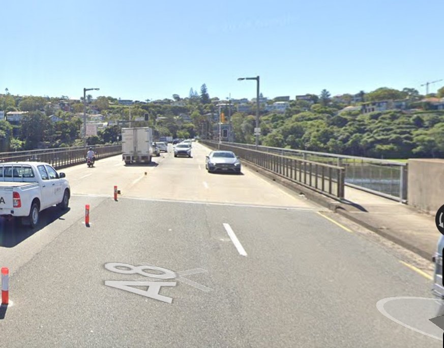
Continue across The Spit Bridge; the bridge span is about 250 meters (You may be required to wait for a bridge opening cycle).
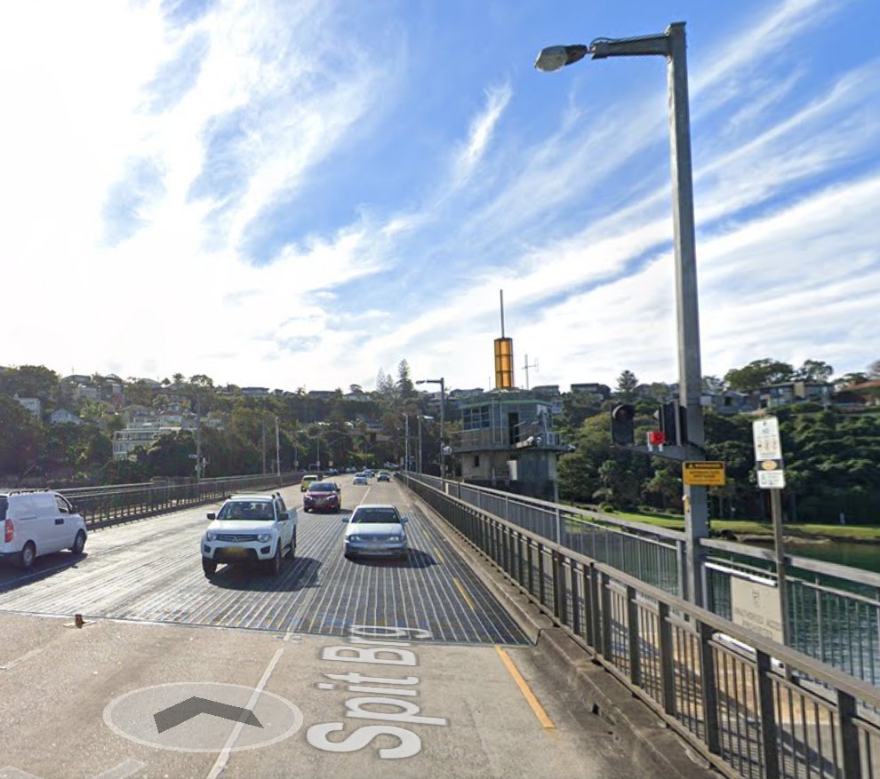
Once on the northern side of the bridge, continue along the pedestrian footpath for about 50 meters, as the A8 curves to the right.
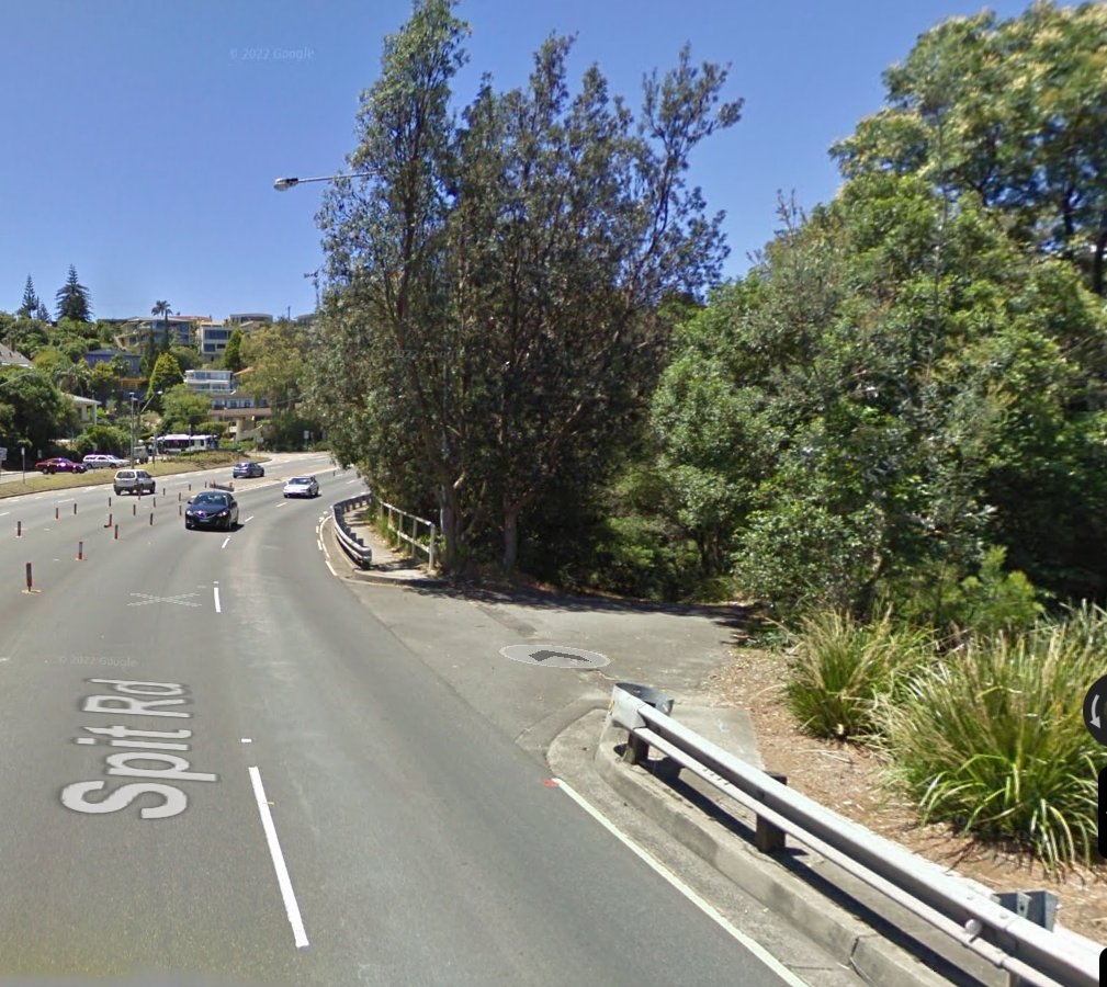
On your right, you will see the start of Fisher Bay Walk, which leads down into the Ellery’s Punt Reserve. This is the recognised start-point (or end) of the route for
Note: be aware the Fisher Bay Walk is also a driveway for service vehicles. As you follow the Fisher Bay Walk, ahead you will see a sign “Manly Scenic Walkway Fisher Bay”. Along the Spit to Manly Walk; you will find numerous signposts beside the track to guide you.
Notes and Things to Check:
Take good trail or hiking shoes, as the walk is over varied terrain
After (or during) wet weather, some parts of the track can become muddy
The Northern Beaches Council notes there are a variety of snakes in local bushland areas; while encounters are rare, a snake will usually move away, unless it feels threatened
When the tide is high, the track detours in places, so you don’t get wet feet
Check the latest Sydney Tide Tables before you go:
https://www.tide-forecast.com/locations/Sydney-Australia/tides/latest
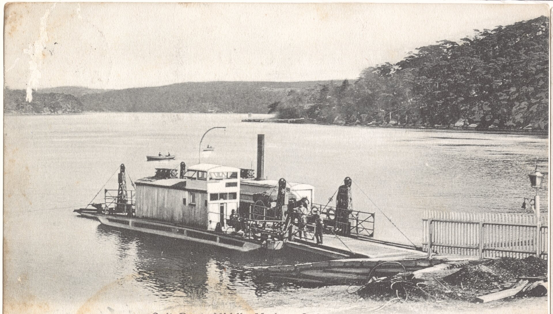
The steam driven Spit Punt at Middle Harbour [NSW OFF RAIL] – the horse and cart suggests a date not later than early 1900s (this punt was introduced in 1889)
3. Finishing at The Spit (going to the CBD, or to Manly)
If you plan to walk from Manly to The Spit, and then to catch public transport into Sydney’s CBD, things are not as complicated (compared to arriving at The Spit by public transport).
And, there may be some who might want to head back from The Spit to Manly, by public transport; so we’ll also cover that.
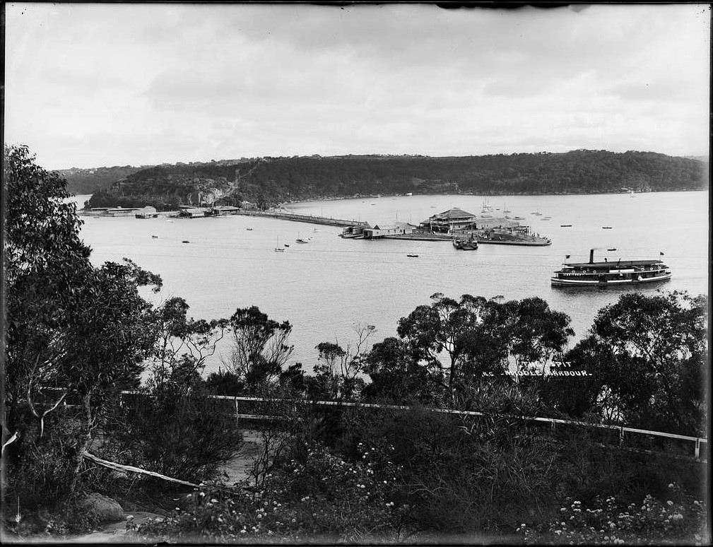
Going to the CBD
As you approach Ellery’s Punt Reserve, follow the sealed pathway of the Fisher Bay Walk as it runs alongside the bush-line on the right.
Fisher Bay Walk terminates at the A8 (on the southbound side), about 50 m before the Spit Bridge. Note: be aware the Fisher Bay Walk is also a driveway for service vehicles.
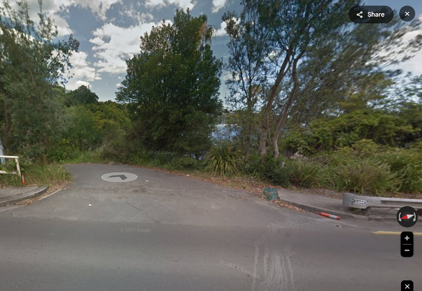
Take the footpath alongside the A8, and continue across The Spit Bridge; the bridge span is about 250 meters (You may be required to wait for a bridge opening cycle).
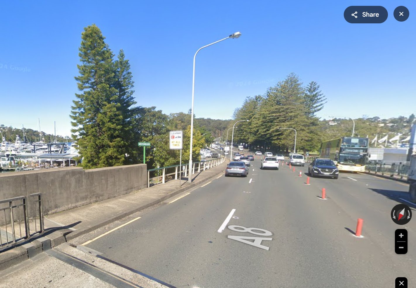
Once on the southern side of the bridge, continue along the pedestrian footpath for about 200 meters, to the
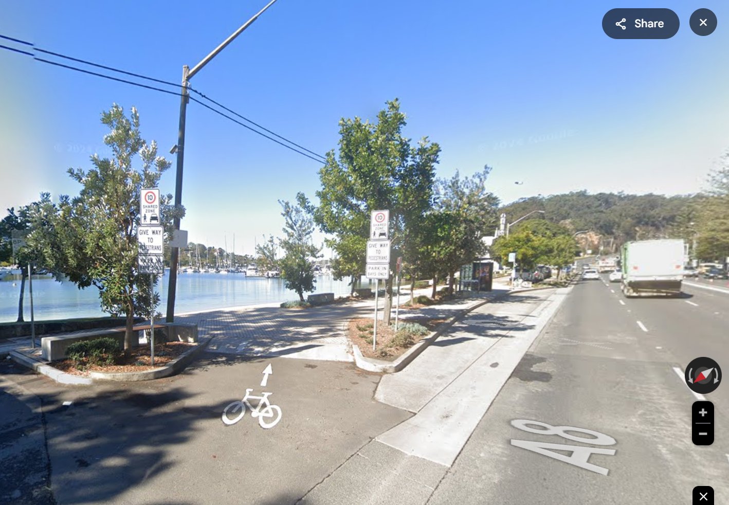
Going (back) to Manly
As you approach Ellery’s Punt Reserve, you have a decision to make about where/how to cross over the A8 Carriageway:
Either take the walkway beneath The Spit Bridge from Ellery’s Punt Reserve, and then walk across the bridge and along on the footpath on the western side of the A8, to the Bus Stop atSpit West Reserve ; this is a distance of around 500mOr follow Fisher Bay Walk to the A8, then walk along the eastern side of the A8, across the bridge and to the Pedestrian Crossing at the A8-Parrawi junction, and then crossing over the A8 and walking back to the Bus Stop atSpit West Reserve ; this is a distance of around 750m
Note that for either, you may be required to wait for a bridge opening cycle.
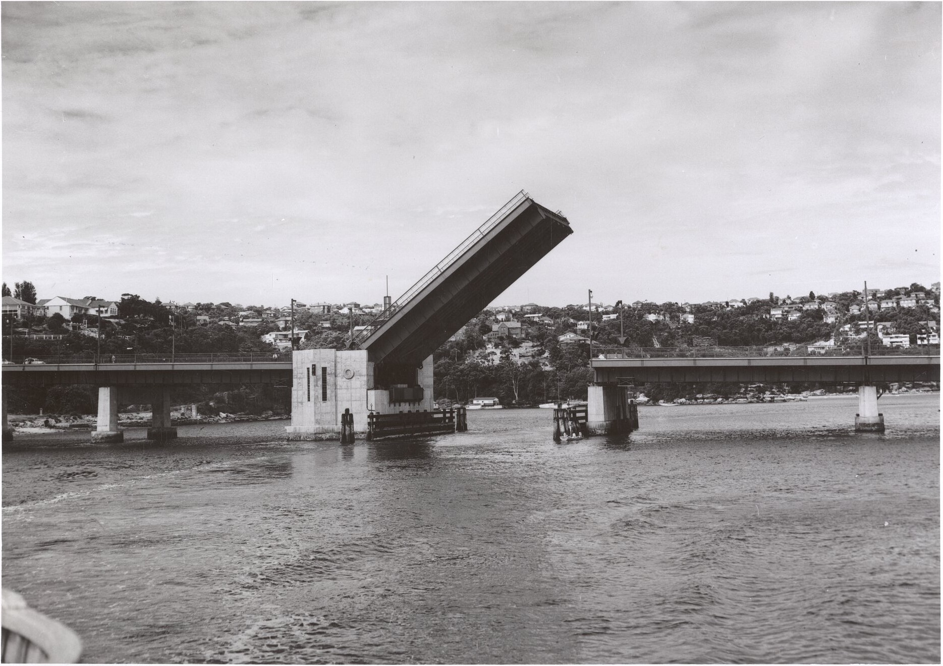
Title: SPIT BRIDGE, NSW OFF RAIL, THE SPIT [undated] || The second Spit Bridge, with a single opening span (known as a bascule) of 80 feet, was opened in 1958
4. At Manly Wharf (starting from, or finishing at Manly)
For completeness, let’s quickly unpack the Manly end:
Starting the Walk from Manly
If you choose to start your walk from Manly (and assuming you arrive in Manly by public ferry), as you exit the Manly Wharf area, you will step onto the (unmarked) Fairlight Walk.
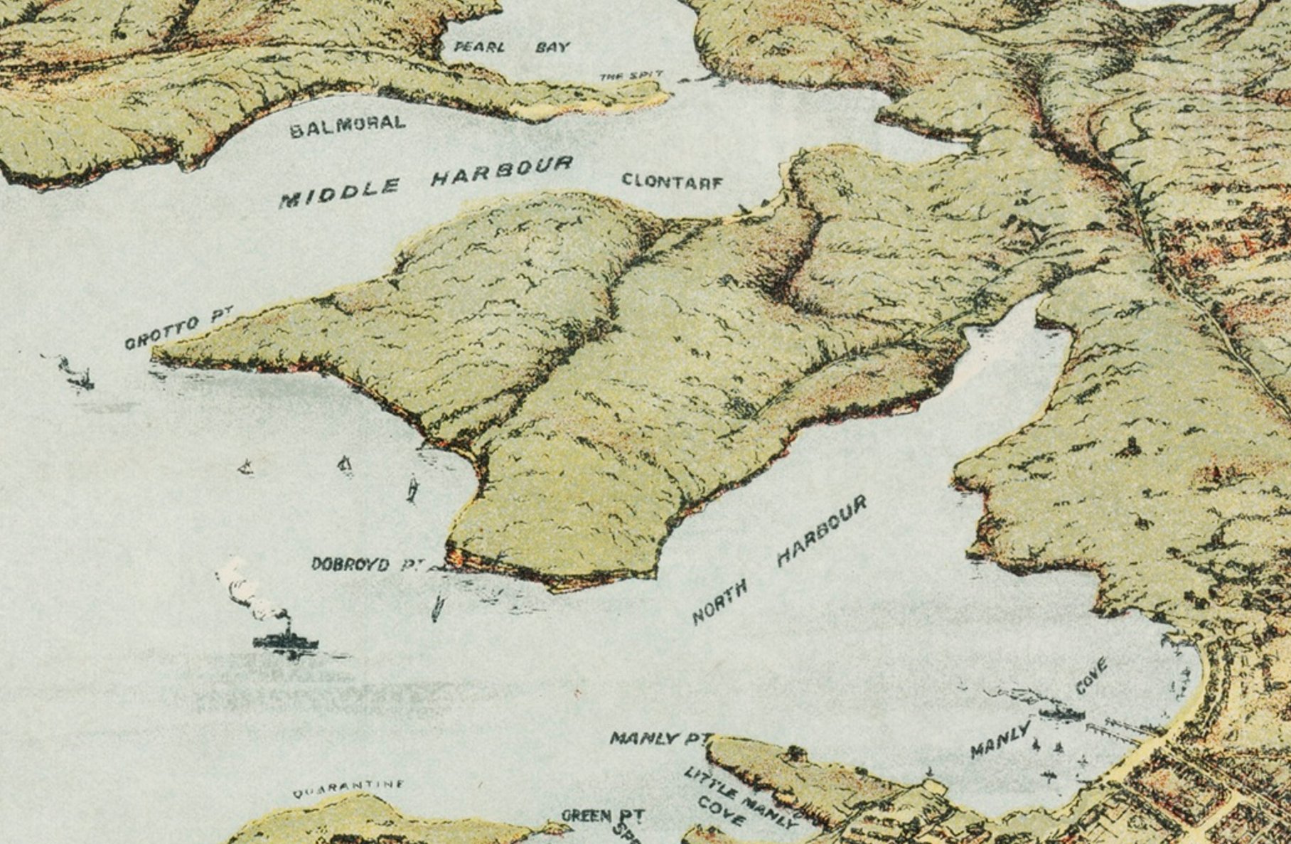
Away to the left of the Ferry Terminal building, you will see a signpost with a number of markers; one of these gives the direction of the
The Fairlight Walk is the first section of the Manly-Spit Walk, and follows the shoreline of Manly Cove, initially in a westerly direction.
Now that you are onto the Manly to Spit Walk, you will find numerous signposts along the way to guide you.
Finishing the Walk at Manly
If you choose to finish your walk at Manly, you will approach along Fairlight Walk, as it follows the shoreline of Manly Cove. As you approach it, the Manly Wharf will become a very obvious landmark.
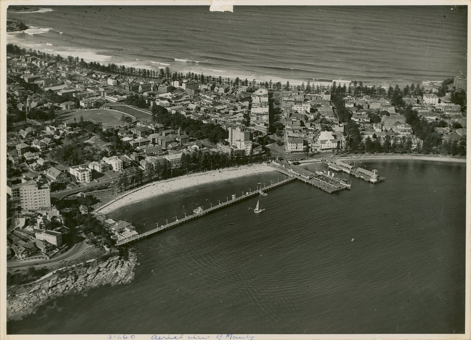
An aerial view of the Manly Wharf, ca 1930s
Wrapping It Up
Initially, I wasn’t going to post this, even though I had almost been caught out by planning to use the wrong Bus Stop for The Spit end of the Walk. I thought that it was ‘just me’, until I read a couple of pieces about people having the same experience, i.e. looking at a map, and then heading to the Bus Stop closest to the
My suggestion, if you are planning to start your
- Alight at the Bus Stop at
Spit West Reserve - Begin a short walk of around 550 meters, along the footpath beside the A8 Carriageway
- This will bring you to Ellery’s Punt Reserve, the recognised start-point for the Spit to Manly Walk
The alternative (that I was somewhat ‘naively’ intending to try) is, to say the least, likely to be rather exciting, probably quite stressful, and could possibly even end up rather badly!
A Final Thought
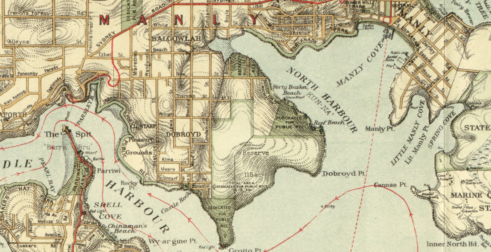
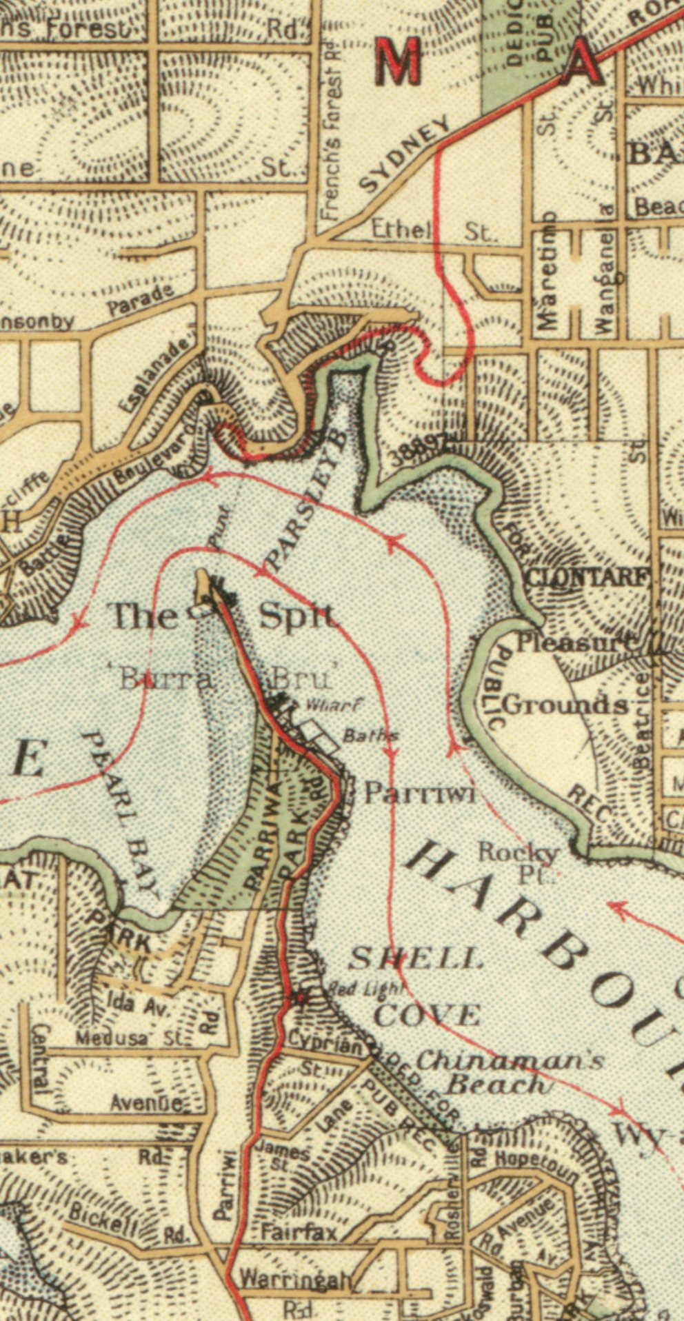
Officially, the Manly to Spit Bridge/Spit Bridge to Manly Walk was opened in 1988. However, the 1919 Department of Lands map of Sydney Harbour reveals that much of the coastal zone between Manly and Seaforth was (then) already zoned “For Public Rec”.
For those of us who enjoy the Spit Bridge to Manly (or Manly to Spit Bridge) Walk, perhaps it is appropriate to reflect for a moment on the foresight of some (apparently) unknown civic authorities, who, well over 100 years ago, set aside much of today’s route for this popular walk.
Had this not been done, who knows whether we would have been able to enjoy this wonderful walk today?

Ellery Hand Punt Memorial [From NSW Government Printer series: Main Roads] This memorial to one of The Spit’s early pioneers stands alongside the Fisher Bay Walk, at Ellery’s Punt Reserve
Useful Links
Manly Scenic Walkway
(Sydney Harbour National Park)
Check for any current alerts:
https://www.nationalparks.nsw.gov.au/things-to-do/walking-tracks/manly-scenic-walkway/local-alerts
Manly Scenic Walkway
[to Spit Bridge]
(Northern Beaches Council)
Manly Scenic Walkway Brochure (PDF):
https://www.northernbeaches.nsw.gov.au/media/9923?1733962627
Your Feedback, please…
Firstly, my thanks to you, for reading my post.
Now, the really BIG question is:
“What value has this Post offered you? “
Has it helped you, or do you need more information?
If you wish to offer some feedback, or to read the feedback from others, please follow the link below to the Feedback Page:
Why Your Feedback is Important to Me
In real life, I am an agile Change Manager, so I know that feedback is an essential part of the improvement process.
Your feedback can help me improve both the content of this Post, and also of future Posts.
If you have a thought, or a question, about the post content, or if you would like to provide feedback about something else, please follow the link to the Feedback Page.
I do look forward to hearing from you, especially if we can make improvements that will help fellow travelers on the road.
Marlene
Please note, before any feedback is posted, it will be moderated. When I am moderating, I may need to contact you, which is why I ask for your email address.
Your email address will
Here is a link to the my afootwego.com CONDITIONS for POST FEEDBACK (2½ mins to read).
Should you wish to peruse them, here are links to my afootwego.com PRIVACY POLICY and Website TERMS and CONDITIONS of USE.
- NOTE:
- This site is specifically designed for responsive display on a mobile device
On devices with wider screens, it will appear as a single, center-aligned column


