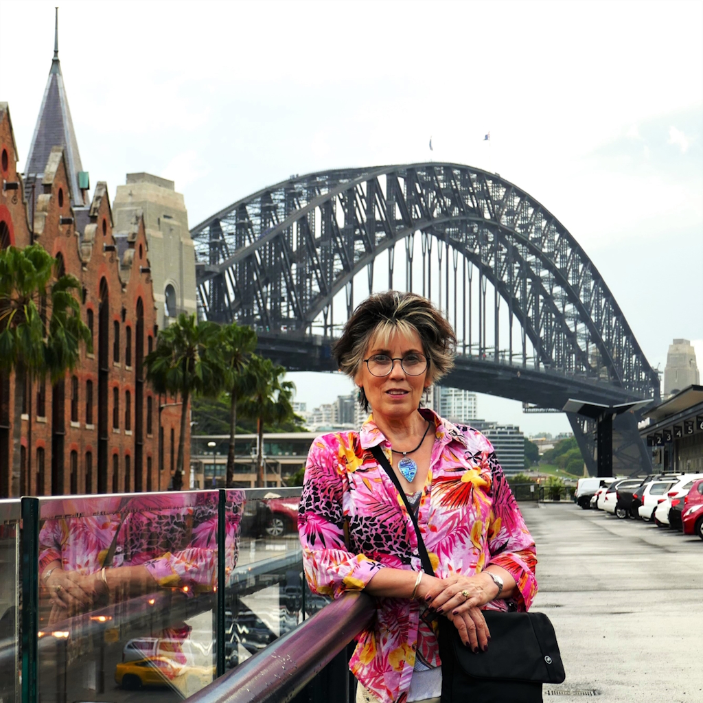
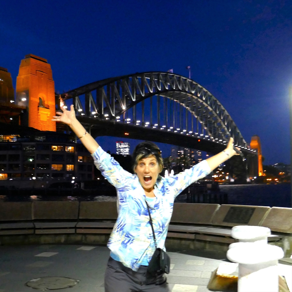
afootwego-01-11-weird-and-wonderfully-unusual-sights-in-sydneys-cbd
afootwego Posts + Stories template
…for people who love to walk…
Supporting Mindful and Responsible Travel
This Post, which includes a Free Self-Guided walking route, investigates 11 Weird and Wonderfully Unusual Attractions within SYdney’s CBD
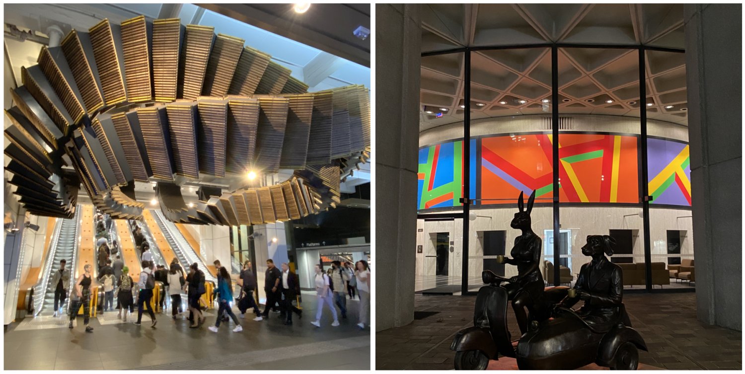
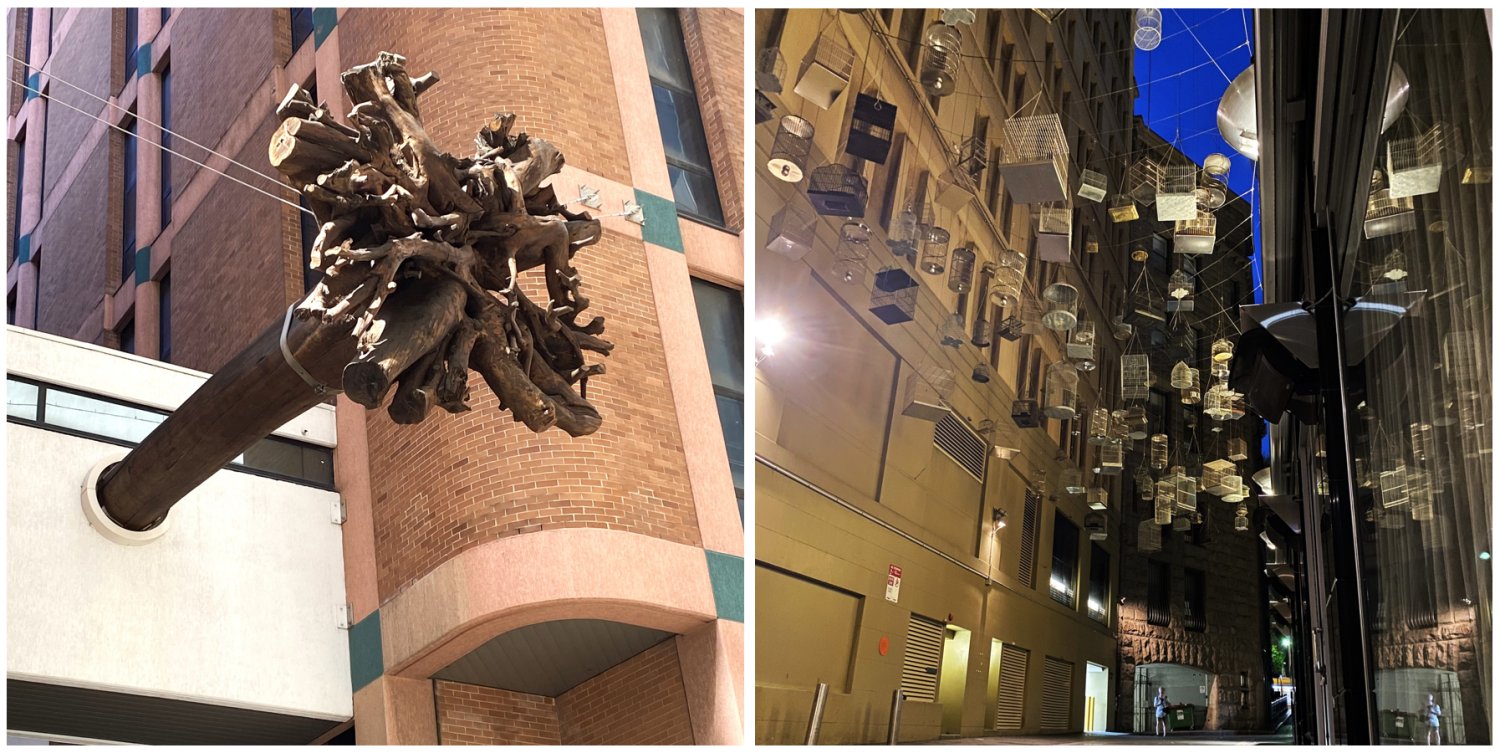
11 Weird and Wonderfully Unusual Sights in Sydney’s CBD
August 2024
24.0
Includes
for your very own
Every destination has something that is unique and unusual, the trick is to be able to find it!
When I go to a city, I like to look for some of the ‘weird and wonderfully unusual’ attractions that it holds, because they tell me something about the character of that city.
The ‘weird’ are things that you don’t expect to see; often these are sculptures, or street art, or even something abandoned. The ‘wonderfully unusual’ are things that might not be quite at the level of ‘top things to see and do’, but they still hold an important message.
Sydney offers a wide range of ‘weird and wonderful’, most are hiding in plain sight. Some are within the inner CBD, while others are a little further afield.
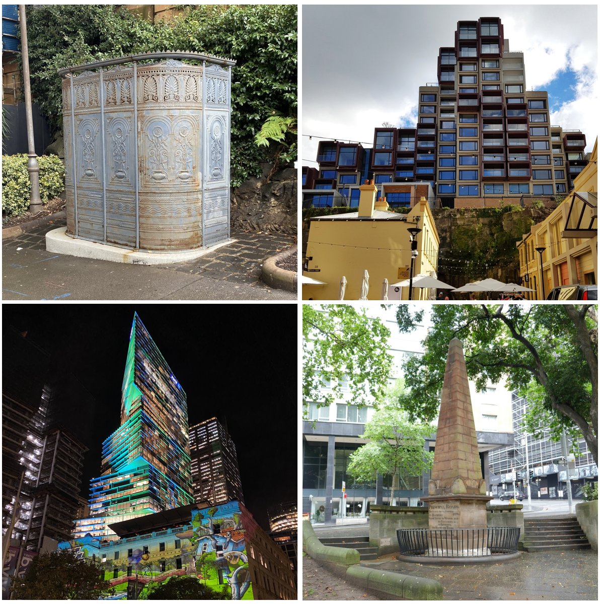
Here is my take on 11 of these, within easy reach of Circular Quay, which is the beating heart of Sydney. All are found between the top of George Street (beneath the Bradfield Highway, at The Rocks), and the former Sydney GPO, at Martin Place.
I have arranged these 11 'weird and wonderful' attractions into a walking route. From a starting point at Circular Quay, the measured walking distance taking in all of the attractions is approximately 3.3 km (2.0 miles), to Martin Place, where the route finishes.
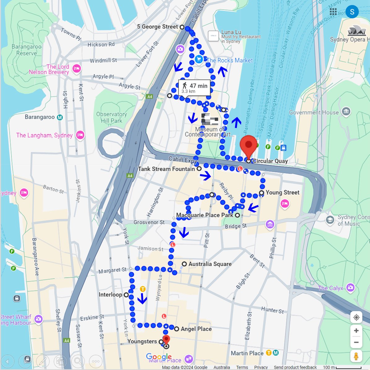
The route takes you through several parts of the early colonial settlement.
You begin by walking along the eastern side of Sydney Cove, where the First Fleet landed in 1788, and then up into The Rocks, which became the home for many of the transported convicts, and for their descendants.
From there, you pass by where the first Hospital was set up, make your way past the site of the first colonial marketplace, then cross over where the Tank Stream flows into the Cove, and continue up to the edge of the original Governor’s garden.
The route then follows the valley of the Tank Stream, along to Australia’s first skyscraper, before deviating away to where the original military barracks were sited, now a park above a train station.
The final section returns to where the Tank Stream once flowed, but is now buried in a culvert, below the site of Sydney’s former General Post Office.
The estimated walking time for the full route, without making any stops, is ±47 minutes (Note: No public transport is available in the Dawes Point area).
For each of the 11 'weird and wonderful' attractions, there is a short description (±1 minute to read). And, for those who want to walk the route, suggested walking ‘directions’ are shown against a light green background, along with a point-to-point map.
Before you begin to use this Free Tour Guide, please take a moment to read through my Conditions for Using Light Footprint Tours Self-Guided Walks, or Tour Guides for Free (±1.0 min read).
Acknowledgement of Country
We acknowledge the Gadigal people of the Eora Nation as the Traditional Custodians of the land described in this Post, and we pay our respects to their Elders, past, present, and emerging.
We recognise that although the Gadigal people may no longer be the title-holders to that land, they are still connected to the culture and Country of their ancestors, and as custodians of their culture, legitimately consider themselves caretakers of their Country.
We also extend our respects to all other First Nations peoples across Australia, and support the continuation of their cultural, spiritual and educational practices.
List of Attractions
In this Post, we shall explore my List of What’s Weird and Wonderful in Sydney’s CBD:
- Wood Block Street Paving – 1880…
- Antique Cast-Iron Urinal – 1880s…
- Sirius Building – 1980, 2024…
- Tank Stream Fountain – 1981…
- Quay Quarter Tower – 1976, 2022…
- Macquarie Place Park – 1810…
- Underwood Ark – 2017…
- Australia Square – 1967…
- Wynyard Station Interloop – 2017…
- Angel Place Forgotten Songs – 2012…
- Youngsters of Barrack Street – 2012…
- Not [Yet] a Coat of Arms – 1874…
My
If you are wanting more information, I can offer an excellent option
My fully curated eBook, “
The eBook delivers a more ‘in depth’ description for each attraction, meaning you gain a much more meaningful experience
Below you will find a sample from the eBook
You can purchase ($10.00 USD) and download the complete eBook by following this link:
11 Stories of Some Weird and Wonderful Shit in Sydney’s CBD
Wood Block Street Paving – 1880
Circular Quay to Wooden Block Paving
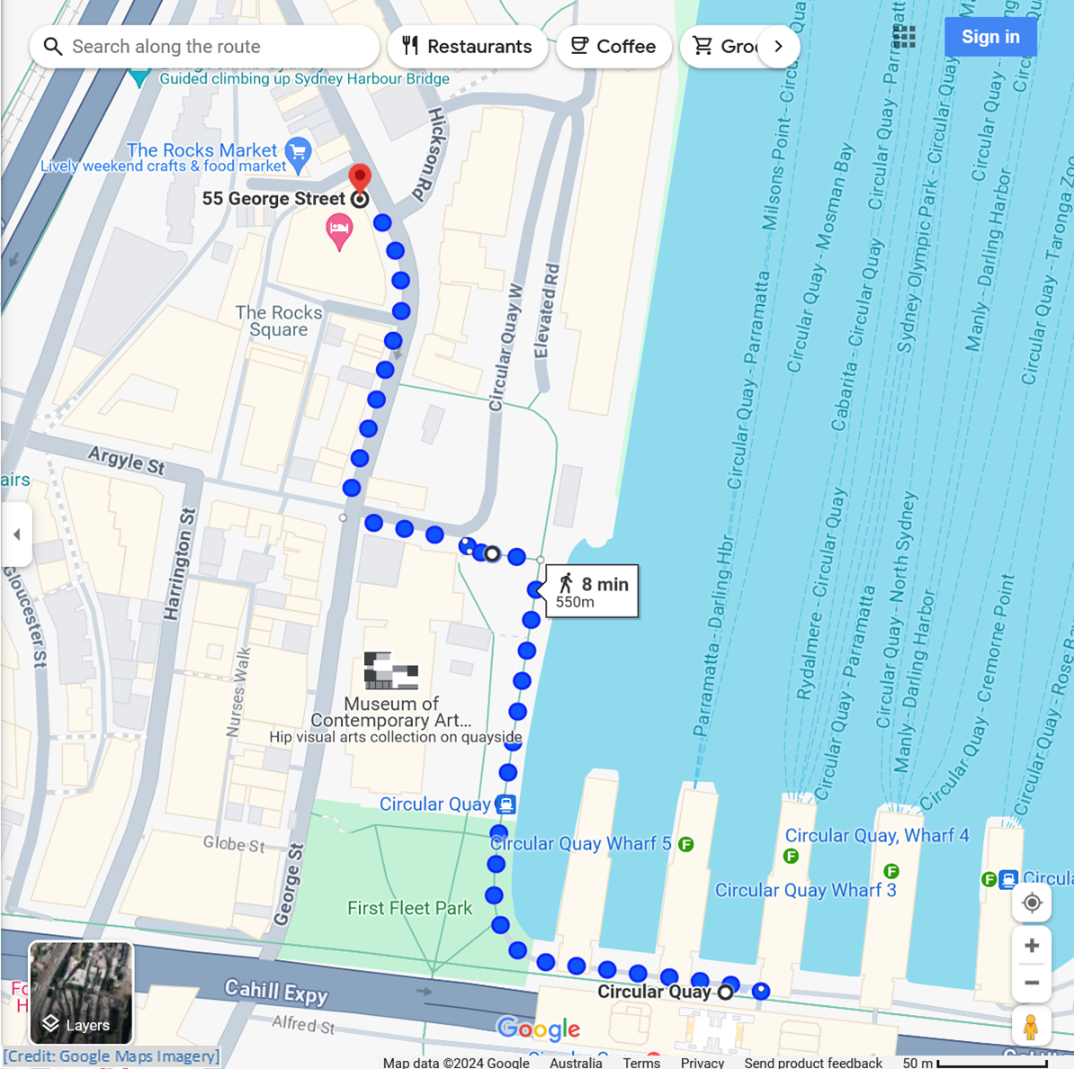
Follow the western edge of Circular Quay to Circular Quay West; follow this up to George Street; follow George Street to the Wooden Block Street Paving display
± 1.0 min to read
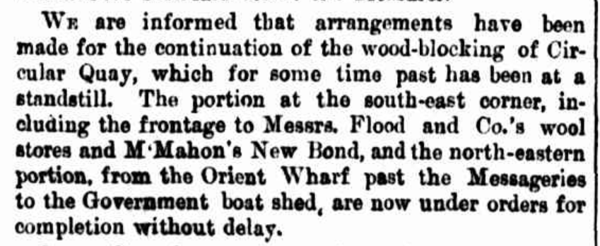
While Sydney did not begin using wooden blocks for paving its streets until 1880, in December 1826 the Hobart Town Gazette carried an article pointing out that “…Vienna and other cities of the Continent of Europe ” were paving street with blocks of hard wood. The article notes “…the wood of the gum tree seems well adapted for this purpose…”.
The Sydney Colonist, in February 1839 suggested “…the authorities charged with the metalling of our public streets ” should consider the use of blocks of wood, rather than stone. It also noted that New York had adopted wooden paving, and London’s Oxford Street was about to.
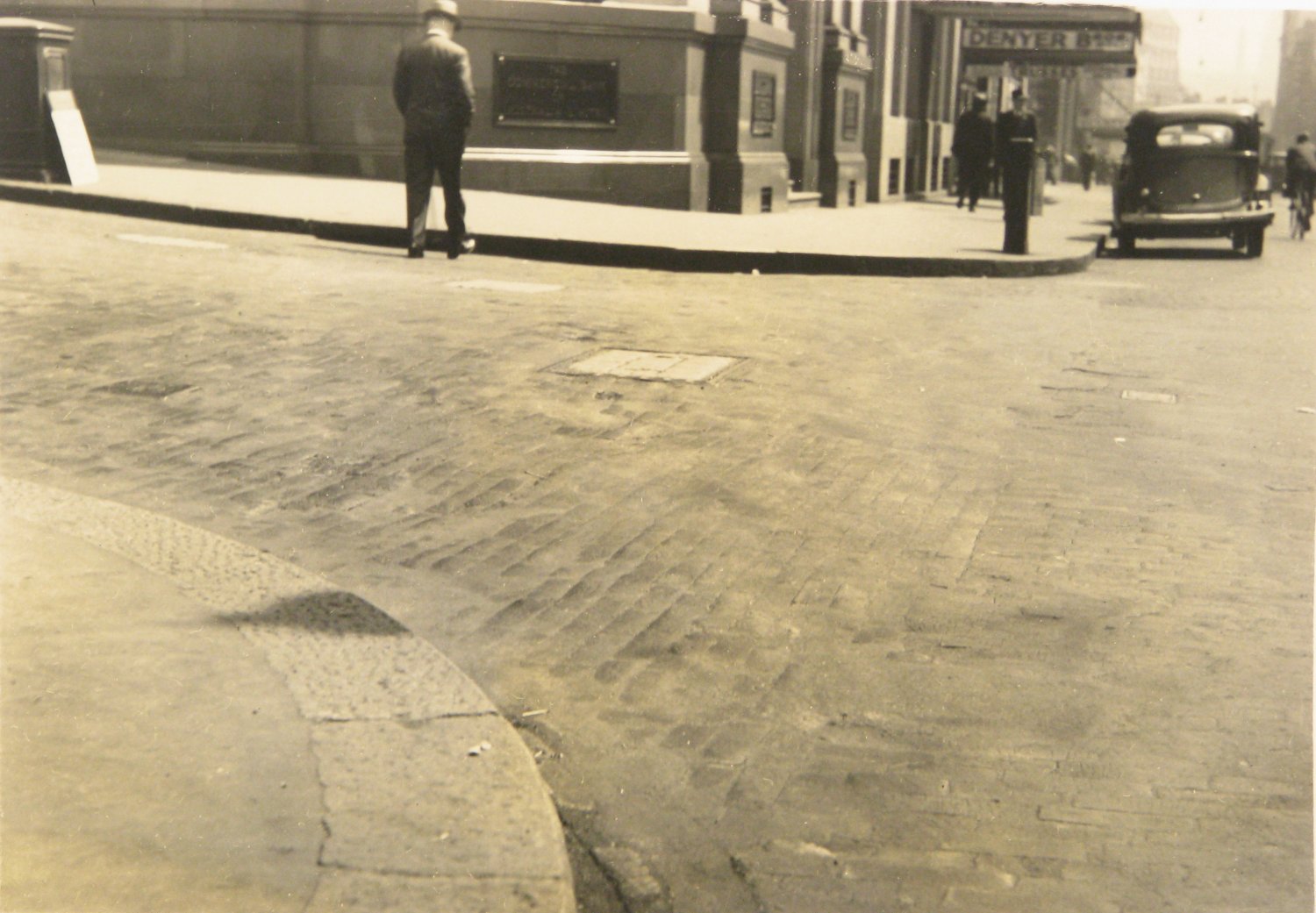
Date of photograph is unknown; construction of the current bank building was begun in 1921
In spite of this prompting, it was not Sydney that created Australia’s first wooden paved streets. This honour apparently goes to Echuca, on the Murray River, in 1867. It seems that Sydney was waiting for someone bold enough to try out the ‘new technology’!
Ultimately, this happened to be Adrien Mountain, who was appointed City Surveyor in 1879. Under his watch, Sydney, and later Melbourne, began to lay mile upon mile of wooden street paving. It seems that he pioneered the use of Australian hardwoods for this purpose.
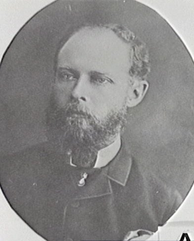
Chief Draftsman, City Surveyor’s Department 1872-1878; City Surveyor 1879-1886, Municipal Council of Sydney. In 1886 Mountain became City Surveyor in Melbourne.
By the 1890s, Australian hardwoods, such as jarrah and karri, were being exported to Britain for paving the streets of British cities. Large amounts of timber were extracted and shipped from the forests of Western Australia.
Wood Block Street Paving – 1880
± 2.5 min to read
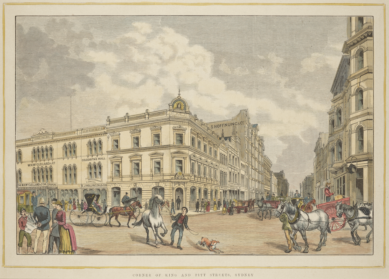
Credit: City of Sydney Archives Unique ID: A-01203632
For over 50 years, Sydney’s streets and roads were paved with wooden blocks. According to archives from the City of Sydney: “The first experimental woodblocks were laid in King Street, between Pitt and George Streets, in August 1880.”
In 1912, with an estimated 100 million wooden paving blocks in use, Sydney had the largest area of wood-paved roads in a single municipality anywhere in the world. The total length of paved roads was 49.8 km (31 miles), covering 598,000 square meters (148 acres) of pavement surface.
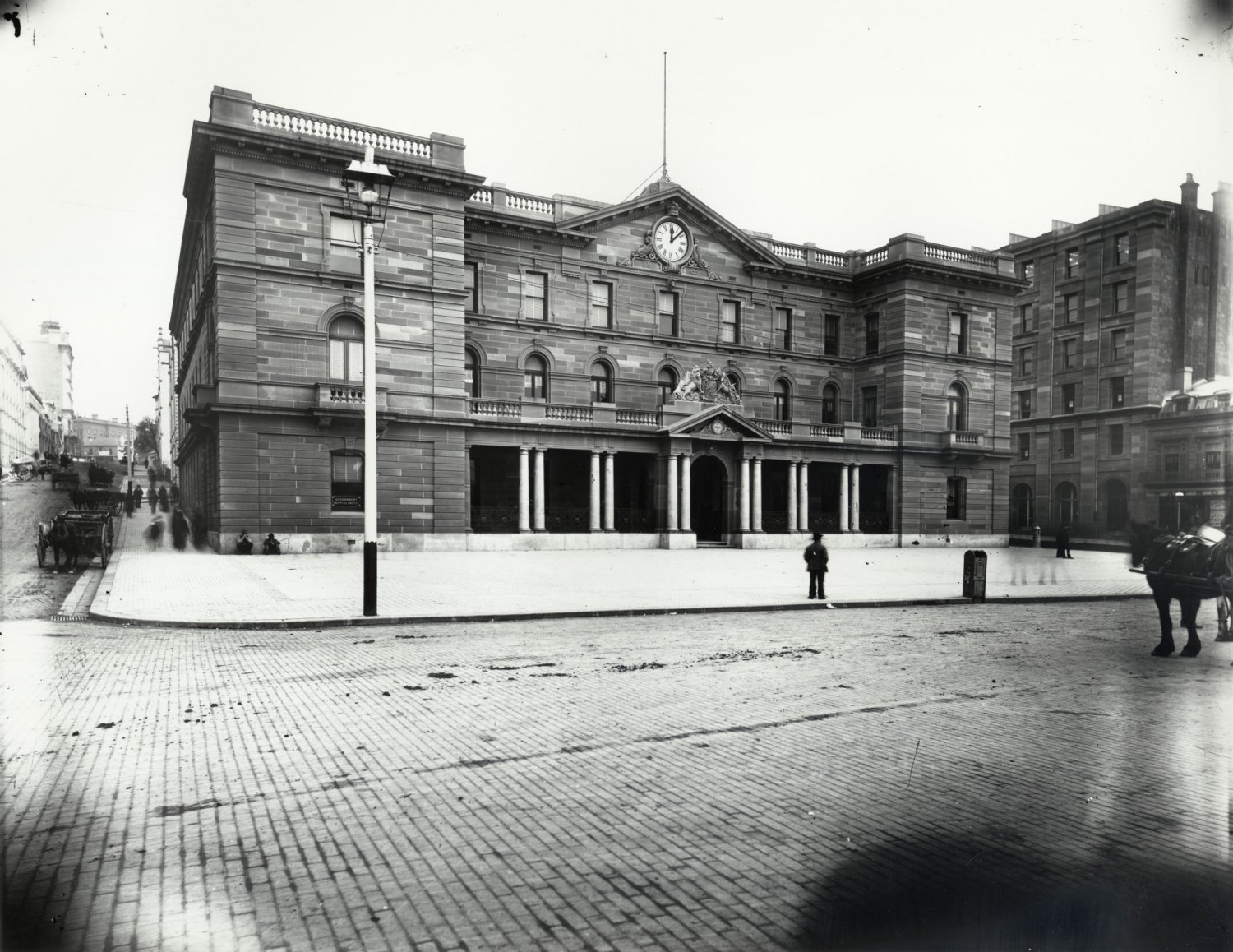
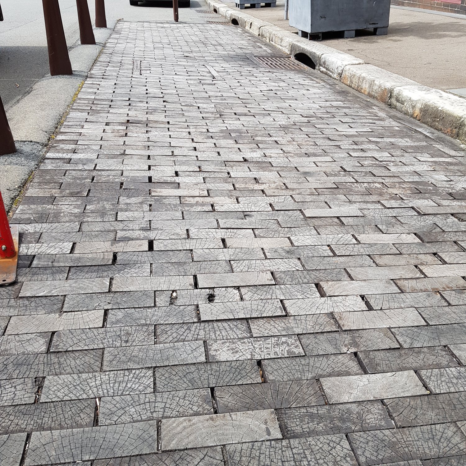
The five square meters of recreated wooden paving on display at The Rocks, near the corner of George and Playfair Streets, is a visual reminder of that era. Two nearby information boards provide parts of the story of Sydney’s wooden streets.
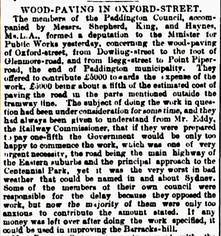
The story of Sydney’s streets and roads begins on 27 January, 1788, as the convicts began to come ashore. David Collins, Secretary to Governor Arthur Phillip, tells us: “…every man stepped from the boat literally into a wood…”.
About the next few days, David Collins says: “As the woods were opened and the ground cleared, the various encampments were extended, and all wore the appearance of regularity.”
At Sydney Cove, there were no roads or streets for the fledgling colony to use. The colonists may have found some tracks through the “wood ”, formed by the local Gadigal people. However, once the tent lines, stores areas, hospital, and cooking areas were established, new tracks would have begun to evolve.
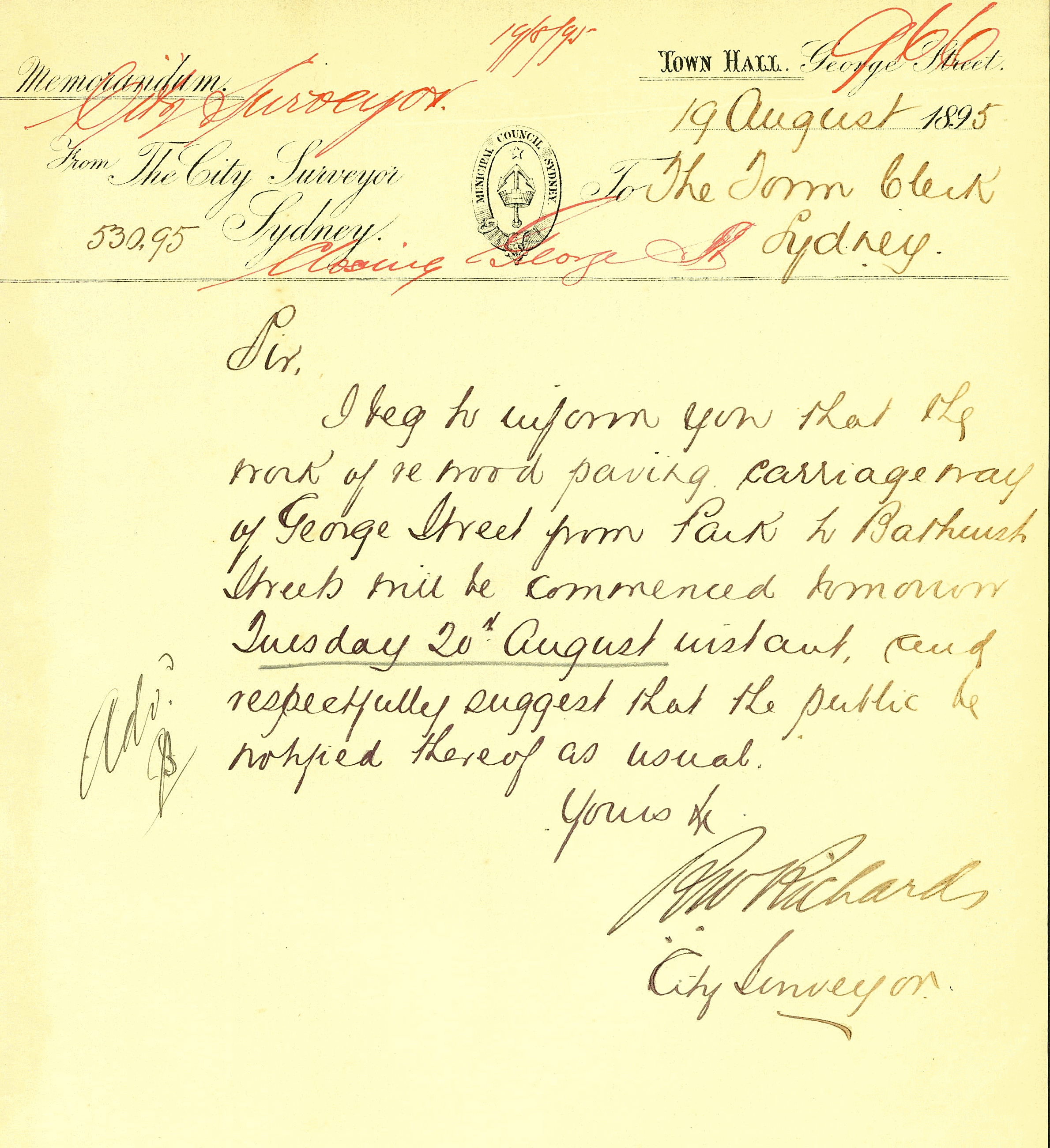
Over time, many of these new tracks would become the early streets (or “rows”) of Sydney. Pitt-row is said to be the ‘oldest named street’ in Sydney; it came into existence as a row of tents, later huts, along the bank of the Tank Stream.
Today’s George Street was originally known as Spring-row, where it ran alongside the Tank Stream. Spring-row began at the original town market place, which was near the mouth of the Tank Stream, probably alongside today’s First Fleet Park.
The track that ran from the market place towards the Artillery Battery, at Dawes Point, was originally known as Sergeant Major’s-row. Spring-row and Sergeant Major’s-row did not run together neatly. At some point, as Spring-row developed, it was renamed to High-street, in keeping with British conventions for naming the main thoroughfare of a town.
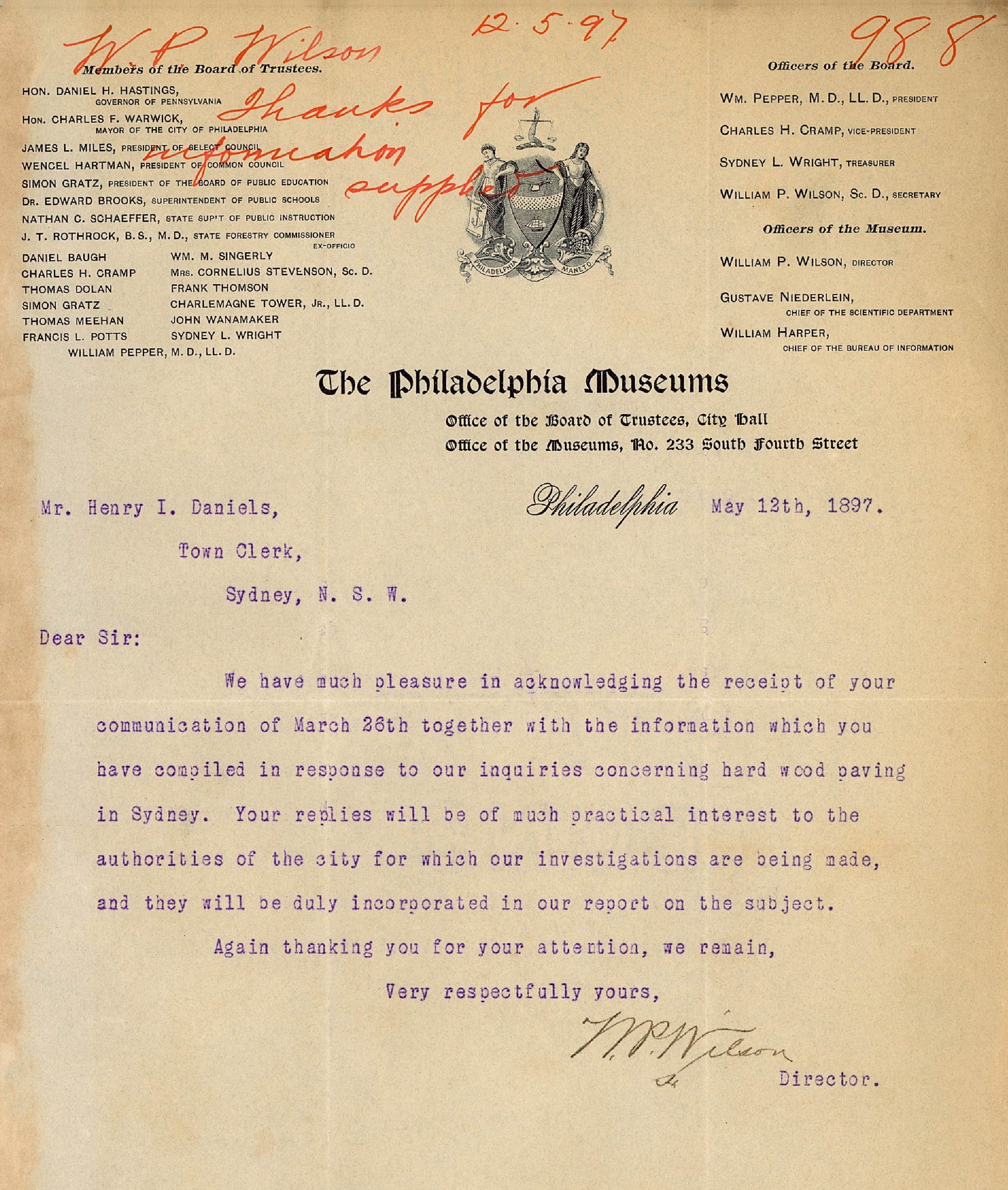
When Governor Macquarie arrived in Sydney, he wanted streets straightened and widened, some were also realigned. This was when the two former rows were joined together to become George Street.
However, there was one perplexing problem facing the colony, as the new Governor went about creating an orderly network of streets across the settlement at Sydney Cove. Australian Blackbutt trees are a hardwood, they are resistant to decay and to termites. The colonists soon found that they were also resistant to their puny British axes!
Governors like straight streets and roadways; Blackbutt trees like to grow where they find good soil. Much of Sydney Cove was almost certainly well covered in mature trees, such as the Blackbutt. Often, stumps as large as 2 meters in diameter were left in the ground, and early roadways had to be built around them. It could take from 10 days to a fortnight to burn out an old stump.
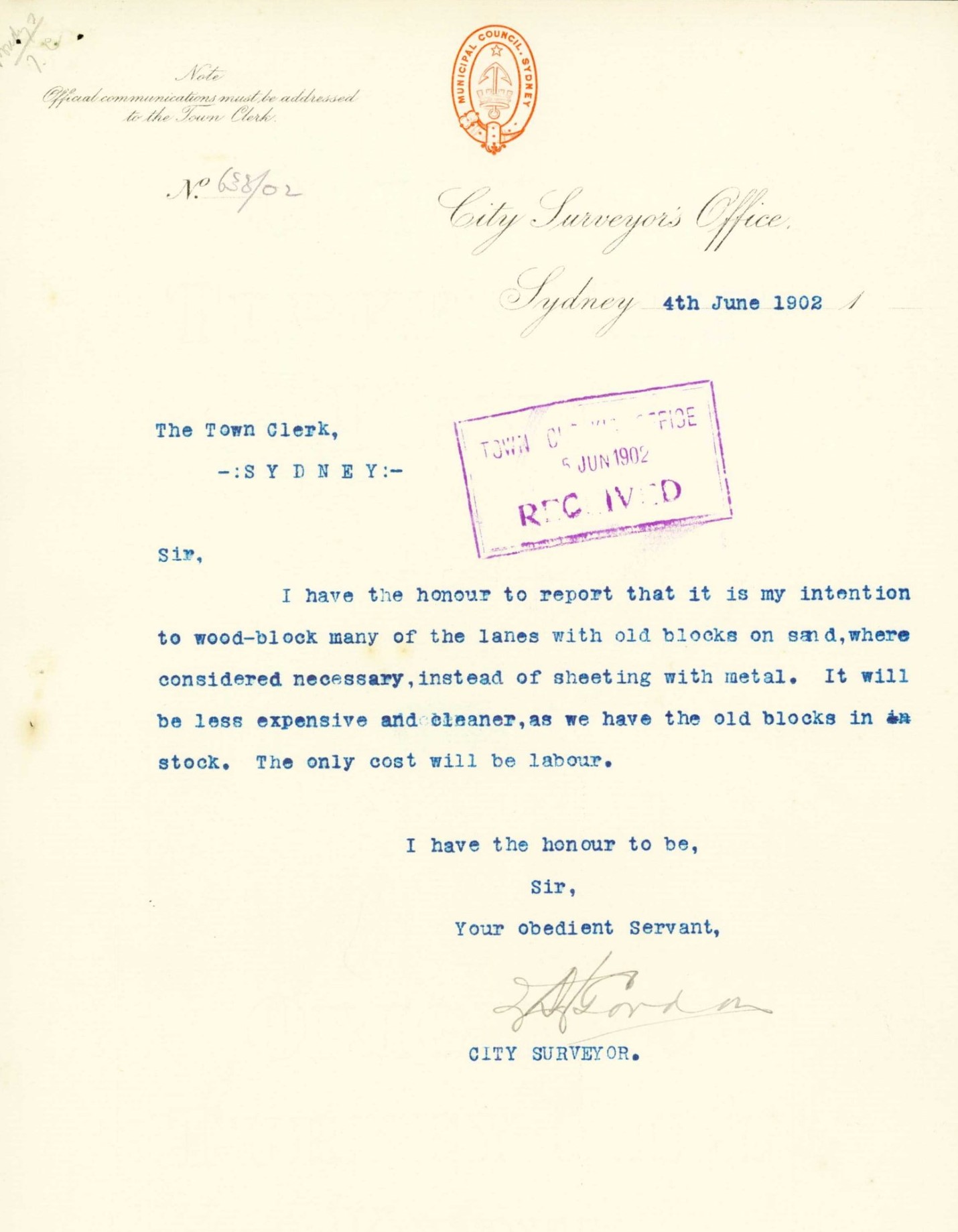
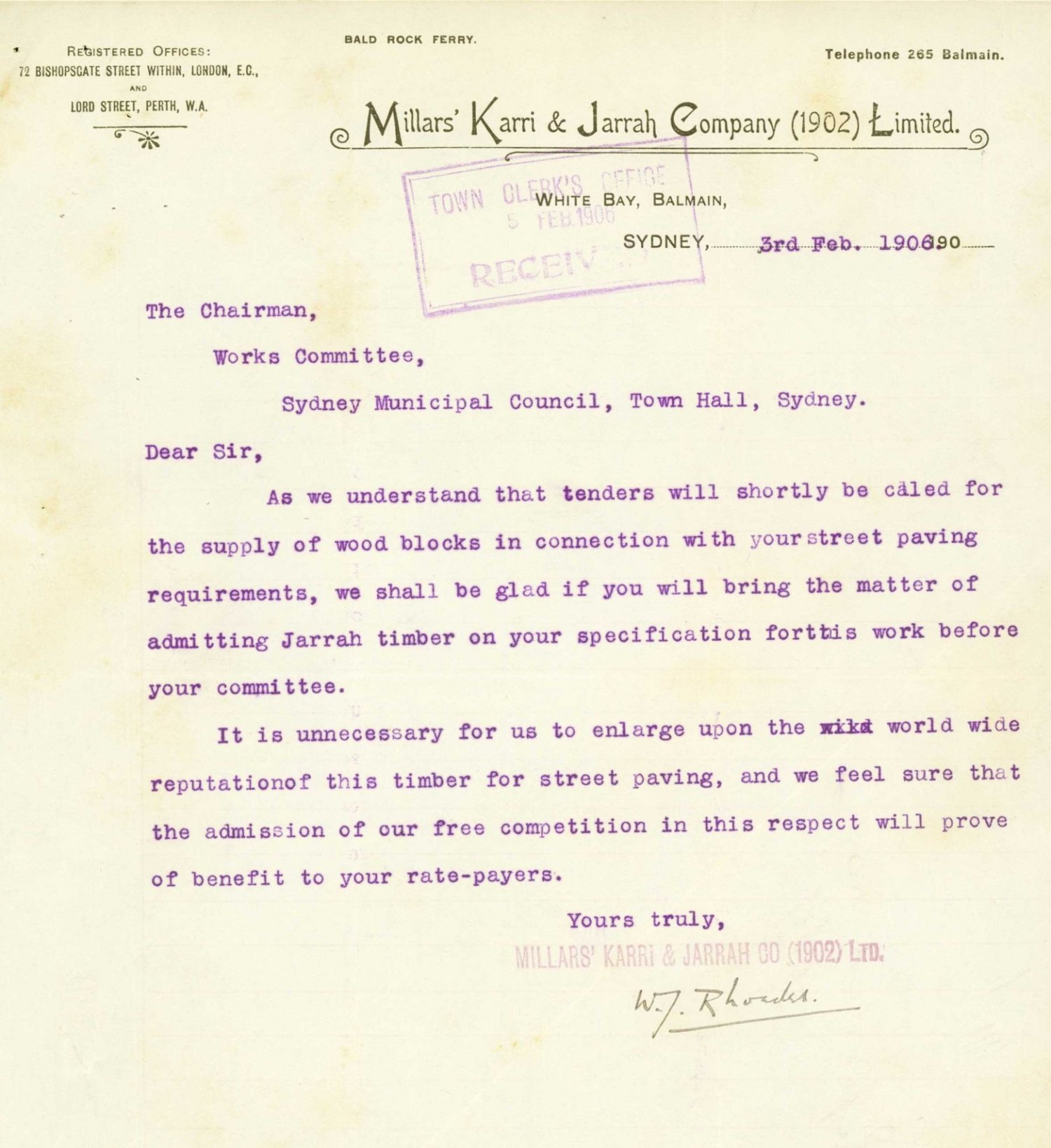
Perhaps there is some irony in the fact that large hardwood trees, once an obstacle to good, straight streets and roadways across Sydney, were soon to become the solution to forming more durable, safer, easily maintained, all-weather road surfaces.
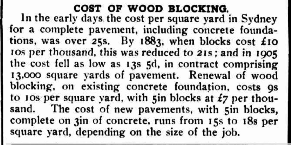
The image below, taken in 1936, shows wood block street paving in use at in Lee Street at Haymarket, near to the Sydney Central Railway Station.

Series: Percy James Bryant Photograph Collection
End of Free sample of eBook content
Download my fully curated eBook, “
11 Stories of Some Weird and Wonderful Shit in Sydney’s CBD
Antique Cast-Iron Urinal – 1880s
Wooden Block Paving to Antique Urinal
Continue walking along George Street until you are beneath the Bradfield Highway (approach to Harbour Bridge)
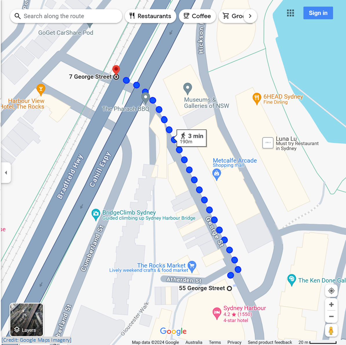
± 1.0 min to read
In early colonial times, public toilets were non-existent, so men, including convicts in work gangs, might be seen relieving themselves wherever they could. What else could they do, when they needed to ‘go’?
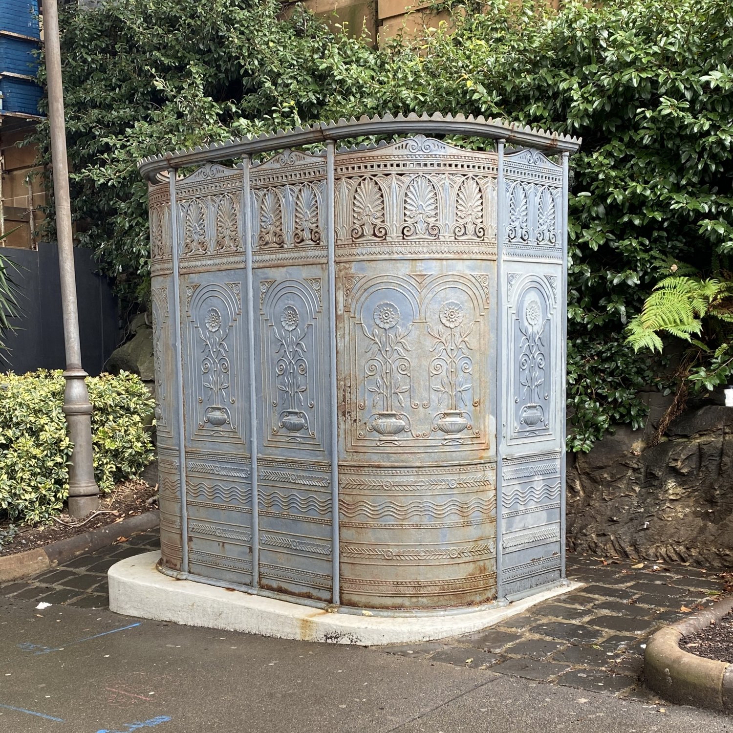
Sydney’s first public toilets appear to have been two cast iron urinals, known as ‘pissoirs’, purchased in the late 1880s by the Sydney Council, from an ironworks in Glasgow. Today, one survives as a working public toilet.
This George Street pissoir once stood on Observatory Hill, with its effluent being discharged into Darling Harbour. It was moved to its current location in the mid-1970s, after being refurbished. It received another (by then, badly needed) refurbishment in mid-2024.
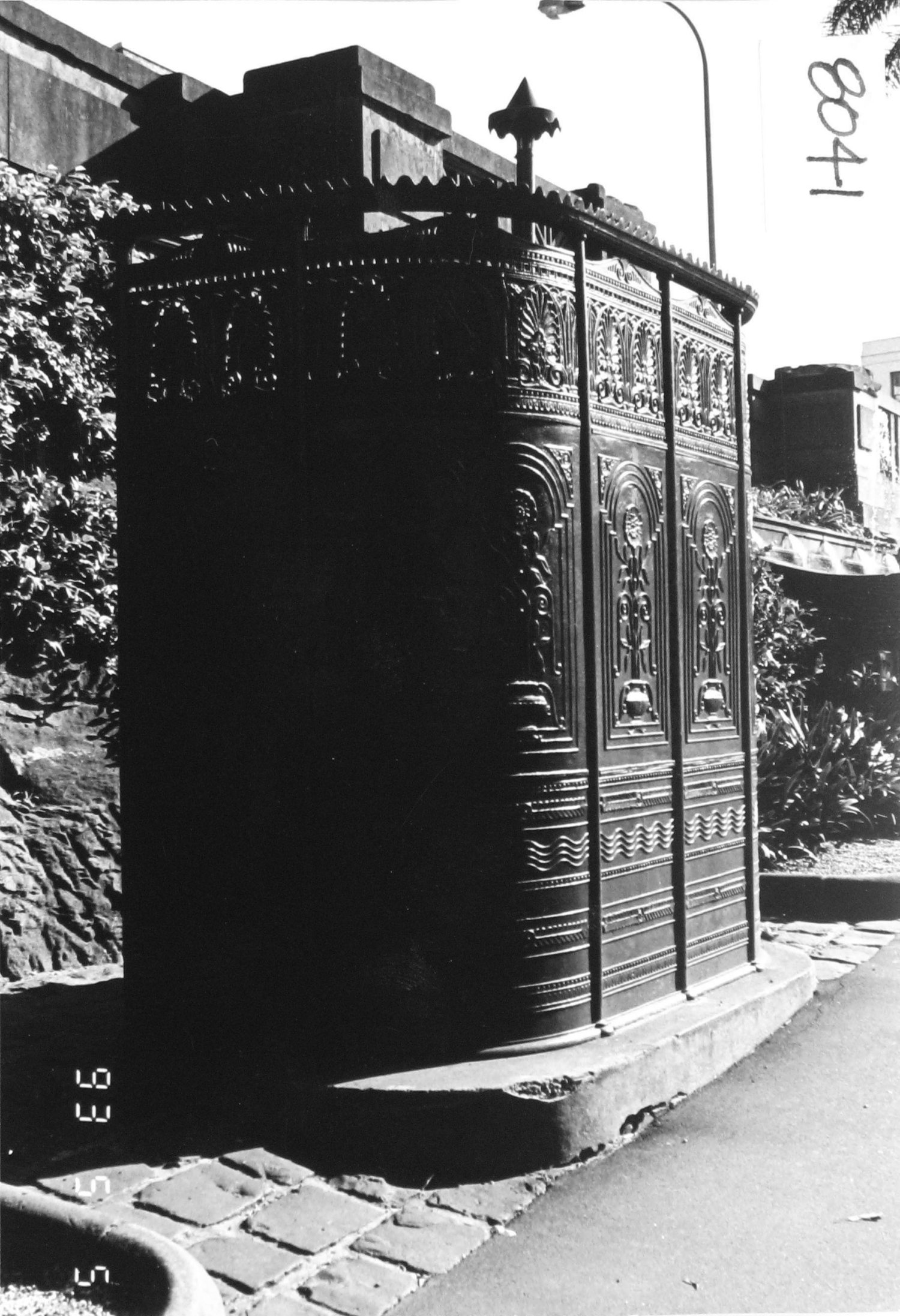
Series: Central Sydney Heritage Inventory Photographs
A City of Sydney Memorandum to the Town Clerk, from 1900, reveals the existence of a “Ladies Lavatory ” and a separate urinal, near the corner of Hay and Parker Streets, in Haymarket
That same year, the outbreak of bubonic plague across Sydney was the catalyst for the introduction of several underground men’s public toilets, known then as ‘lavatories’. The remains of one are partially buried in a corner of Macquarie Place.
Sirius Building – 1980, 2024
Antique Urinal to Sirius Building
Return along George Street; then take Gloucester Walk to the Bunker’s Hill Lookout; Sirius Building is on your right
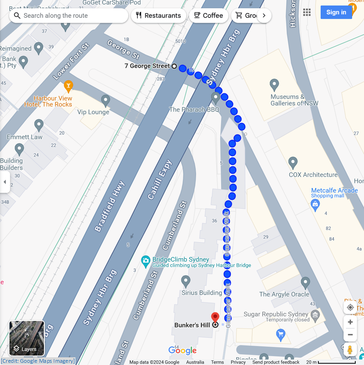
± 1.0 min to read
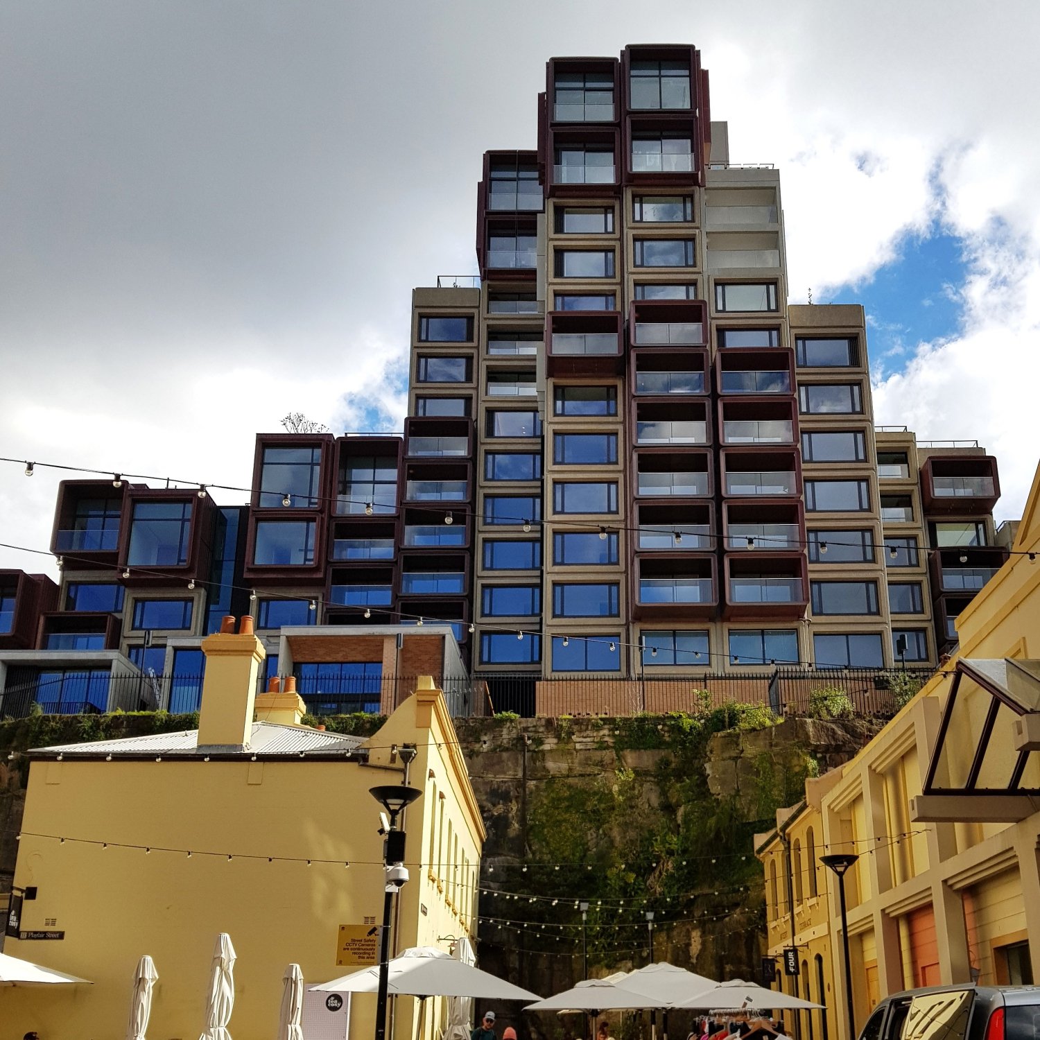
Built in the late-1970s, the Sirius Building is a piece of “brutalist architecture ”. It is big and bold; some see it as being beautiful, to others it is ugly.
The Sirius building was opened in 1980 as affordable public housing. This was a consequence of a State Government attempt during the 1970s to redevelop the area of Sydney Cove and The Rocks.
Following a community reaction, Union labour placed “Green Bans ” on sites where public housing tenants would be displaced. After the State Government conceded, the Sirius Building, with 79 apartments, was designed and constructed.
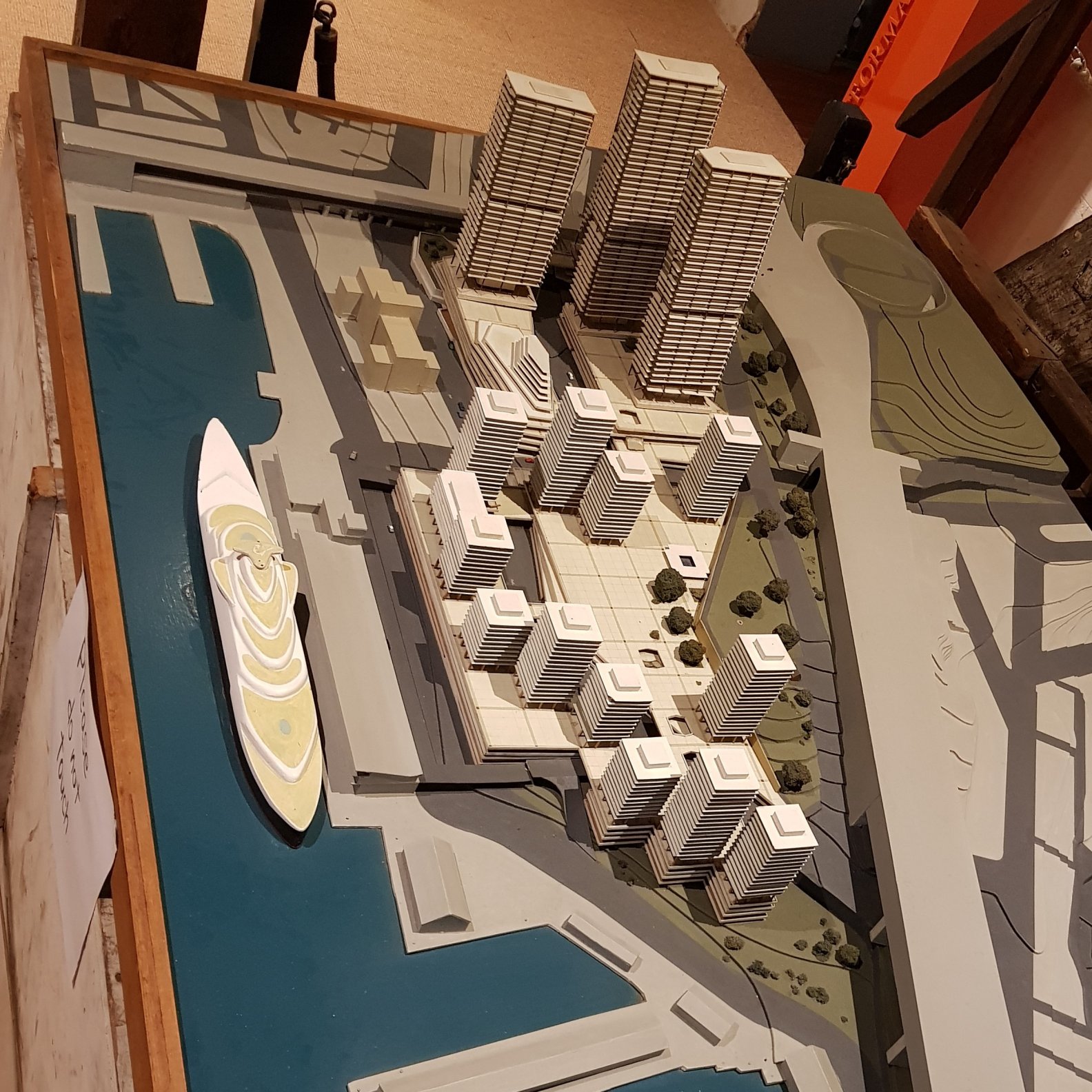
Fast forward some 30 years. In 2014, around 200 people residing in the Sirius Building received eviction notices. Behind this was a new State Government initiative: to sell off various government housing assets around Millars Point, including at The Rocks.
By mid-2019, the Sirius building was in the hands of a private developer. By mid-2021, many of the refurbished apartments had been sold. Apartment prices ranged from $35 million for a penthouse, to $1.5 million for a ‘simple’ studio, while a single car park was another $1.5 million.
The irony here is how what was once social housing for low-paid workers, who had become displaced due to the redevelopment of the Rocks, has now become the exclusive domain of Sydney’s very rich!
Tank Stream Fountain – 1981
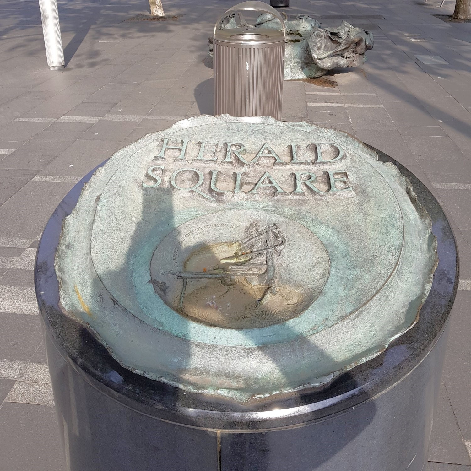
Sirius Building to Tank Stream Fountain
Continue on Gloucester Walk to Argyle Stairs; descend to Argyle Street; follow this to George Street; follow George Street to Alfred Street; cross over to Herald Square
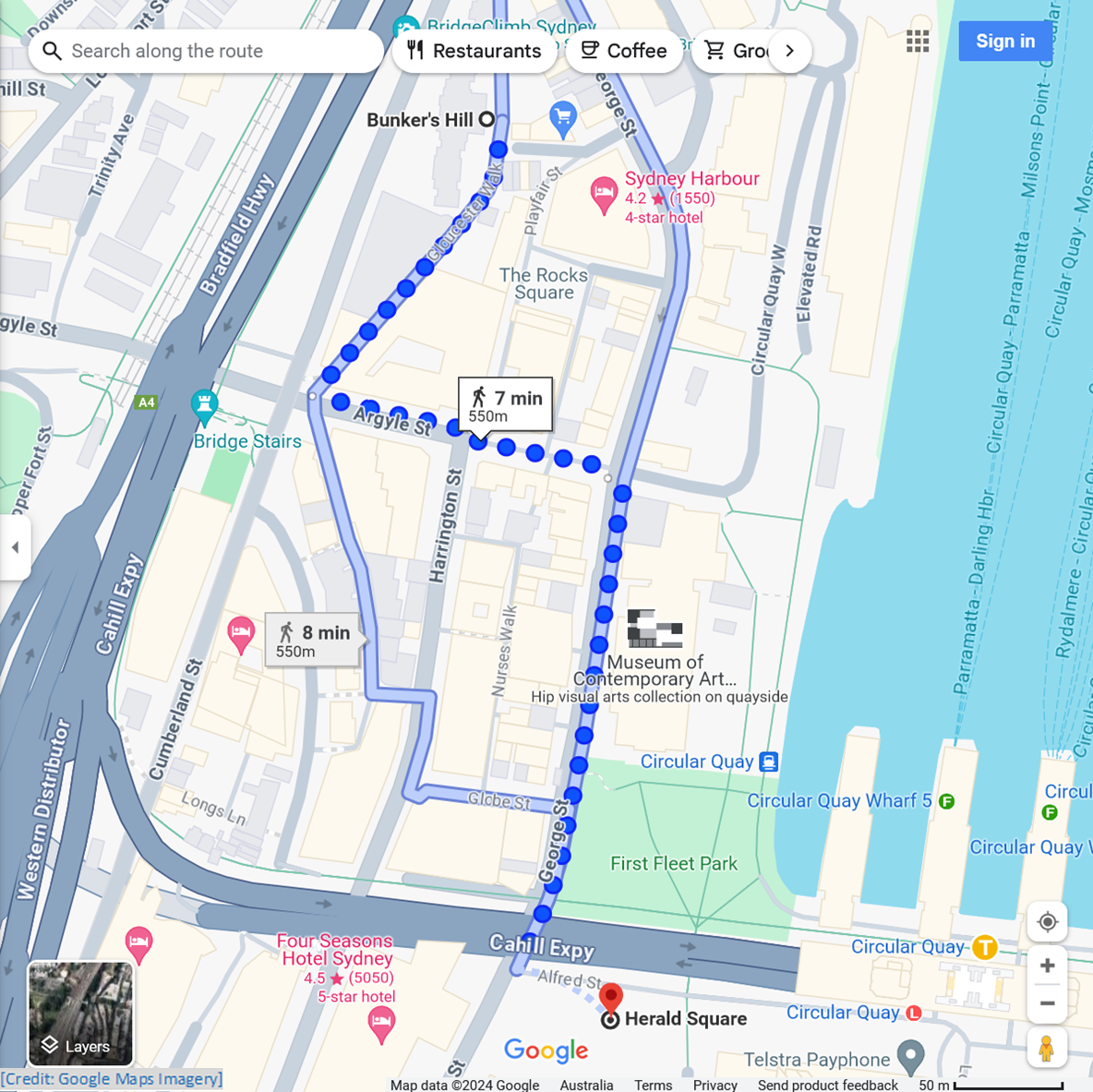
± 1.0 min to read
The Tank Stream was a key reason why Governor Arthur Phillip decided to place his new settlement at Sydney Cove, in 1788. The name of the stream comes from the holding tanks, which were cut into the bedrock, in 1792.
However, over time, this “run of fresh water ”, which was vital to the survival of the early colony, became heavily polluted. By the 1850s, when work began on covering over the Tank Stream, it had become both a stormwater drain, and sewer.
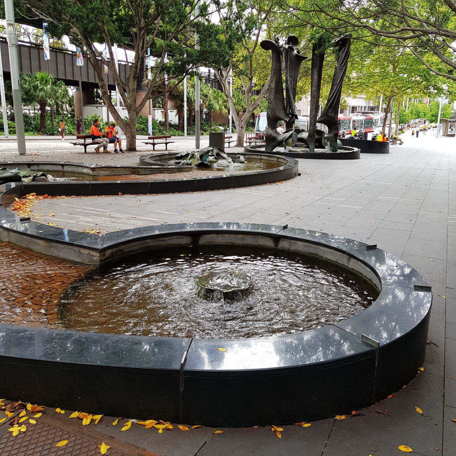
The Tank Stream Fountain was gifted to the City of Sydney in 1981 by John Fairfax & Sons Limited. It was the creation of Australian Sculptor Stephen Walker (1927-2014). The message he leaves for us finishes with:
1981:
The Tank Stream Fountain recalls mankind’s past dependence on this flowing stream and our links with life around the region
The fountain pools contain numerous examples of Australian fauna, such as birds, crabs, echidnas, frogs, goannas, snakes and tortoises.
Quay Quarter Tower – 1976, 2022
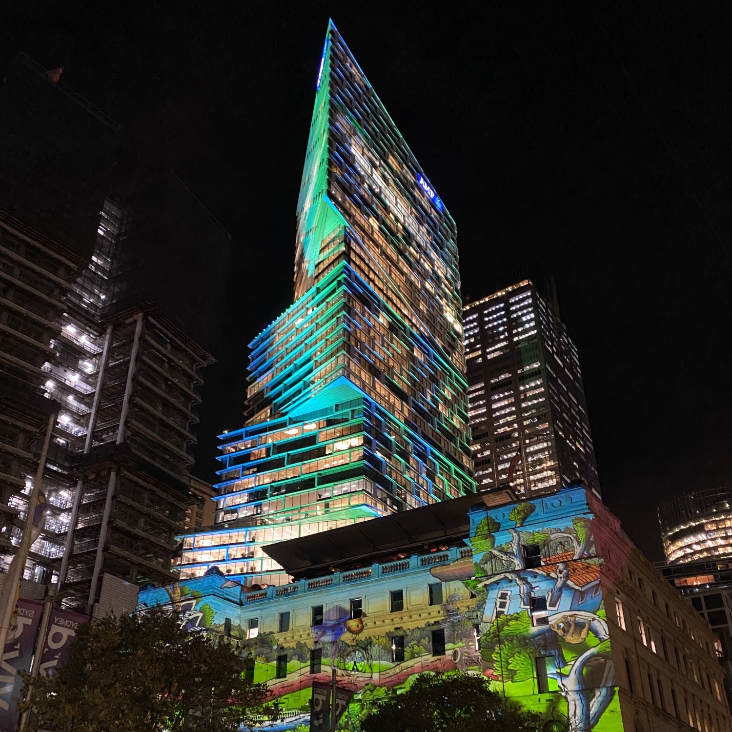
Tank Stream Fountain to Quay Quarter Tower
Follow Alfred Street to Young Street; take Young Street to Customhouse Lane; Quay Quarter Tower is on your left
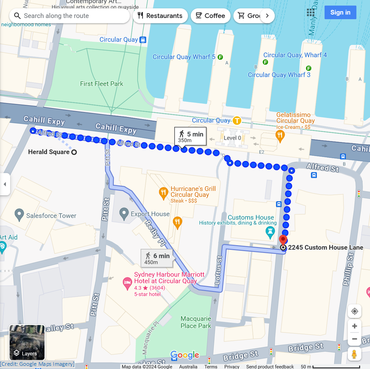
± 1.0 min to read
An “upcycled ” skyscraper stands out prominently on the skyline at Circular Quay. It may not be the tallest, but its unusual appearance is eye-catching.
This is the ‘second coming’ of this building, which was once Sydney’s tallest building. Previously, this was the AMP Centre tower, completed in 1976, with 45 floors.
When AMP began looking for a site for a new tower building, around 2010, they ran into problems with overshadowing regulations. The solution came from Danish architects 3XN, who proposed a transformational design.
While the appearance of the AMP Centre tower was rather conventional, almost ugly, the new design has delivered a much more interesting sight. The distinctive north-facing façade has a sunshade hood, which blocks 30% of the solar radiance.
The transformation occurred between 2014 and 2022, with over 65% of the original structure being retained, including 95% of the core. At the same time, the available floor area has been doubled.
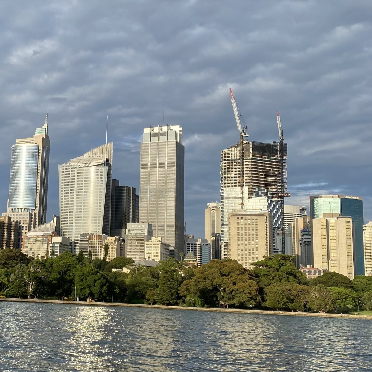
It also seems that this transformation, or “upcycling ”, is not just a first for Sydney, this is the world’s first “upcycled ” skyscraper! In the process, it achieved an estimated overall carbon saving of 12,000 tonnes.
Now known as Quay Quarter Tower, in late 2022, QQT was awarded the biennial International High-Rise Award, and was singled out for “radical sustainability ”.
Macquarie Place Park – 1810
Quay Quarter Tower to Macquarie Place
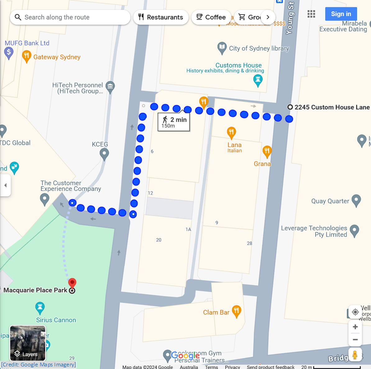
Follow Customhouse Lane across Loftus Lane to Loftus Street; walk up Loftus Street to Reiby Place; cross over into Macquarie Place Park
± 1.0 min to read
Governor Lachlan Macquarie designated Macquarie Place in Government Orders of October 1810. At that time, it was near to the lower corner of the Governor’s garden.
There is a suggestion that this area had become an unofficial town square. In 1816, Governor Macquarie had a convict gang of labourers begin work on “…clearing and levelling…” Macquarie Place. It was then to be enclosed by “…a Dwarf Stone Wall and Paling in the form of a Triangle.”
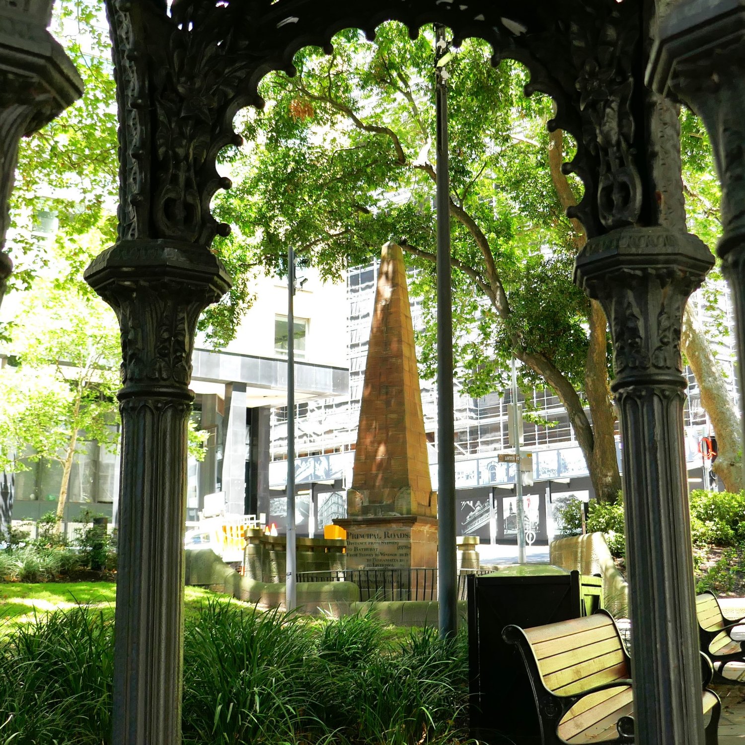
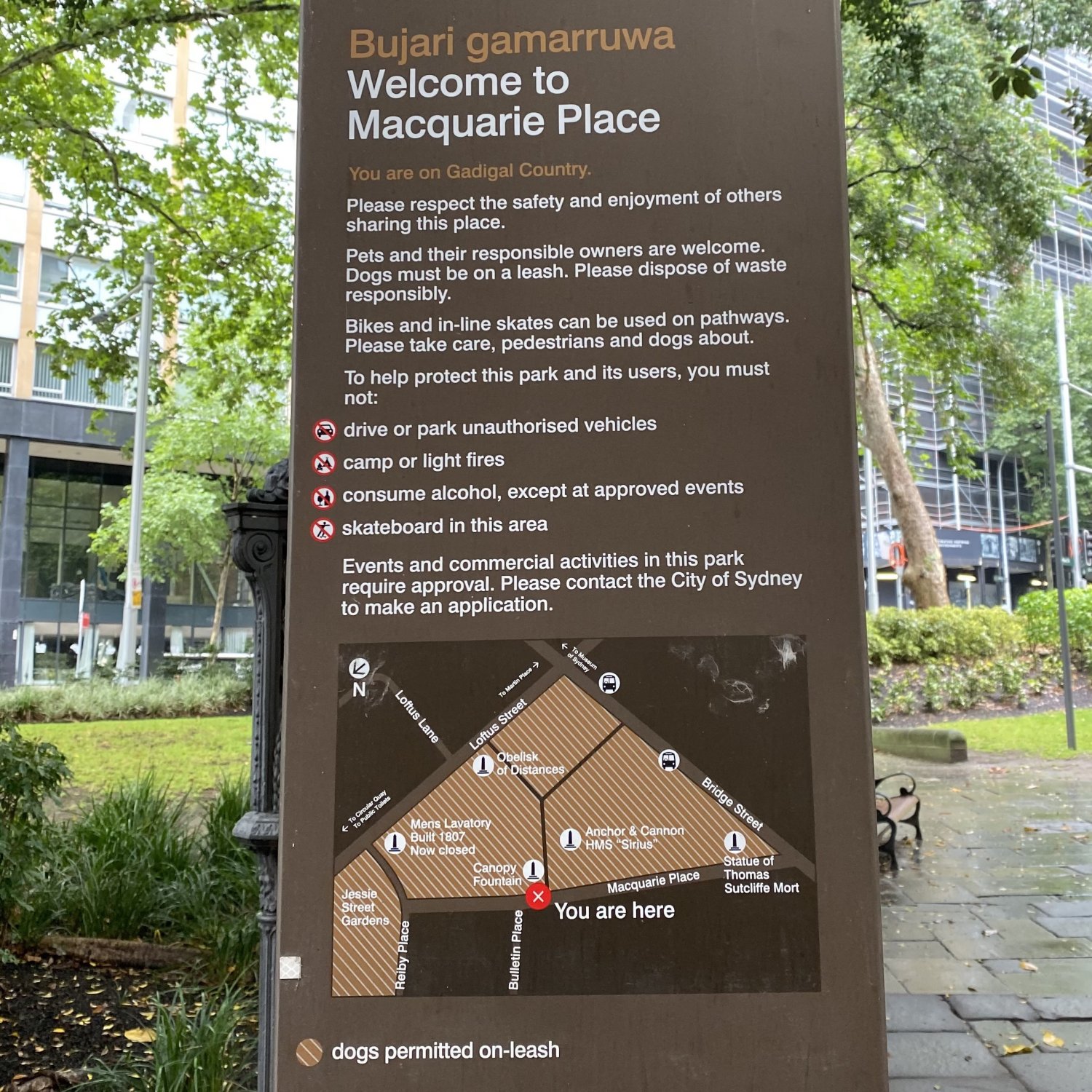
Several early colonial-era maps and drawings show Macquarie Place as a triangle of land, with pathways running through it, and an obelisk in the centre. This is the Obelisk of Distances, which is described below.
More changes to the Sydney Cove shoreline were made when during the construction of Semi-Circular Quay, from 1837 to 1844. Around this time, a new street was extended from Bridge Street to Alfred Street.
This became Loftus Street, with almost half of Macquarie Square becoming part of the new street, while the Obelisk was left sitting on the edge of the remainder of the triangle, on the footpath along the street.
Let’s now investigate the Macquarie Place colonial artefacts, that we can still actually touch:
- The Obelisk of Distances (1818)
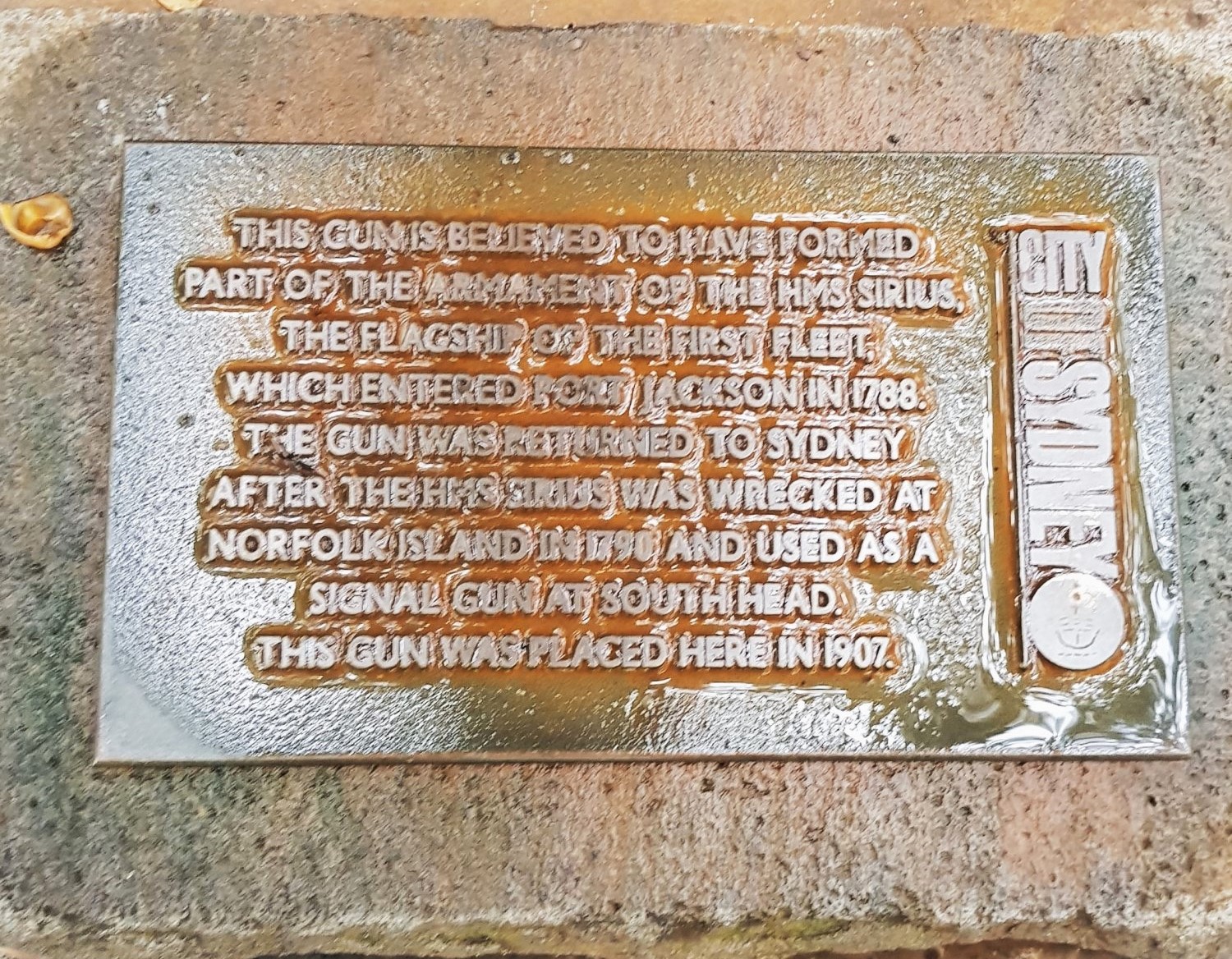
- Anchor and Cannon from HMS Sirius (1907)
- Thomas Sutcliffe Mort Statue (1883)
- Cast-iron Canopy Drinking Fountain (1870)
- The Men’s Underground Lavatory (1908)
The Obelisk of Distances (1818)
± 1.0 min to read
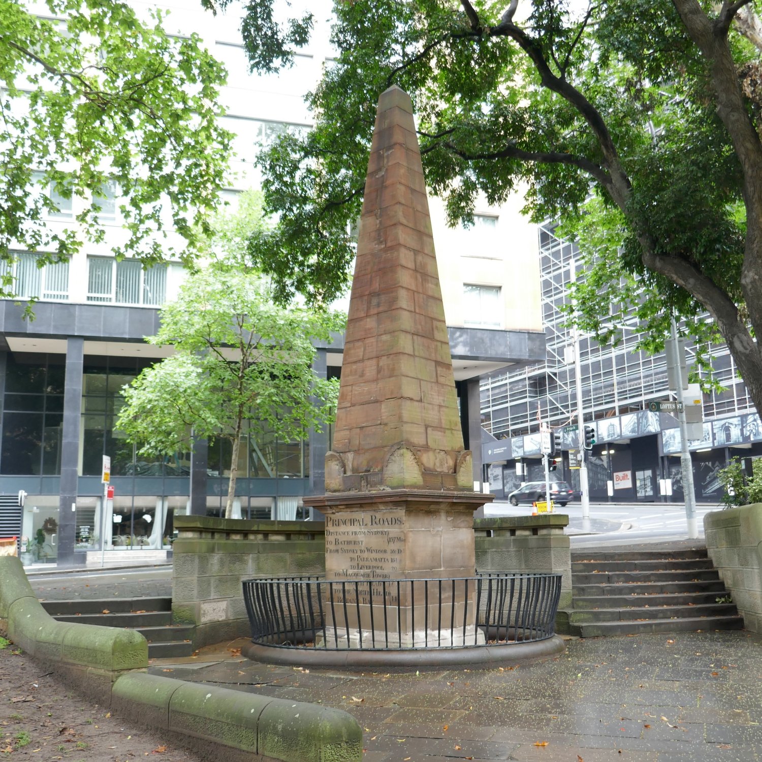
It seems probable that Governor Macquarie’s intention was for the centre of Macquarie Place to be where the Obelisk was sited. This was a reference point to some of his achievements in the colony.
The Obelisk itself is the work of two convicts, an architect and a stonemason. Francis Greenway designed the obelisk, which was to mark the spot from which “all public roads leading to the interior of the Colony are measured ”.
Edward Cureton crafted the Obelisk, having been contracted in September 1816 to complete the work within six months. It would be late 1818 before he received his final payment.
Francis Greenway arrived in Sydney in mid-1814. Within two years, he was appointed “acting Civil Architect and Assistant Engineer ”. Amongst his surviving works in Sydney are St James’ Church and Hyde Park Barracks.
Before receiving his Obelisk contract, Edward Cureton had been paid £40, in November 1814, for cutting 54 milestones. These were obviously in place in October 1816, when heavy penalties for defacing or damaging them were advertised.
Anchor and Cannon from HMS Sirius (1907)
± 1.0 min to read
In 1787, a British fleet of nine ships, carrying over 1000 people, set sail from Portsmouth in England, bound for Botany Bay, in the territory of New Holland. On a voyage of over 250 days, they were escorted by a lightly armed storeship, and a tiny armed tender, HMAT Supply.
The lightly armed storeship was HMS Sirius. She was the heaviest of the First Fleet vessels, but was not the longest. HMS Sirius was originally HMS Berwick. She was built as a ‘merchantman’ (i.e. a trading ship), designed for the Baltic. It seems that she was fitted out, and renamed, for the First Fleet.
For context, at 33.5 meters (100 feet), and with a beam of 9.8 m (32 ft), HMS Sirius’s dimensions are similar to the Sydney Harbour Emerald Class Ferries (Fred Hollows, Bungaree, etc,), which are marginally longer at 36.3 meters (119 feet), with a beam of 10 m (33 ft)
After arrival at Sydney Cove, HMS Sirius was sent to the Cape of Good Hope in October 1788, for grain and flour. In February 1790, with HMAT Supply, she went to Norfolk Island with a cargo of convicts and Marines. Here, disaster struck!
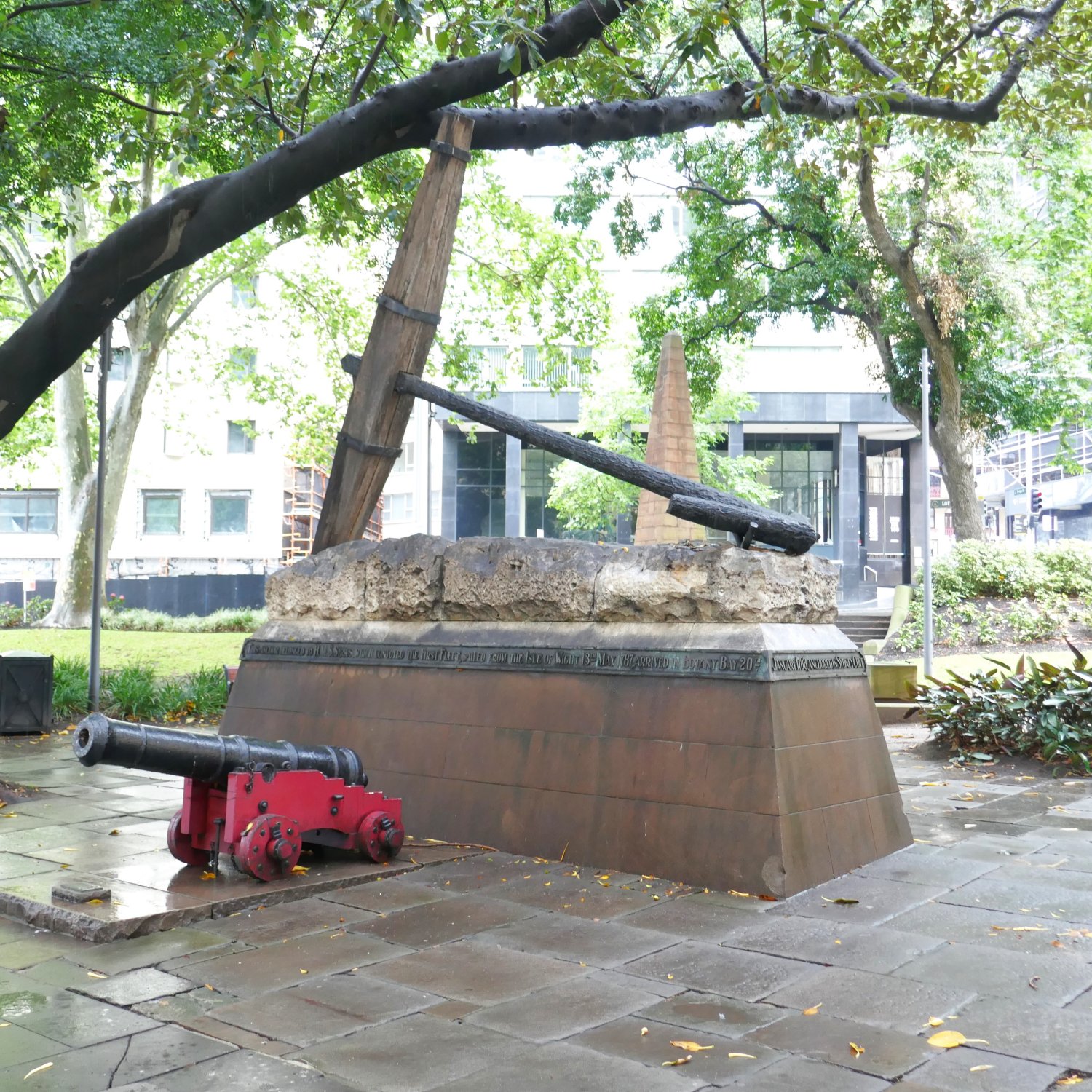
While attempting to unload stores, HMS Sirius struck a reef, and was soon wrecked; fortunately, no lives were lost. In mid-1905, one of her anchors was recovered from the reef, and was returned to Sydney.
The anchor, together with a cannon that had previously been carried by HMS Sirius, was unveiled in Macquarie Place on Anniversary Day, 1907.
Thomas Sutcliffe Mort Statue (1883)
± 1.0 min to read
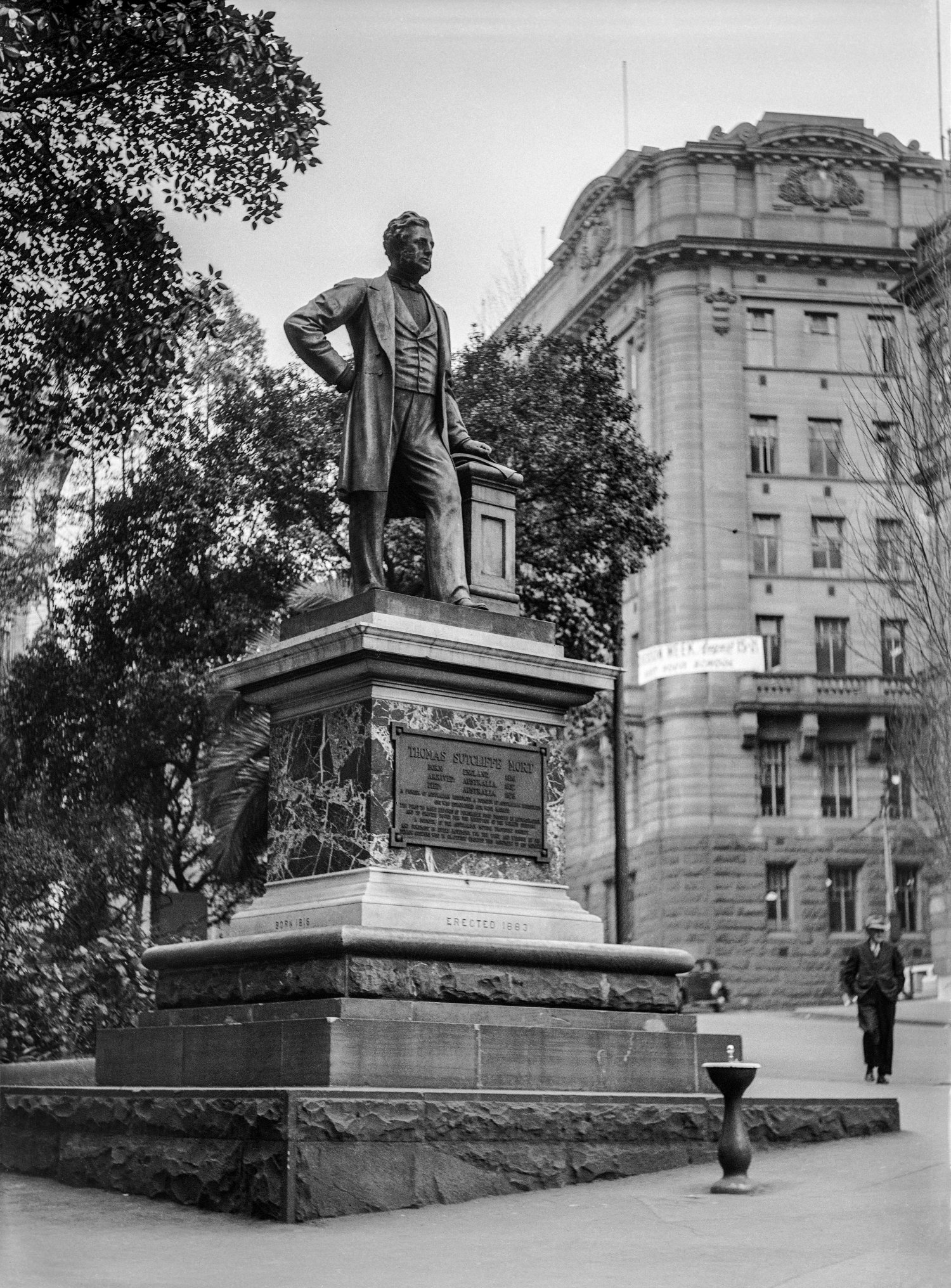
When Governor Macquarie departed Sydney, in February 1822, a Doric drinking fountain stood in the corner of Macquarie Place, near to Bridge Street. This had been designed by Elizabeth Macquarie, wife of the Governor, and architect Francis Greenway, and had been crafted by Stonemason Edward Cureton, under the supervision of Elizabeth Macquarie.
Today, a statue of Sydney businessman Thomas Mort stands on that same spot. Thomas Mort came to Sydney in 1838. During the early 1840s, he became an auctioneer, and eventually established Mort & Co., which became a leading import-export business. He is credited with establishing Australia’s wool Market.
Along with his other entrepreneurial ventures, which included engineering, dairying, mining, refrigerated shipping, and pastoral financing, Thomas Mort was active in horticultural circles, and in the Anglican Church. In 1849, he was involved in establishing the Australian Mutual Provident (AMP) Society.
When Thomas Mort died, in 1878, public committees were formed in Sydney to find a way to “honour the memory of the late Mr Thomas S Mort ”. Eventually, the committees of “working men”, and a committee made up of influential members of the State and City, were in agreement that a statue should be commissioned.
In June 1883, only a few months after the remnants of the Doric fountain had been removed, the Thomas Sutcliffe Mort statue was unveiled by the State Governor. The ceremony was attended by several thousand people, including workers from the Mort Dockyard; it was reported these workers gave up two hours of paid work to be able to attend.
Cast-iron Canopy Drinking Fountain (1870)
± 1.5 min to read
For over 50 years from the arrival of the First Fleet in Sydney Cove, supply of fresh water remained problematic. Population growth increased demand, while periods of drought created crisis conditions.
Sydney’s first public drinking fountain appears to have been at the corner of Bent and O’Connell Streets, while the second one was the Doric fountain, in Macquarie Place. The Bent Street fountain may have been installed before Governor Macquarie’s arrival, in 1810.
In 1870, the Mayor of Sydney ordered eight cast iron ornamental drinking fountains, from Walter Macfarlane in Scotland. The story goes that the order was placed from an illustrated catalogue. A piece in the Australian Town and Country Journal of 9 July 1870 advised: “Their entire cost is £269 3s. 8d.”
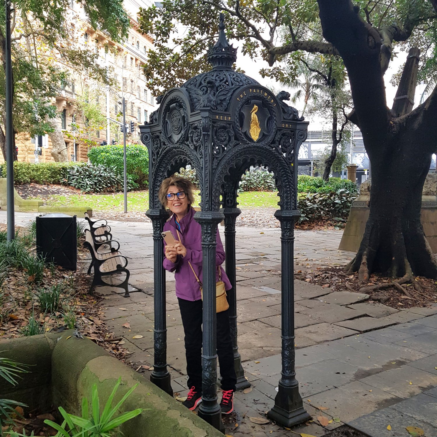
On arrival the fountains were placed in different wards of the city, with one “…on the Circular Quay, near the Customs House.” It is believed this is the Canopy fountain now in Macquarie Place, however it is missing the actual font (or fountain) section.
The fountain design was particularly decorative, even symbolic. Four griffins occupy the corners of the pagoda-shaped canopy; the griffin winged lion symbolizes strength, as it guards treasure and priceless possessions.
The original font was adorned with four salamanders, which symbolize survival and ability to withstand fire, while drinking water spouted from a crane, on the edge of the font. In the centre was an urn, with four copper drinking cups, suspended by chains.
Because of concern that the shared cups could spread disease, most of the Sydney’s fountains were retro-fitted with bubbling mechanisms in the early 20th century. This ensured that mouths came into contact with the water only, not with a shared cup or tap.
Photographs taken in 1986 and 1989 show the Canopy in Macquarie Place, with a drinking font. Elsewhere, there are records about a 1990 proposal to reconstruct a brass swan at the centre of the Macquarie Place fountain. Perhaps the font was damaged, removed for repair, and became “lost”?
The Men’s Underground Lavatory (1908)
± 1.0 min to read
Prior to Sydney’s 1900 outbreak of bubonic plague, there were public toilets across the city, including the cast iron pissoir on Observatory Hill. To improve public hygiene, City authorities began replacing urinals with underground public lavatories.
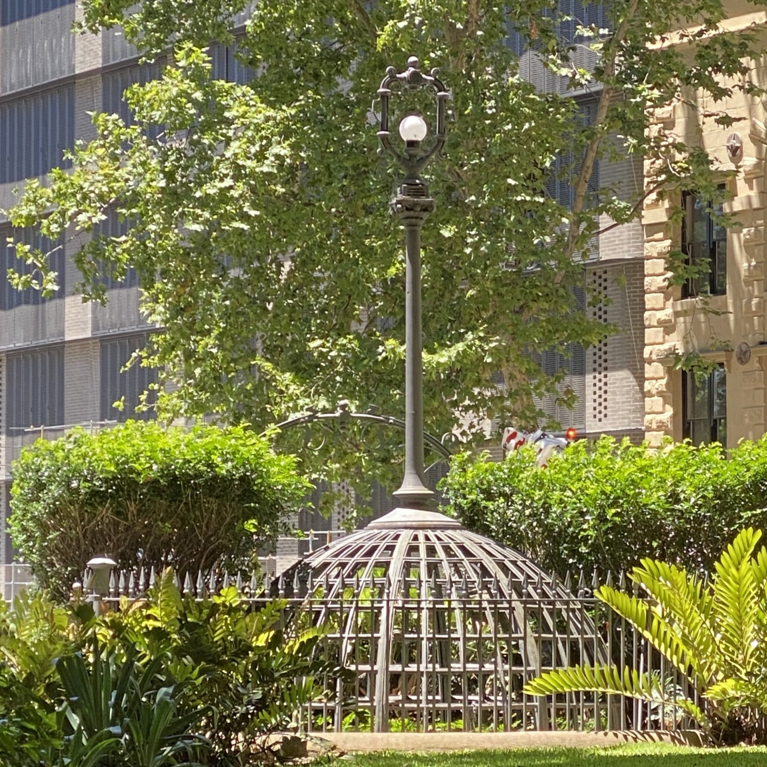
These required less space on the street, and were also less obtrusive. Between 1901 and 1911, twelve underground men’s public lavatories were built across the city. Of these, one at Macquarie Place was decommissioned in 1996, and was filled with sand in 2002. Another, in Hyde Park suffered a similar fate. One at Darlinghurst remains intact (but locked).
Sydney’s underground public lavatories were designed and built in a quite ornate and lavish style: white glass tiles on the walls, paved floors, polished wooden doors and frames. For ventilation, two stairways were used; one for entry, the other for exit.
Town Clerk records show that the underground public lavatories were open daily from 5am until midnight. During this time, they were “attended ”, with two attendants working in shifts at each. By the 1990s, the era of Sydney’s underground public lavatories was over.
At Macquarie Place, only the frame of the metal and glass dome, with the Art Nouveau ironwork, remain visible as a reminder of early 20th Century Sydney.
Underwood Ark – 2017
Macquarie Place to Underwood Ark
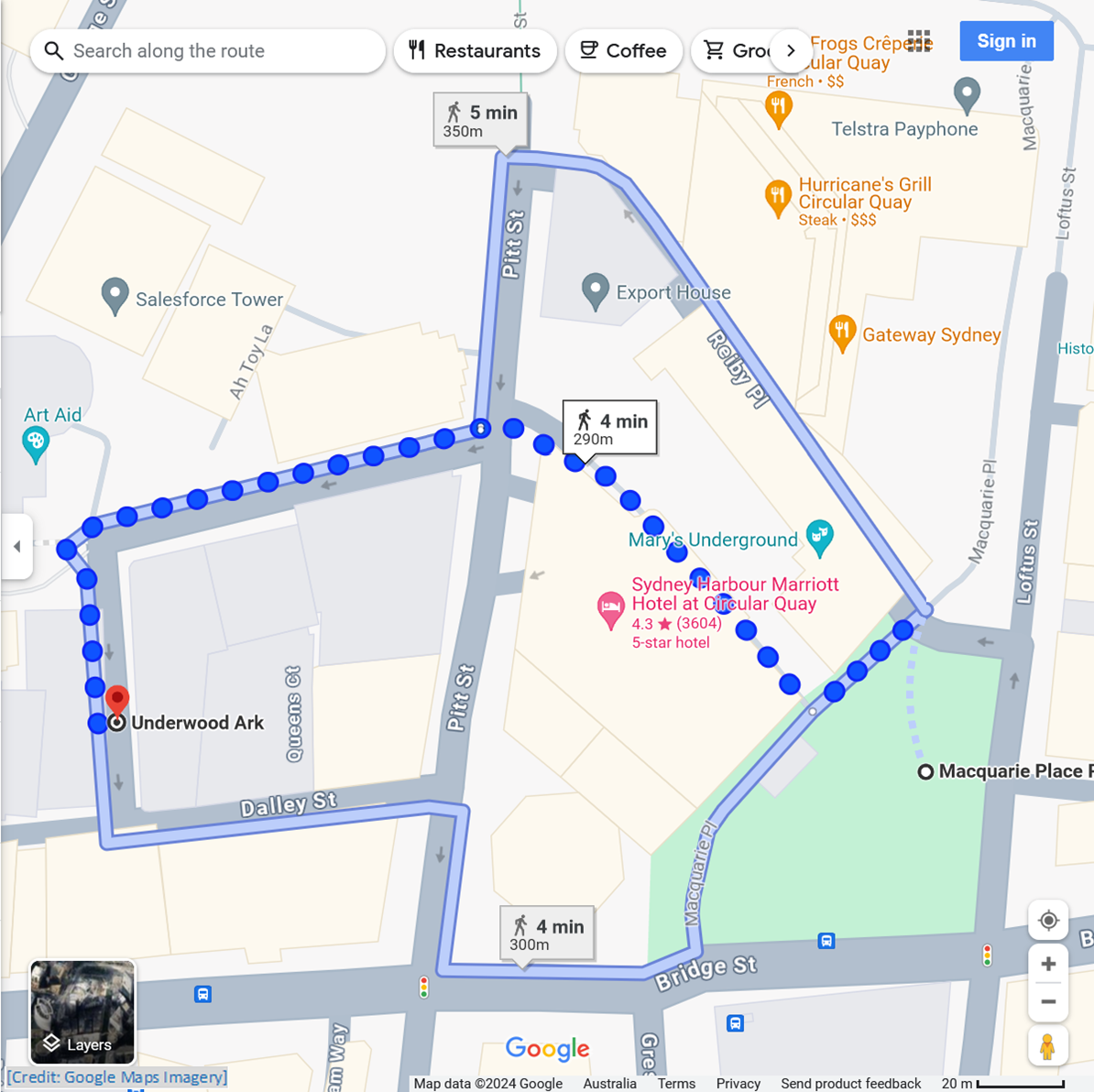
Take Bulletin Place away from Macquarie Place Park; cross over Pitt Street (with care); follow Underwood Street; as it turns to the left, you will see the Ark above you
± 1.0 min to read
Sydney’s Underwood Street is built above where the mouth of the Tank Stream was, when the First Fleet arrived in Sydney, in January 1788. Some three and a half years later, convict James Underwood arrived in Sydney, as part of the Third Fleet.
He had been sentenced to seven years transportation, for a crime which cannot be found by historical researchers. By the early 1800s, he had a grant of land at the mouth of the Tank Stream, and was in a shipbuilding partnership, with the (then) Chief Constable.
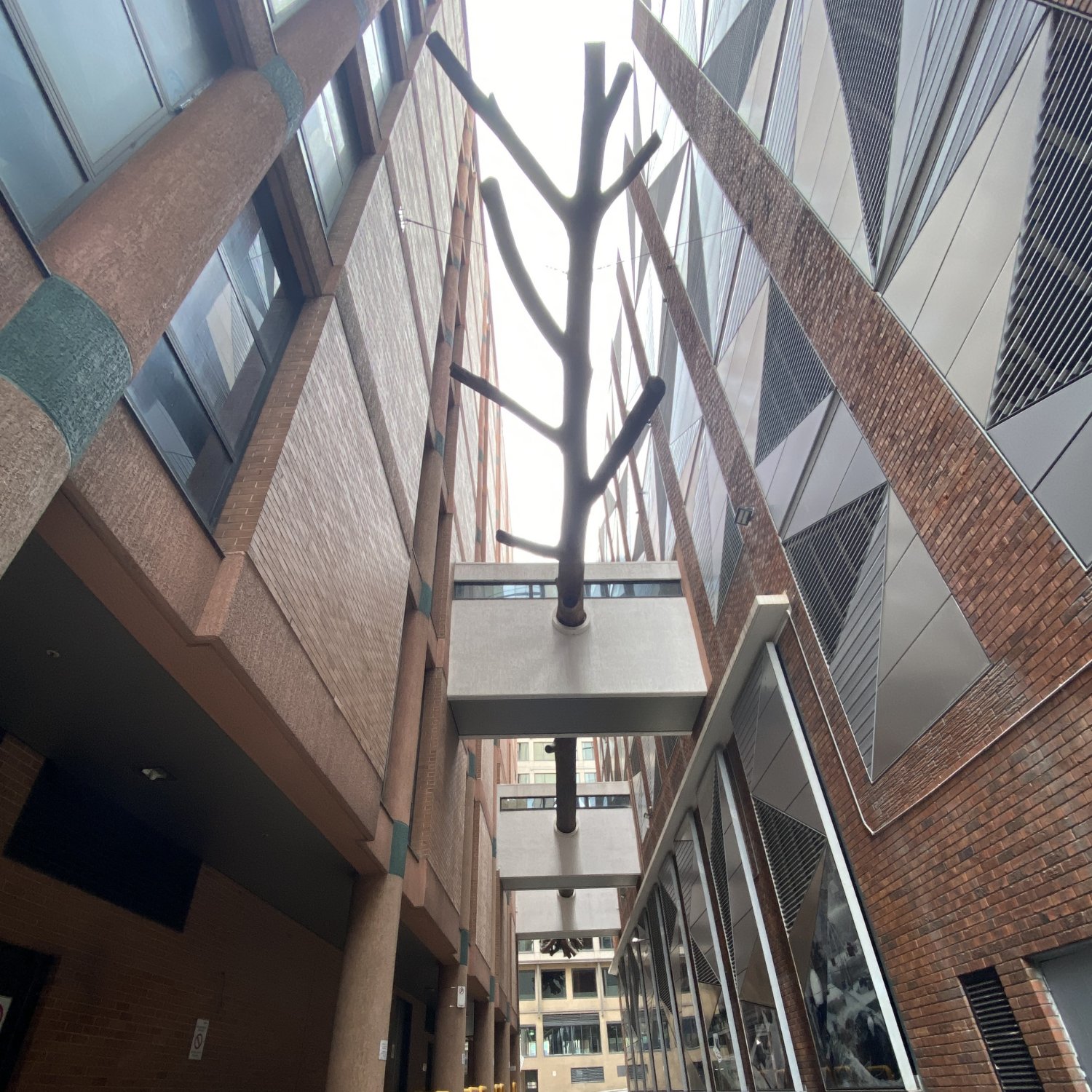
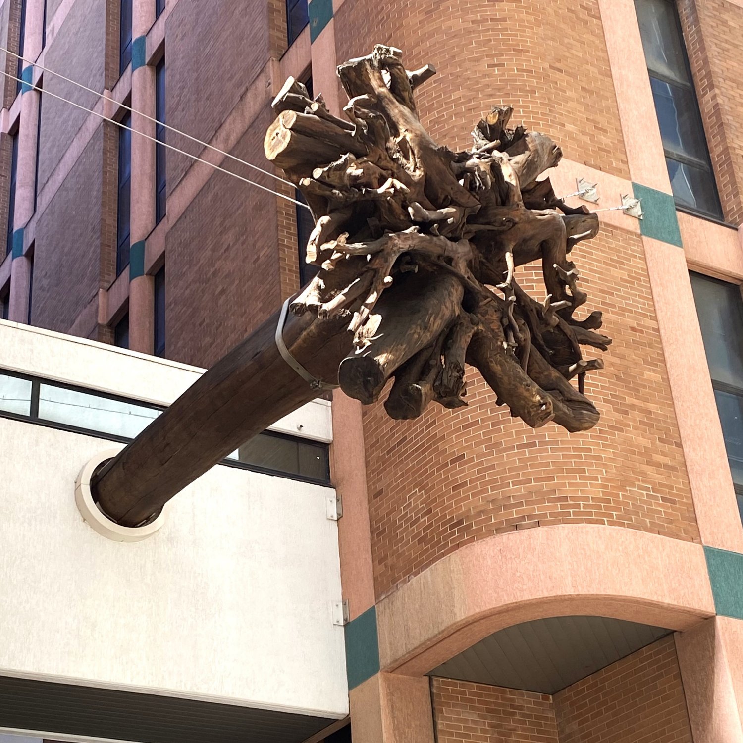
Today, Underwood Street is home to the Underwood Ark, the 35 meter (115 feet), 20 tonne (22 ton) trunk of an Australian Blackbutt tree. Blackbutts are members of the Eucalyptus family, and can exceed 70 meters in height (there are records of Blackbutts exceeding 85 meters). There would have been Blackbutts growing along the Tank Stream.
The Underwood Ark was installed in its position, about 10 meters (33 feet) above the street, in 2017, as a public urban art project, between property developer Mirvac, and the National Art School. Mirvac was redeveloping Underwood Street as part of the nearby EY Centre.
Sculpture artist Michael McIntyre describes the Underwood Ark as a “symbolic vessel that carries the history of this particular place, floating down the once existing stream.” Curiously, as the estimated age of this tree is more than 200 years, it was probably a seedling when James Underwood arrived in Sydney.
Australia Square – 1967
Underwood Ark to Australia Square
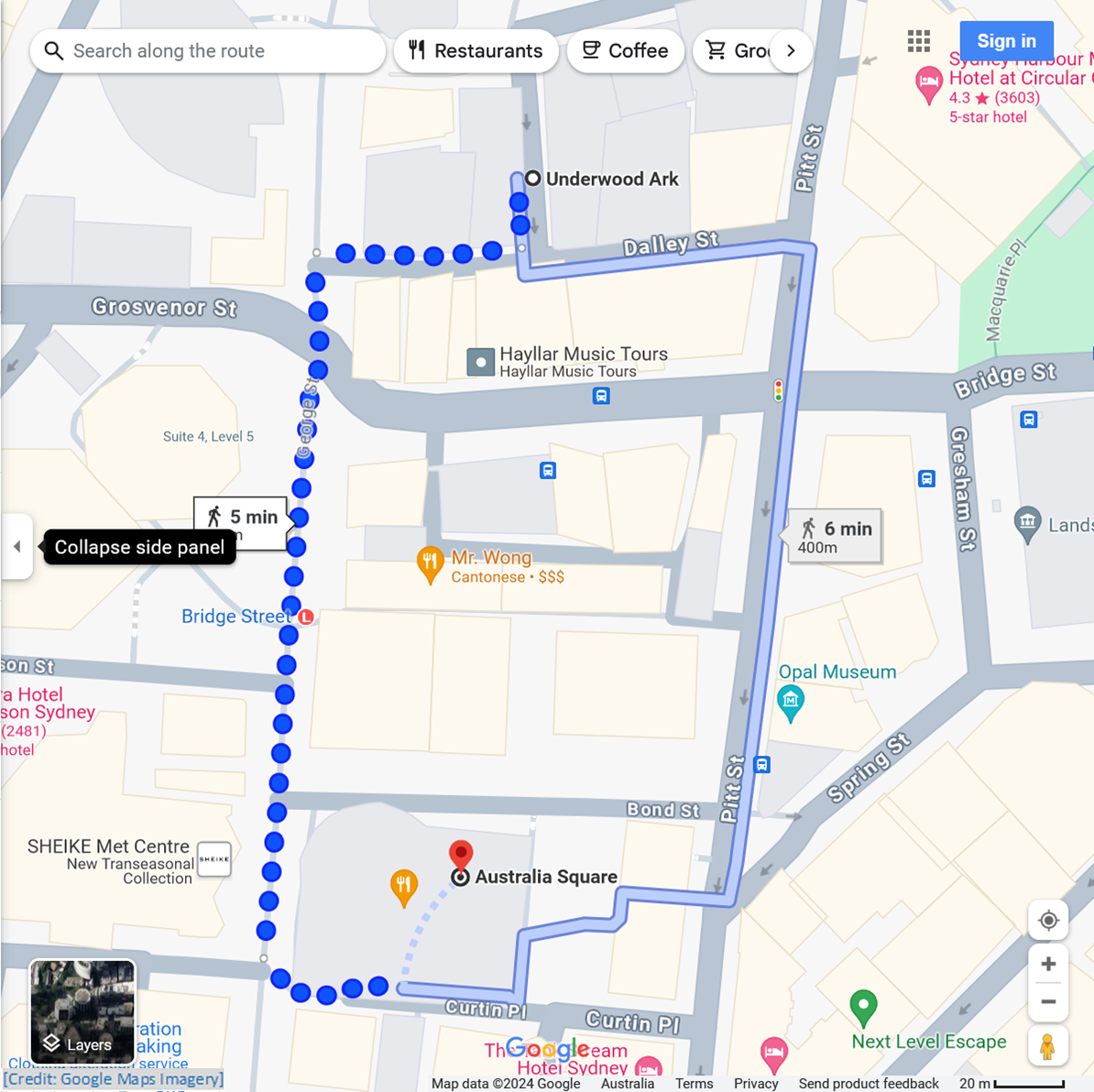
Follow Dalley Street to George Street; follow George Street, crossing over Bridge Street, continue along George Street, going past Bond Street; Australia Square will be on your left
± 1.0 min to read
Australia Square takes up the entire block bordered by Pitt, Bond, and George Streets, and Curtin Place. When it was completed, in 1967, Australia Square set new benchmarks for the construction industry, both in Australia, and globally:
- it became Australia’s first true skyscraper, at 170 meters (560 feet) high
- it remained Sydney’s tallest building from 1967 until 1976
- it was the tallest lightweight concrete office building in the world
- its design allowed for completion of one floor every five working days
- the circular form of the tower minimises adverse wind effects at ground level
- the public plaza area around the tower provided outdoor spaces to meet the needs of modern ‘office workers’
- when opened, it featured the world’s largest revolving restaurant
Australia Square was designed by Austrian-born Australian Architect Harry Seidler. His radical approach resulted in a building which provides diagonal outward views for its occupants, rather than looking out directly into the windows of nearby buildings.
Amongst Harry Seidler’s other innovations was the public display of iconic works of art. The ground floor lobby of Australia Square Tower originally displayed tapestries by Hungarian-French artist Victor Vasarely, and Swiss architect Le Corbusier. In the courtyard, on the edge of George Street, Harry Seidler placed an abstract monumental sculpture, by American artist Alexander Calder, called ‘Crossed Blades’.
In 1988, during Australia’s bicentennial year, the sculpture ‘Waiting’, by American artist John Seward Johnson II, was added to the piazza/plaza on the Pitt Street side of Australia Square.
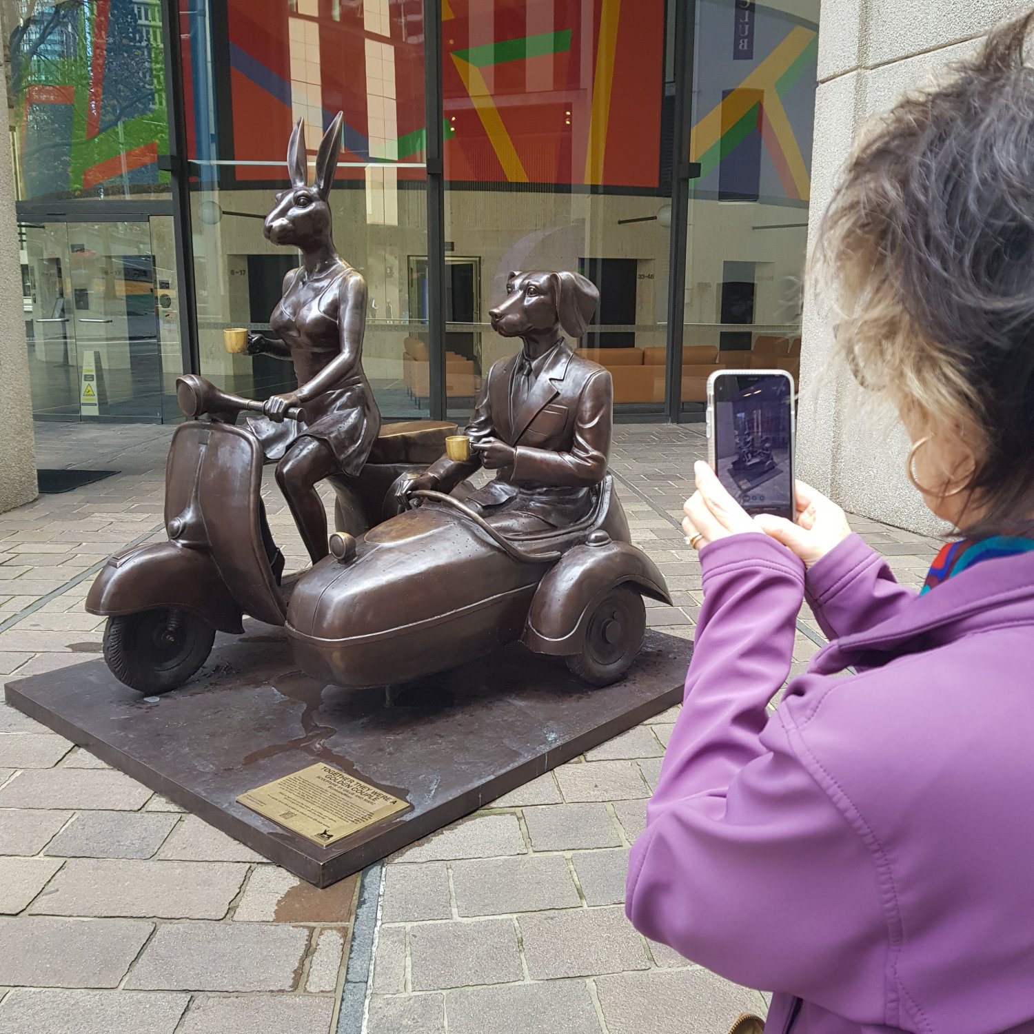
Then, in 2022, the sculpture ‘Table of Love’ was installed near the George Street entrance to Australia Square Tower. This was by Gillie and Marc Schattner, world renown for their animal sculptures, and especially Rabbitwoman and Dogman. In late-2023/early-2024, Table of Love was replaced by ‘Together They Were a Golden Couple’, which features Rabbitwoman and Dogman.
Public Artwork at Australia Square
Artwork in the Lobby (2003)
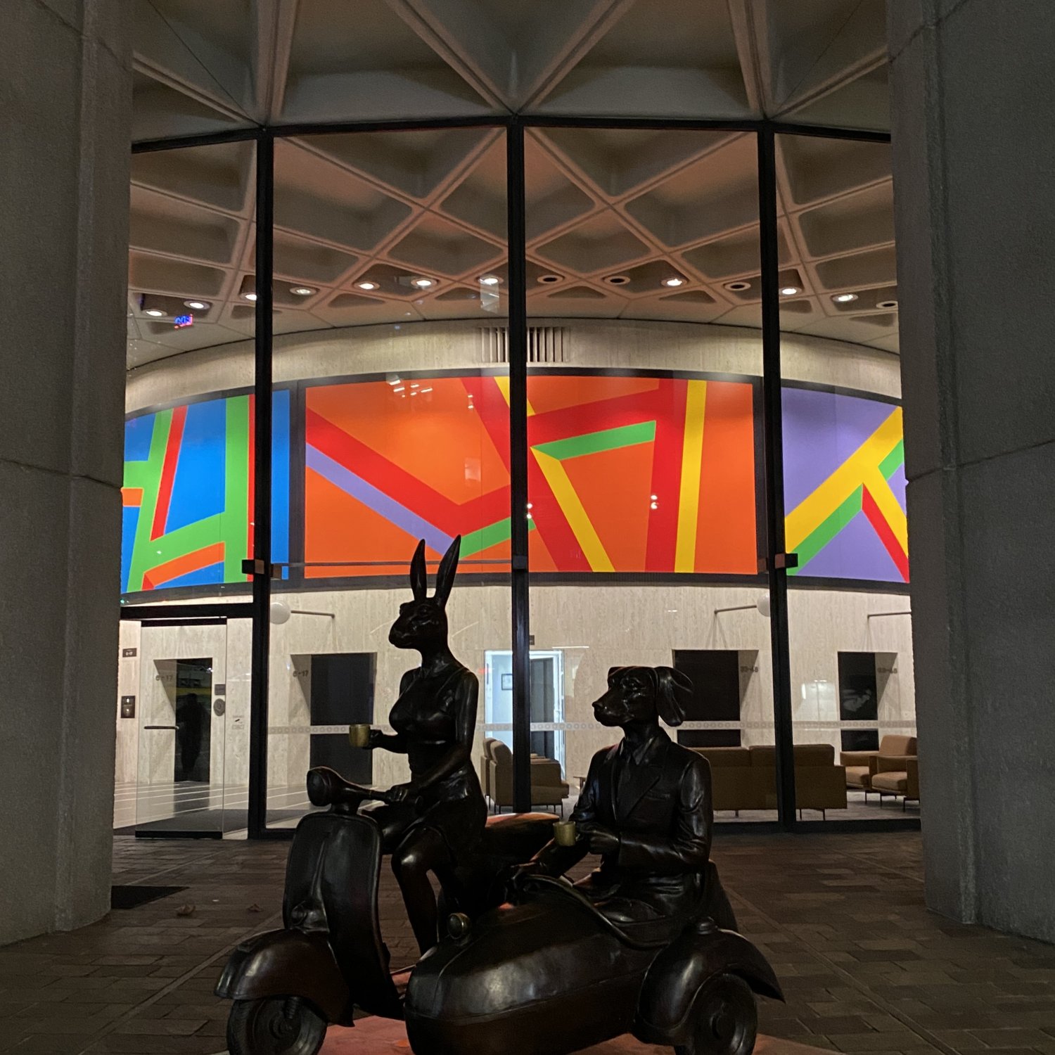
In 2003 the lobby tapestries were replaced with the present brightly coloured mural, by New York artist Sol LeWitt. This was commissioned by Harry Seidler, to continue showcasing international works of art at Australia Square.
The lobby also features the distinctive ‘Nervi’ ceiling, which is the work of Italian structural engineer, Pier Luigi Nervi. Nervi had been consulted by Harry Seidler about the concrete design of Australia Square Tower.
Crossed Blades by Alexander Calder (1967)
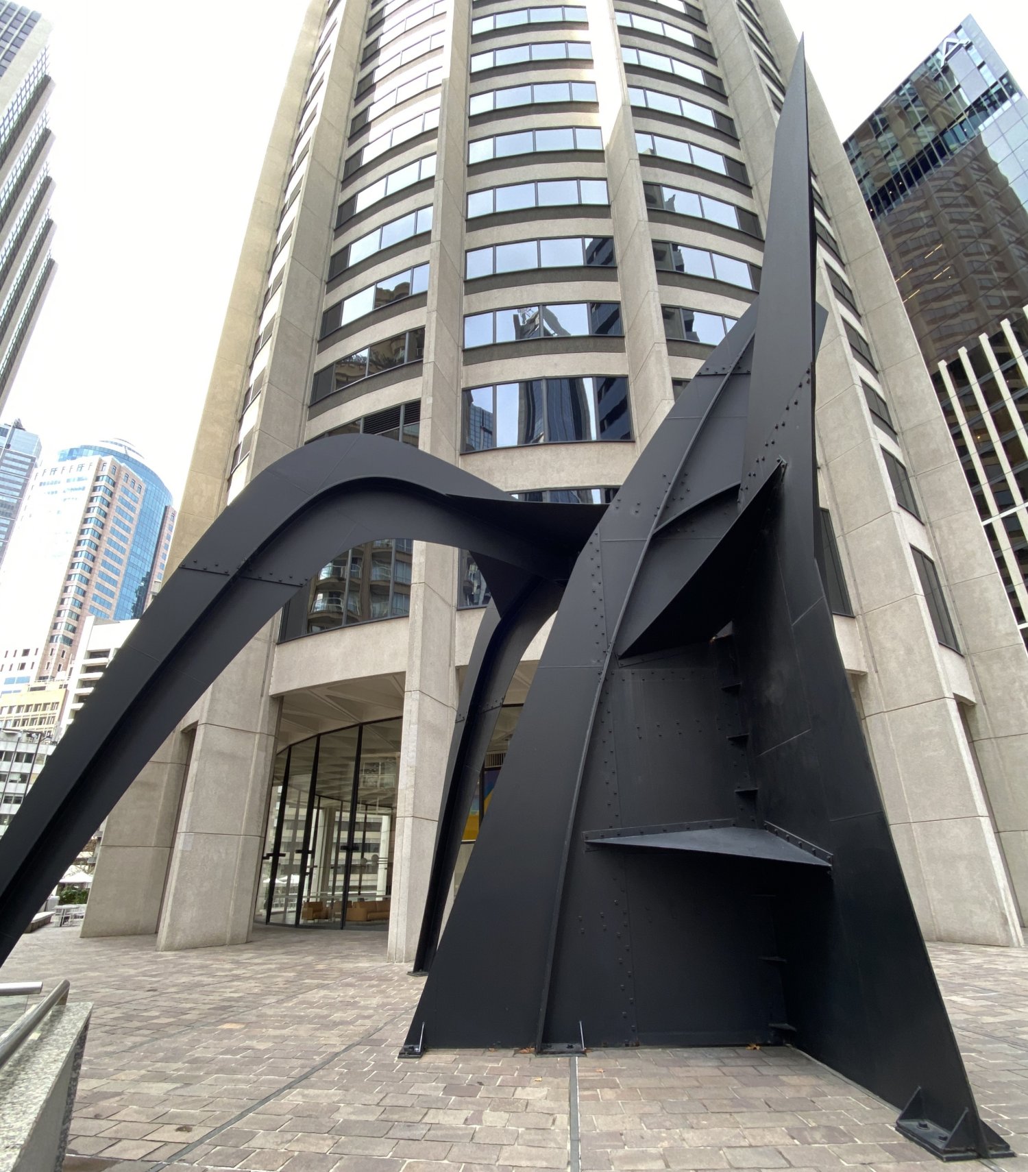
‘Crossed Blades’, by American sculptor Alexander Calder, was specifically commissioned by Harry Seidler, perhaps as a counterpoint to the soft colours and lines of Australia Square Tower.
Alexander Calder’s studio and workshop were in central France, in the town of Saché. He crafted many abstract sculptures of sheet metal, which are known as ‘stabiles’. Once the parts of the sculpture were completed, it was shipped to Sydney, where Harry Seidler had to arrange for it to be assembled.
Waiting (1988)
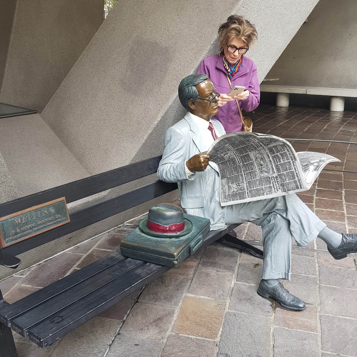
From a distance, and especially in photographs, the sculpture ‘Waiting’ appears to be just a guy in a suit, sitting on a park bench, reading a newspaper. He‘s quite probably a worker from one of the nearby offices.
Actually, ‘Waiting’ has spent over 35 years sitting on his park bench, reading the same newspaper. The level of detail in this sculpture is especially realistic.
The sculptor, Seward Johnson II, created numerous life-size bronzes of ordinary people, doing ordinary things. Another ‘Waiting’, with a different newspaper, can be found in Harrisburg, Pennsylvania.
Rabbitwoman and Dogman (2023)
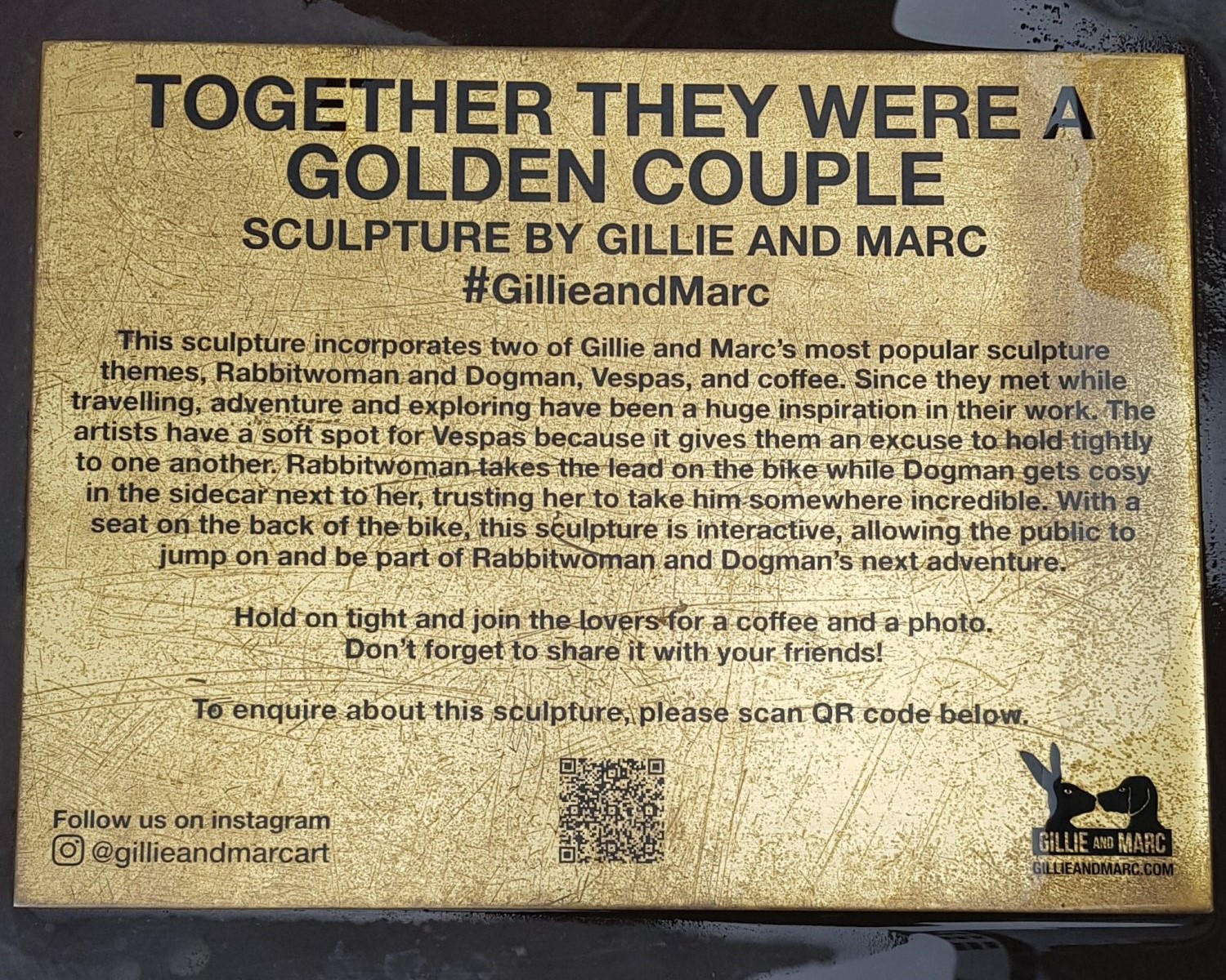
Although Gillie and Marc Schattner also paint, their sculptures are perhaps their most popular works for public art. Their hybrid characters, Rabbitwoman and Dogman, created in 2011, would appear to have become their signature pieces. Their first exhibition together was in Singapore, in 1990.
Gillie and Marc’s studio is an old toy factory of 2500 square meters (26910 sq ft), in the heart of Botany, a suburb in the inner south of Sydney. The rooftop has been transformed into a garden, as a part of their dream to create a green oasis in an industrial zone.
Wynyard Station Interloop – 2017
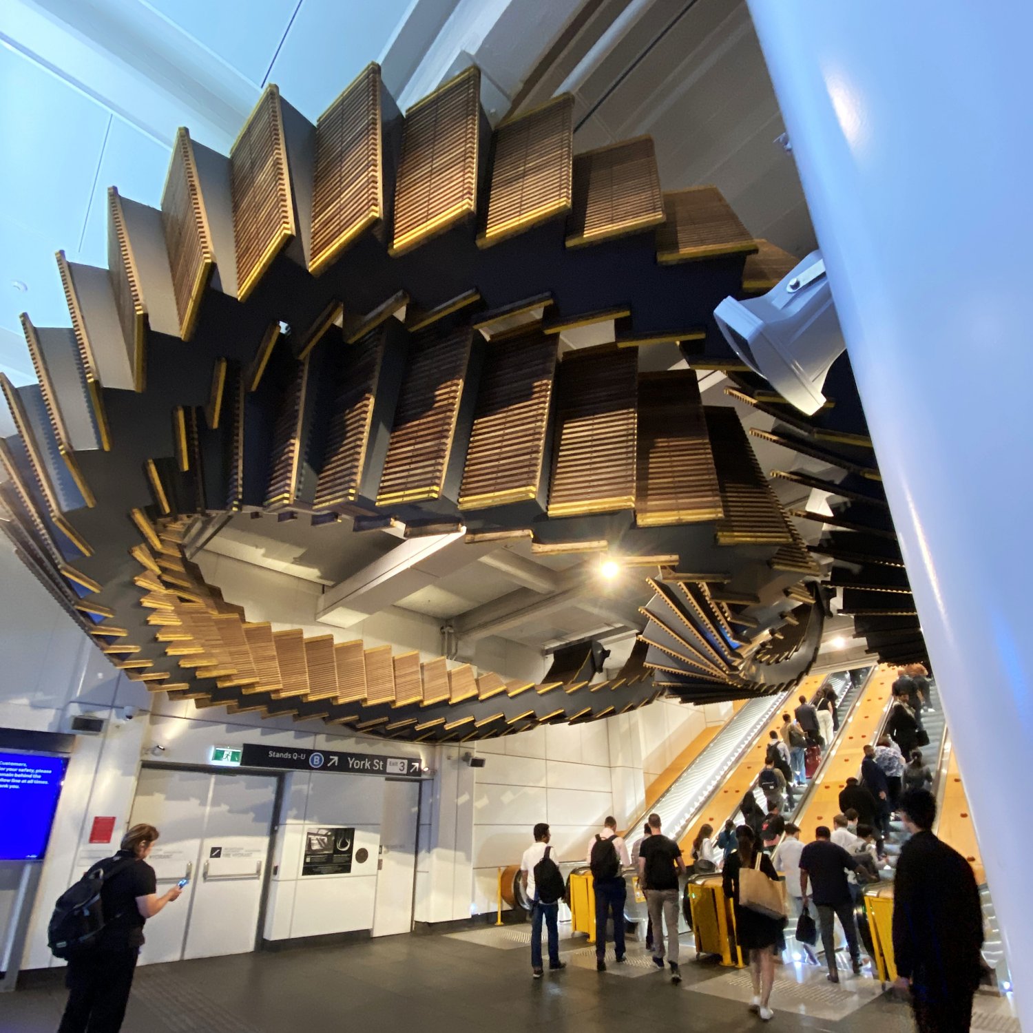
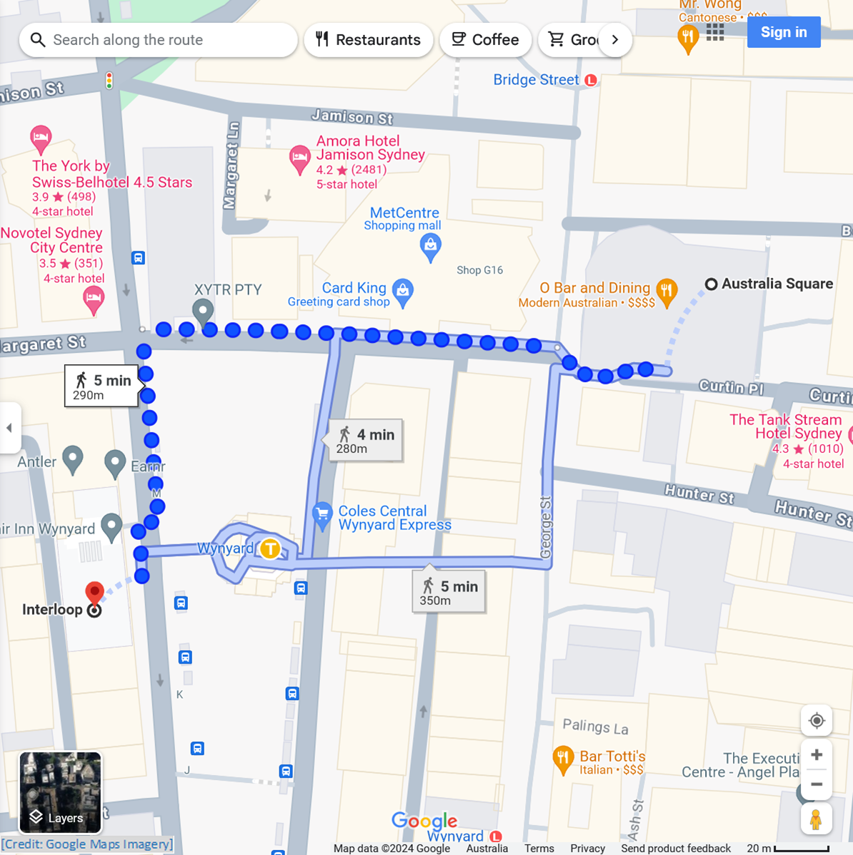
Australia Square to Wynyard Interloop
Cross over George Street, then follow Margaret; go past Wynyard Lane and Carrington Street; turn into York Street; continue to the Station entrance
± 1.0 min to read
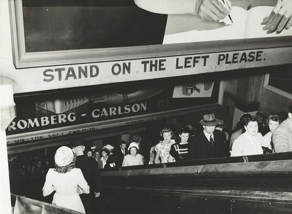
When the first underground stations of Sydney’s City Circle Railway were being planned, in 1913, escalators were seen as the solution to moving large numbers of travellers from deep underground in a short time.
The Sydney Harbour Bridge, and Wynyard Station, were both opened in early 1932, as were stations at Town Hall, and Central. OTIS escalators were installed at both Wynyard and Town Hall during 1931, and were ready for the opening day.
At that time, the escalators were fitted with wooden ‘treads’ (i.e. steps). During the mid-1950s, the first generation of escalators at Sydney’s underground stations were replaced. The second generation of escalators were given a major service and refit in the 1990s, and again in 2012.
In 2013, two escalator incidents occurred with guide dogs. In both cases, the dogs suffered injuries to their feet. In 2016, the NSW Government announced that the wooden escalators in the city railway loop were to be replaced with modern metal ones, citing safety and accessibility needs. The replacement occurred during 2017.
The Interloop sculpture suspended above today’s escalators at Wynyard Station consists of 244 wooden treads from the mid-1950s replacement escalators. Artist Chris Fox has looped together two sets of heritage escalators, which have a combined length of 50 meters. Interloop was installed over a weekend in early December 2017.
Digital ID: 17420_a014_a014000660
Angel Place [Forgotten Songs] – 2012
Wynyard Interloop to Angel Place
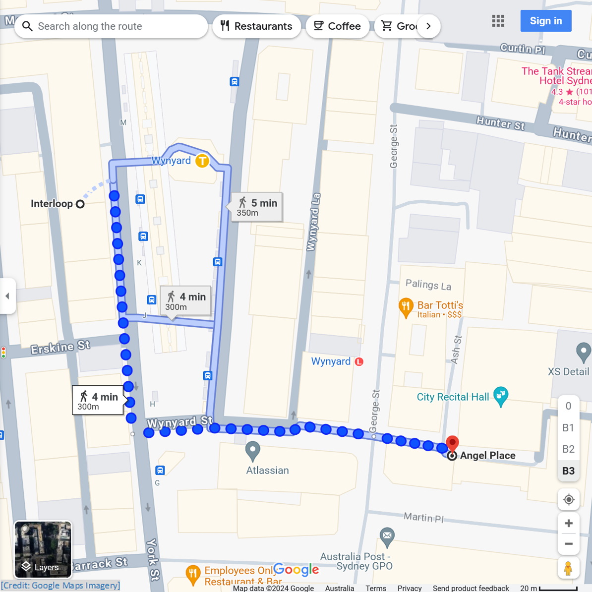
Exit onto York Street; continue to Wynyard Street corner; follow Wynyard Street to George Street; cross over to Angel Place
± 1.0 min to read
In pre-European times, the area of today’s Angel Place was a part of a small valley. In this valley, a bubbling stream tumbled its way over numerous rock ledges towards the harbour. The stream still runs, but today it is encased in a culvert, several metres underground.
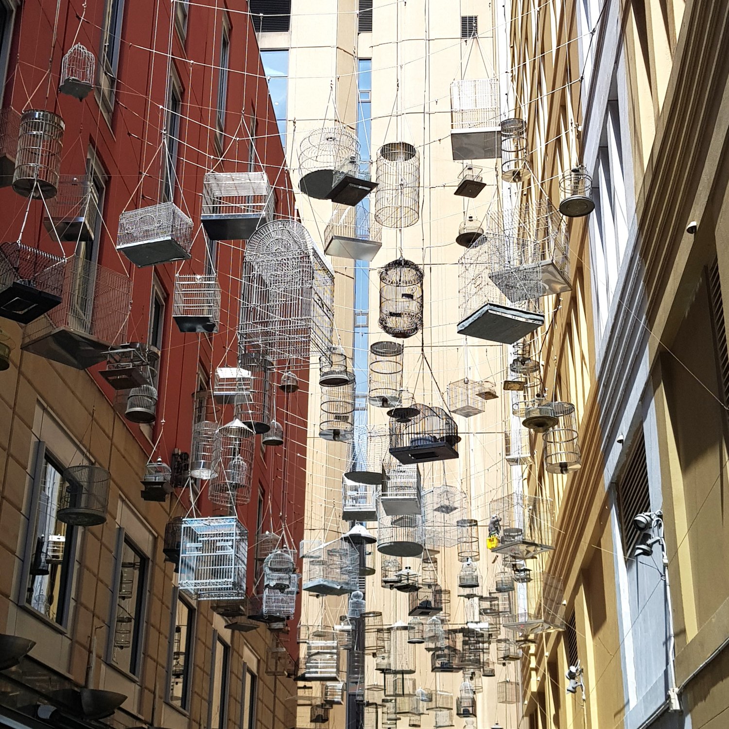
The small valley, with its canopy of tall trees, and bushy lower level of shrubs, would have been the habitat for much birdlife. Today, the only bird calls heard in Angel Place are recordings. These are part of the overhead display of 180 suspended empty birdcages, known as Forgotten Songs.
In 2009, artist Michael Thomas first created Forgotten Songs, as a temporary display. It was recommissioned by the City of Sydney in 2012, on a permanent basis. The different birdsong recordings ring out during the day and at night, according to the behaviour of each species.
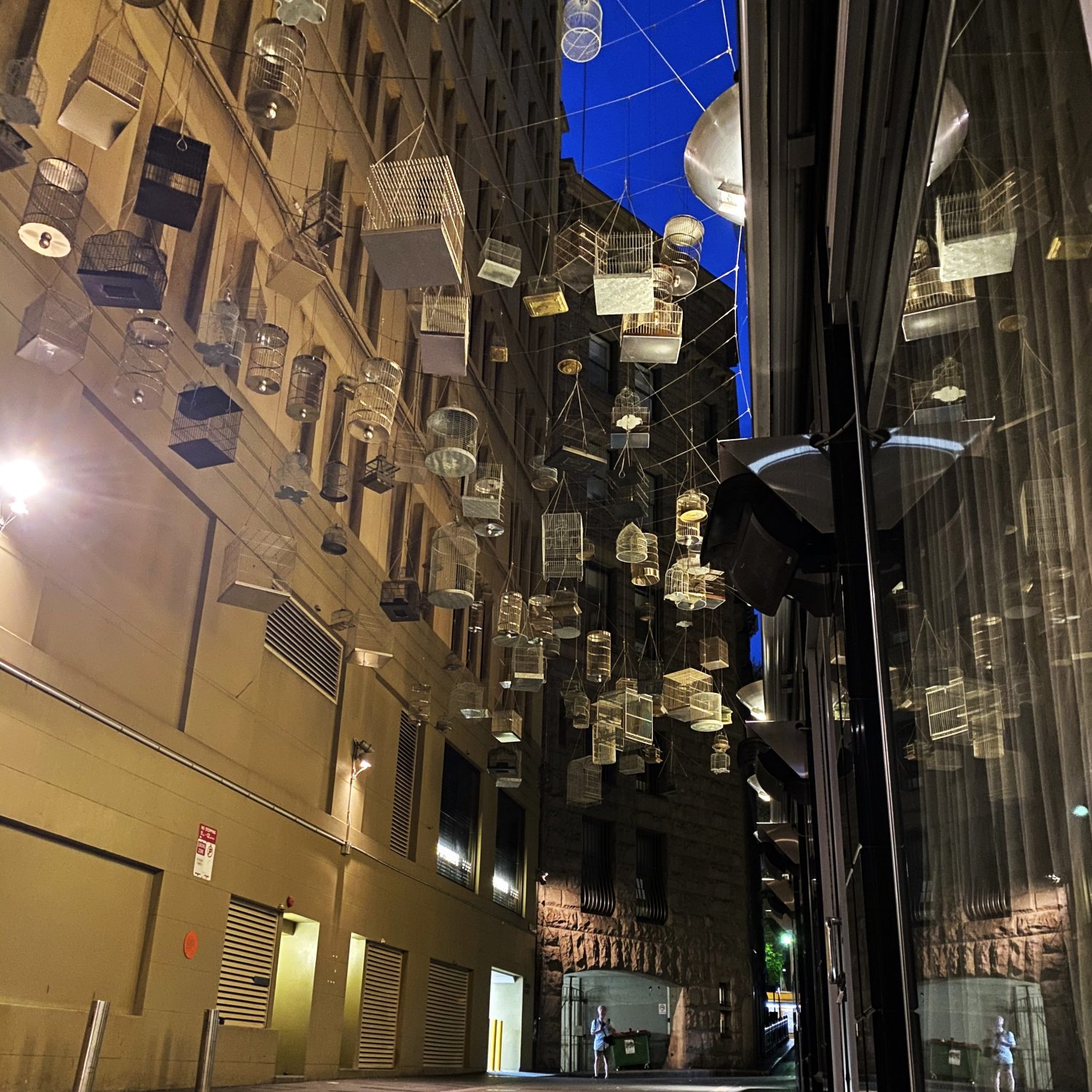
Along with the suspended birdcages, embedded into the pavement are the names of the 50 bird species that have been forced out of the Sydney Cove area, since colonial settlement began in 1788.
The name Angel Place comes from the Angel Inn, once found in the laneway, where the City Recital Hall stands today. At that time, this laneway was known as Terry-place, named after its earliest settler inhabitants, Rosetta and Samuel Terry.
Youngsters of Barrack Street – 2012
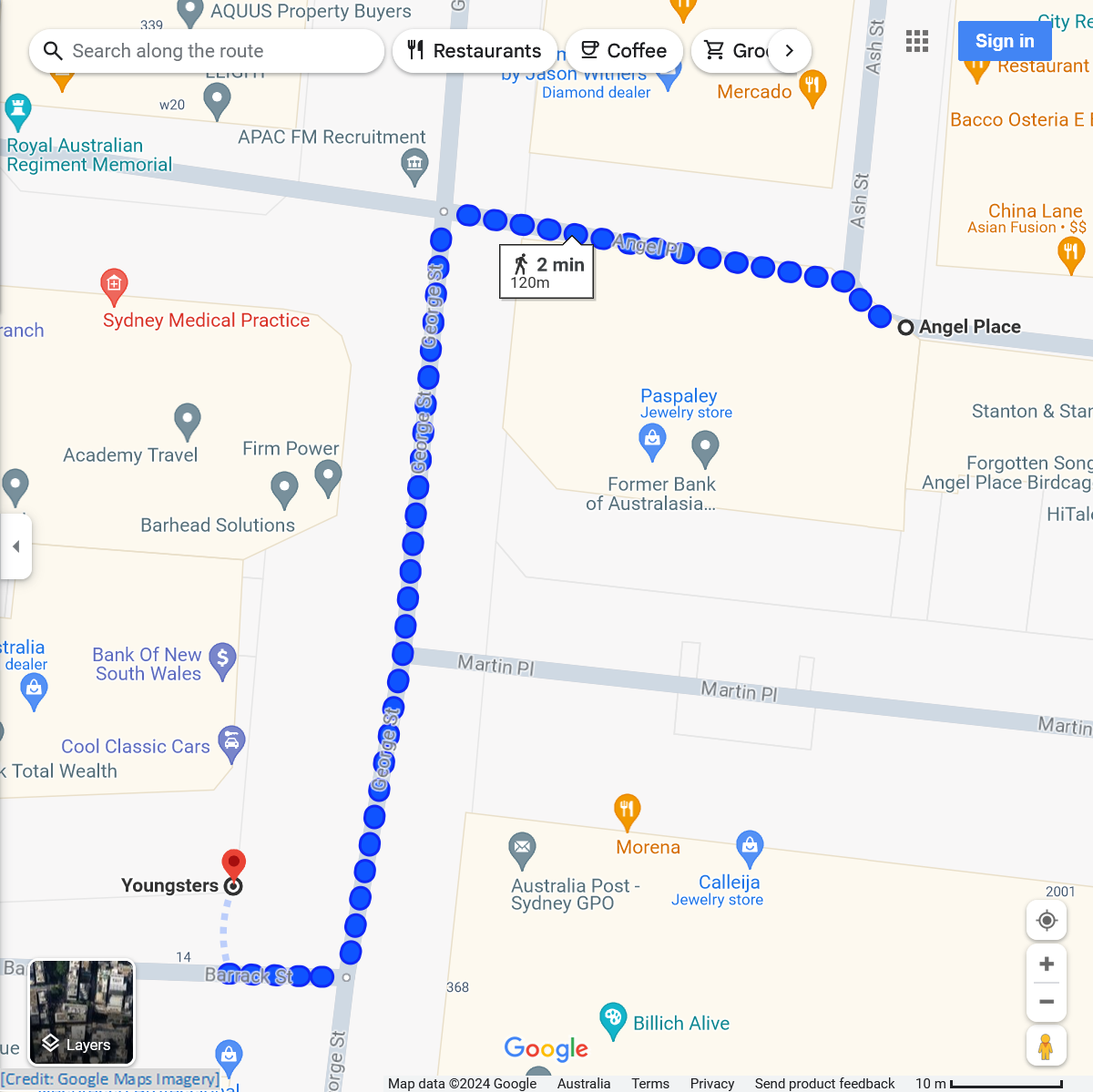
Angel Place to Barrack Street
Return to George Street; follow this to Barrack Street (opposite former GPO)
± 1.0 min to read
The artist behind the two particularly life-like sculptures of children in Barrack Street is British-born, Sydney-based Caroline Rothwell. Known as the Youngsters, her works were installed in 2012.
In a radio interview about her work, Caroline Rothwell described how an early morning truck driver, at about 5.00am, noticed a ‘little person’ standing on the corner (of George Street). The driver got out of his truck, and ran to the little person, thinking it was lost.
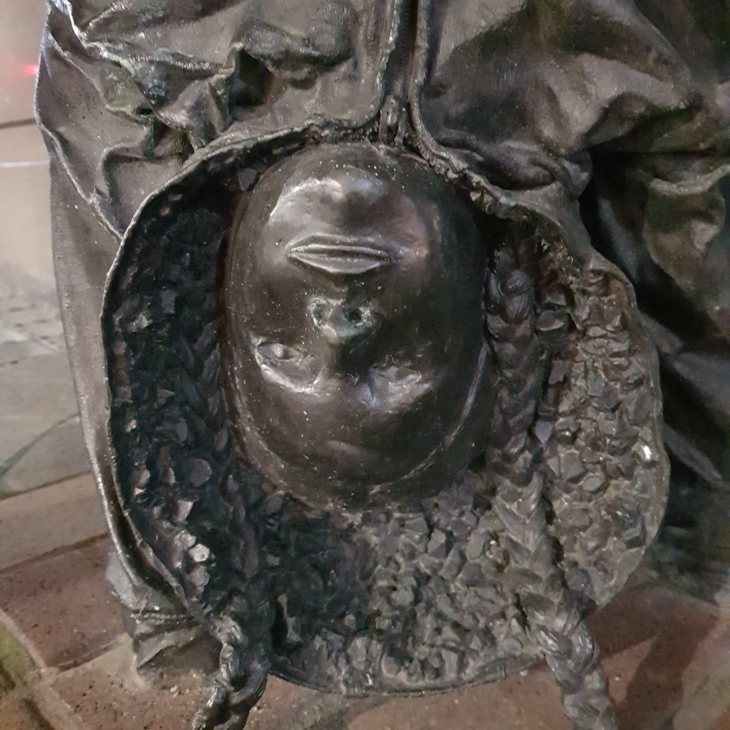
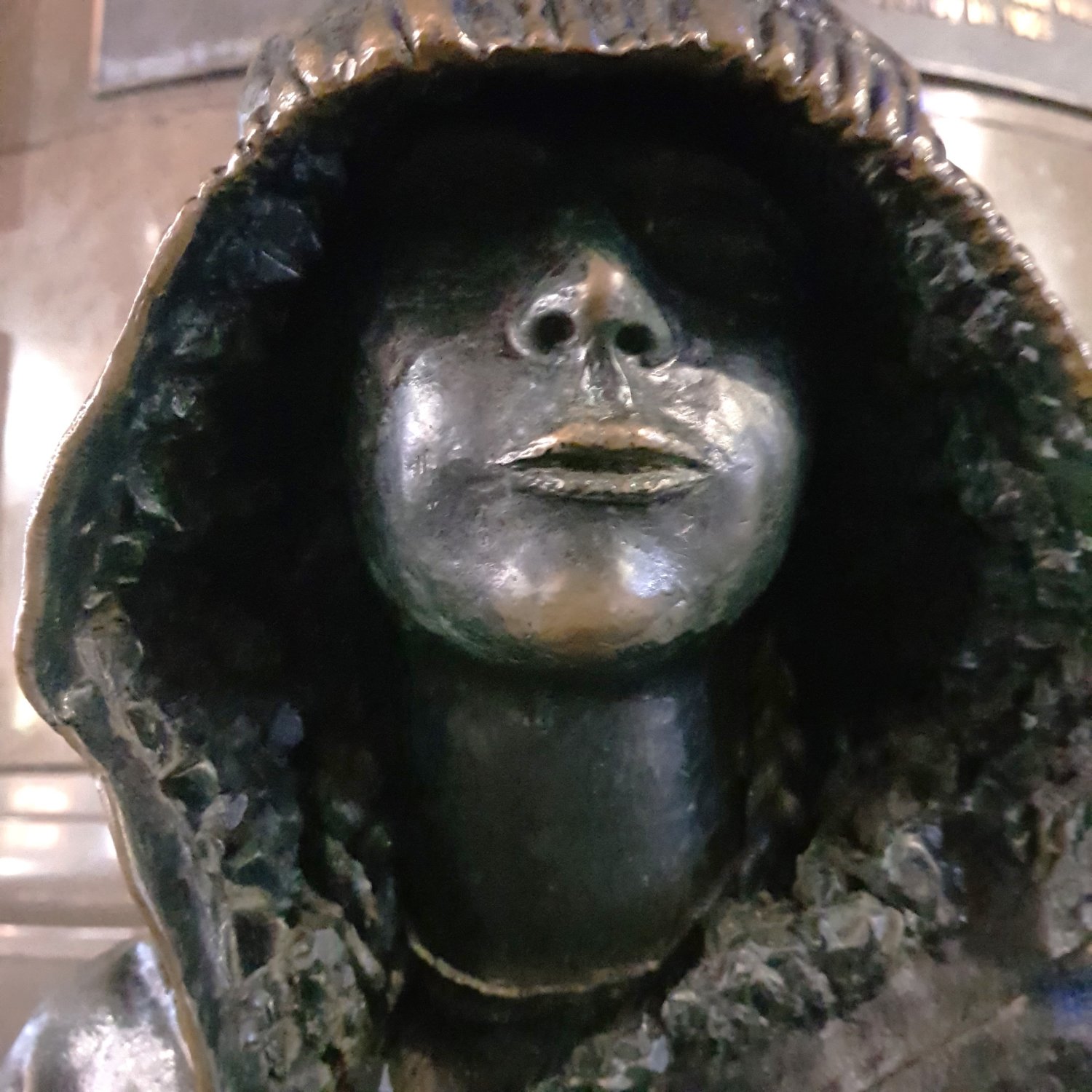
Caroline Rothwell explained her use of the hoodie: “…the hoodie’s been seen as a subversive uniform and I wanted to undermine that.” She has lined both hoods with casts of amethysts and pieces of coal, which is a reflection of Australia’s mineral economy.
Perhaps the weirdest thing about her Youngsters is Caroline Rothwell’s explanation that “…the faces of these little people have stingray eyes and mouths.” If you look into the hoodie of the standing figure, there is a distinct resemblance to a stingray’s mouth and nostrils.
Note: the bronze plaque behind the standing sculpture is about the history of the Commercial Banking Company of Sydney building
Not [Yet] a Coat of Arms – 1874
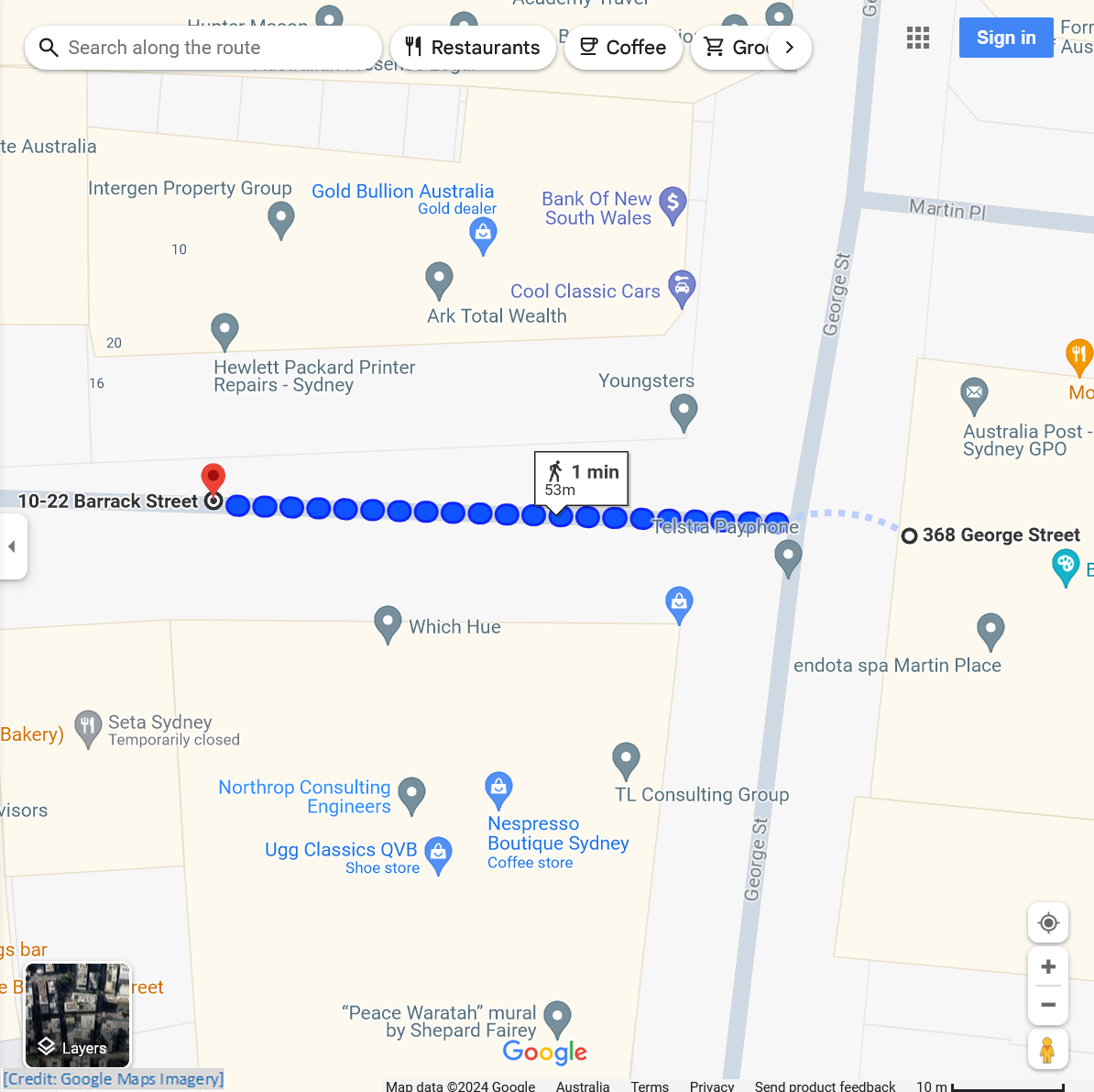
Barrack Street to Not [Yet] a Coat of Arms
From the corner of Barrack and George Streets, cross George Street (with care) to stand outside the former GPO building
± 1.0 min to read
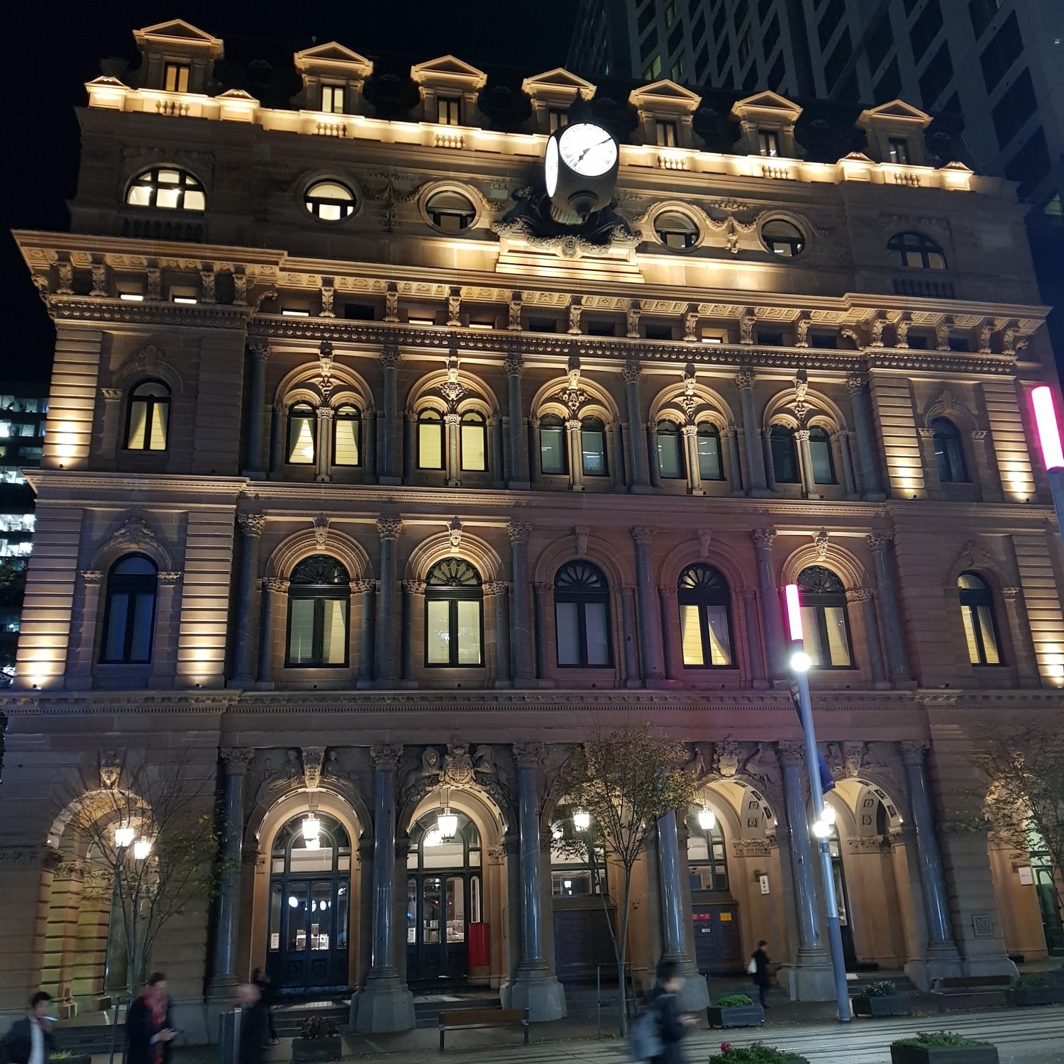
For a ‘bonus’, the final piece of weirdness on this route is found on the nearby former Sydney GPO, now the Fullerton Hotel.
Standing at the corner of George and Barrack Streets, you are opposite the “Little Brother ” clock of the former GPO.
At ground-level, there are five arches, flanked by columns, with carved sculptures at the top of the arch. The second arch from the
Nothing too unusual here, perhaps ?
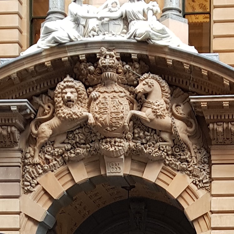
The second arch from the
Now, take a close look at both the Kangaroo, and the Emu. What is wrapped around each of them?
Look back to the Unicorn; does it also have something wrapped around it?
Isn’t this a bit weird? What does it mean?
Other Weird and Wonderfully Unusual Sights in Sydney
Elsewhere across Sydney there are other Weird and Wonderfully Unusual sights to see. Here is a small sample:
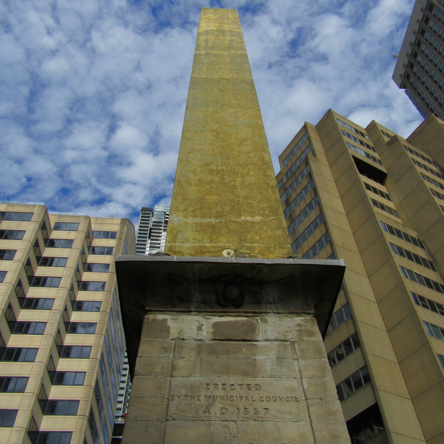
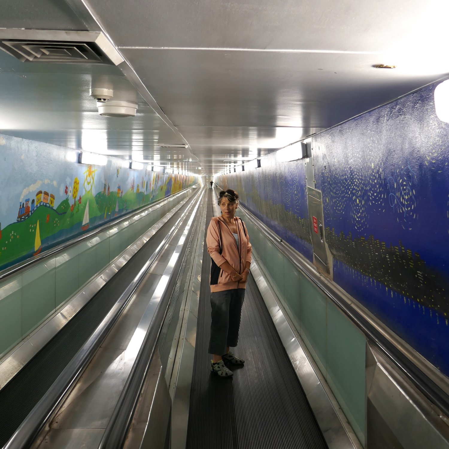
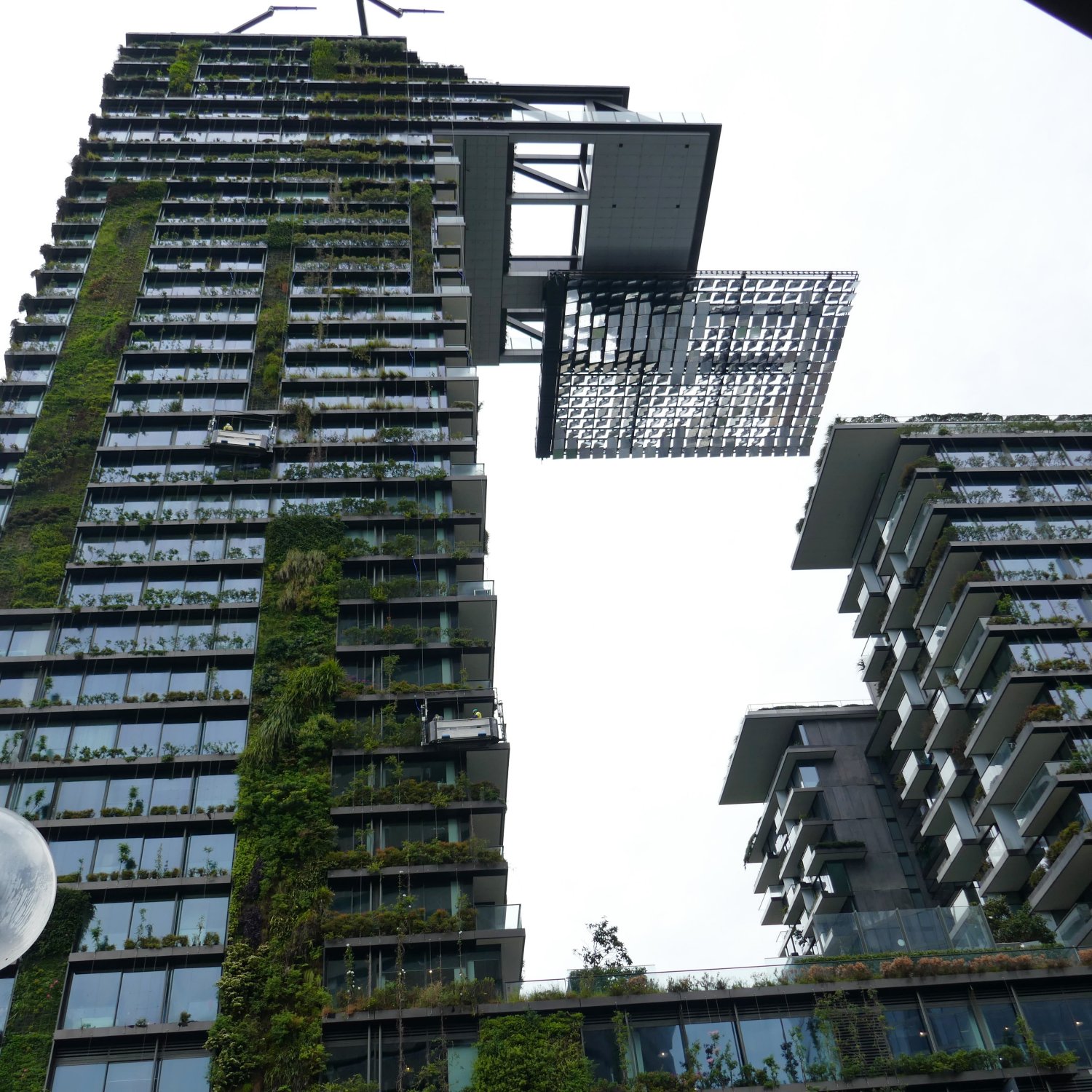
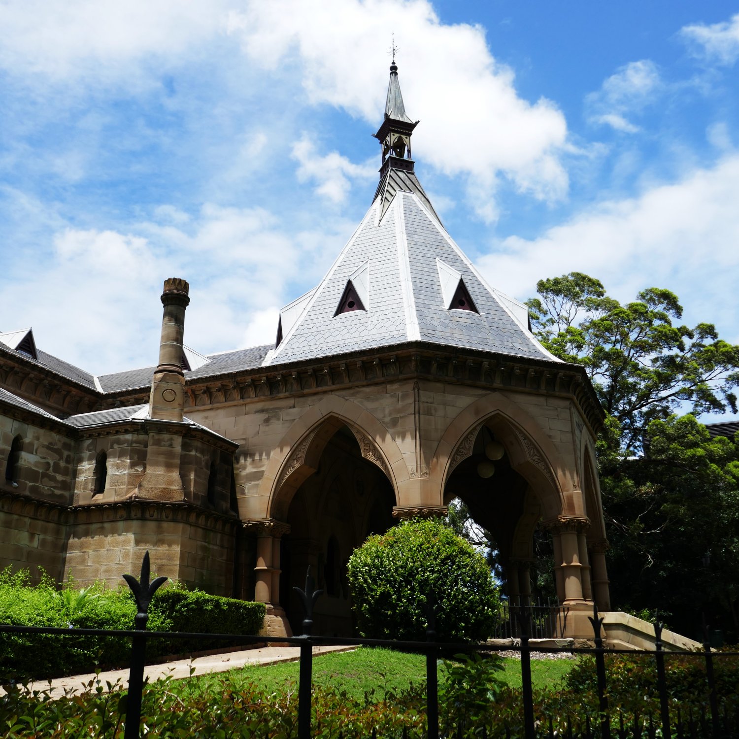
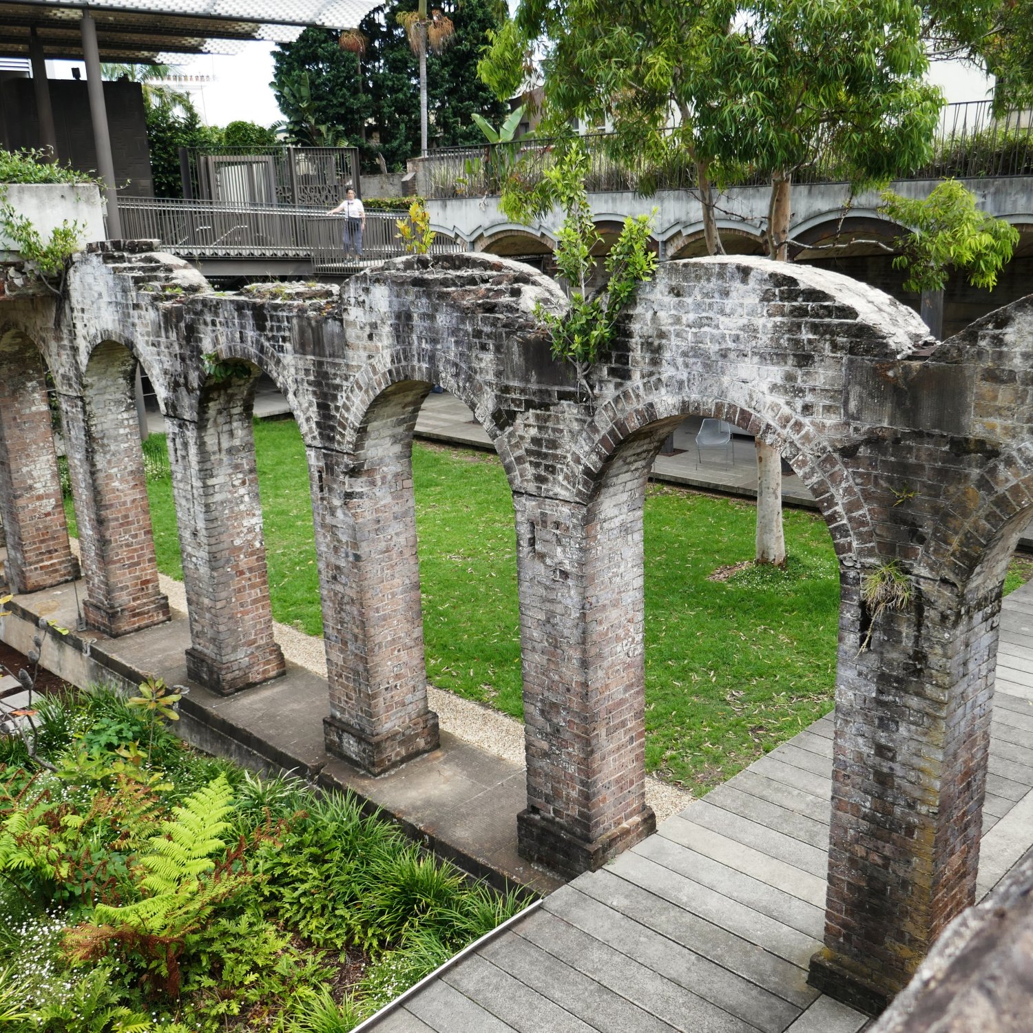
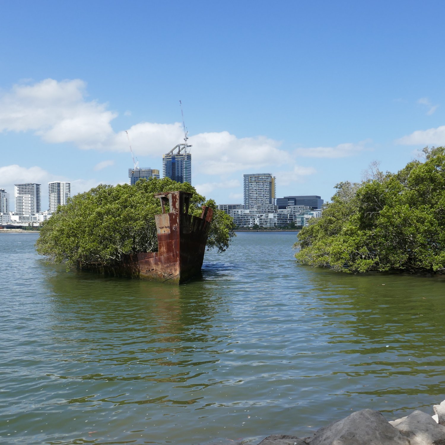
If you would like more details about these, and other Weird and Wonderfully Unusual attractions across Sydney, be sure to let me know by leaving some feedback.
Your Feedback, please…
Firstly, my thanks to you, for reading my post.
Now, the really BIG question is:
“What value has this Post offered you? “
Has it helped you, or do you need more information?
If you wish to offer some feedback, or to read the feedback from others, please follow the link below to the Feedback Page:
Why Your Feedback is Important to Me
In real life, I am an agile Change Manager, so I know that feedback is an essential part of the improvement process.
Your feedback can help me improve both the content of this Post, and also of future Posts.
If you have a thought, or a question, about the post content, or if you would like to provide feedback about something else, please follow the link to the Feedback Page.
I do look forward to hearing from you, especially if we can make improvements that will help fellow travelers on the road.
Marlene
Please note, before any feedback is posted, it will be moderated. When I am moderating, I may need to contact you, which is why I ask for your email address.
Your email address will
Here is a link to the my afootwego.com CONDITIONS for POST FEEDBACK (2½ mins to read).
Should you wish to peruse them, here are links to my afootwego.com PRIVACY POLICY and Website TERMS and CONDITIONS of USE.
- NOTE:
- This site is specifically designed for responsive display on a mobile device
On devices with wider screens, it will appear as a single, center-aligned column
